Search Results Header
Search Constraints
Showing results for: Format/Genre maps Remove constraint Format/Genre: maps Language English Remove constraint Language: English Library Location Rare Book & Manuscript Library Remove constraint Library Location: Rare Book & Manuscript LibrarySearch Results
Notice: Access to some items may be restricted because of copyright. Members of the Columbia Community can log in and learn about the Terms of Use.
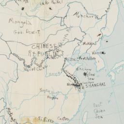
1. China and Japan Map
Rosset, Barney
- Name: Rosset, Barney (Cartographer)
- Collection Name: Barney Rosset papers
- Date: School year 1935-1936
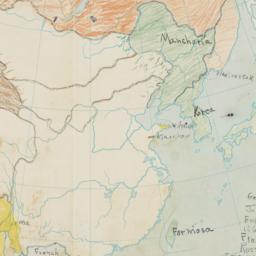
2. China and Japan Map-colored in
Rosset, Barney
- Name: Rosset, Barney (Cartographer)
- Collection Name: Barney Rosset papers
- Date: School year 1935-1936
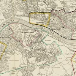
3. Map of Pittsburgh area, showing locations of the Carnegie Steel Mills
Carnegie Corporation of New York
- Collection Name: Carnegie Corporation of New York Records. Series III. Grants. III.A. Grant files, ca.1911-1988. Box no. 60
- Date: 1917
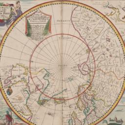
4. Mapp of Regions and Countreyes Under and About the North Pole
Seller, John, active 1658-1698
- Date: probably 1658-1698
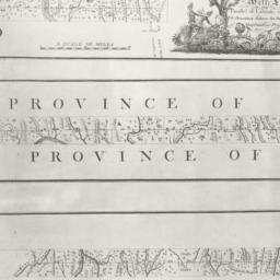
5. A Plan of the boundary lines between the Province of Maryland and the three lower counties on the Delaware with part of the parallel of latitude which is the boundary between the provinces of Maryland and Pennsylvania
- Collection Name: Historical Map Collection
- Date: 1768