Search Results Header
Search Results
Notice: Access to some items may be restricted because of copyright. Members of the Columbia Community can log in and learn about the Terms of Use.
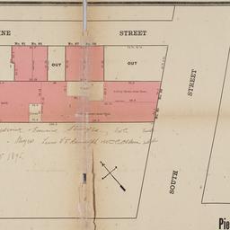
81. [Map of the area in Lower Manhattan bound by Pine Street, South Street, Wall Street and Front Street]
- Collection Name: Seymour B. Durst Old York Library Collection
- Date: 1895?]
- Item in Context: https://dlc.library.columbia.edu/durst/cul:4mw6m905rb

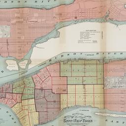
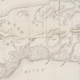
82. Map of the bays, harbors, and rivers around New York : showing the channels, soundings, lighthouses, buoys &c., and the complete topography of the surrounding country : including Hempstead, Sandy-Hook, South-Amboy, Newark, Yonkers, N. Rochelle & Glen Cove
Bache, A. D. 1806-1867
- Name: Bache, A. D. 1806-1867
- Collection Name: Seymour B. Durst Old York Library Collection
- Date: [1866]
- Item in Context: https://dlc.library.columbia.edu/durst/cul:wpzgmsbcfh
83. Map of the boundaries of the Fire Department of the City of New York
New York (N.Y.). Fire Department
- Name: New York (N.Y.). Fire Department
- Collection Name: Seymour B. Durst Old York Library Collection
- Date: 1871
- Item in Context: https://dlc.library.columbia.edu/durst/cul:98sf7m0chc

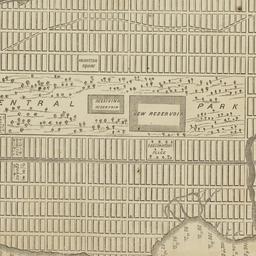
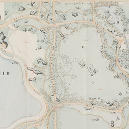
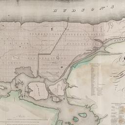
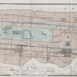
84. Map of the Central Park : showing the progress of the work up to January 1st 1860
Olmsted, Frederick Law, 1822-1903
- Collection Name: Seymour B. Durst Old York Library Collection
- Date: [1860]
- Item in Context: https://dlc.library.columbia.edu/durst/cul:15dv41ns2m
85. Map of the Central Park, New York
- Collection Name: Seymour B. Durst Old York Library Collection
- Date: 1856]
- Item in Context: https://dlc.library.columbia.edu/durst/cul:gf1vhhmgs3
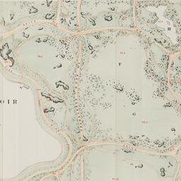
86. Map of the Central Park showing the progress of the work up to January 1st, 1863
Sarony, Major & Knapp Lith
- Collection Name: Seymour B. Durst Old York Library Collection
- Date: [1863]
- Item in Context: https://dlc.library.columbia.edu/durst/cul:3j9kd51c63
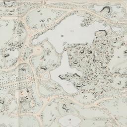
87. Map of the Central Park showing the progress of the work up to January 1st, 1864
- Collection Name: Seymour B. Durst Old York Library Collection
- Date: 1864]
- Item in Context: https://dlc.library.columbia.edu/durst/cul:x95x69p8g8
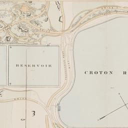
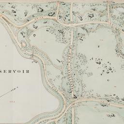
88. Map of the Central Park showing the progress of the work up to January 1st, 1865
- Collection Name: Seymour B. Durst Old York Library Collection
- Date: 1865]
- Item in Context: https://dlc.library.columbia.edu/durst/cul:5dv41ns1sq
89. Map of the Central Park showing the progress of the work up to January 1st, 1866
- Collection Name: Seymour B. Durst Old York Library Collection
- Date: 1866]
- Item in Context: https://dlc.library.columbia.edu/durst/cul:7h44j0zpd9
90. Map of the Central Park showing the progress of the work up to January 1st 1867
- Collection Name: Seymour B. Durst Old York Library Collection
- Date: 1867?]
- Item in Context: https://dlc.library.columbia.edu/durst/cul:mgqnk98sh4
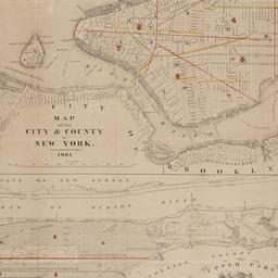
91. Map of the city & county of New York
Hayward, George, approximately 1800-
- Name: Hayward, George, approximately 1800-
- Collection Name: Seymour B. Durst Old York Library Collection
- Date: [1861]
- Item in Context: https://dlc.library.columbia.edu/durst/cul:37pvmcvdp7
92. Map of the city and county of New York : with the adjacent country
Burr, David H., 1803-1875
- Name: Burr, David H., 1803-1875
- Collection Name: Seymour B. Durst Old York Library Collection
- Date: 1829]
- Item in Context: https://dlc.library.columbia.edu/durst/cul:59zw3r228s
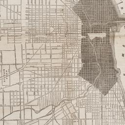
93. Map of the city of Chicago
- Collection Name: Seymour B. Durst Old York Library Collection
- Date: 1871]
- Item in Context: https://dlc.library.columbia.edu/durst/cul:0zpc866t20

94. Map of the City of New York
W.C. Rogers & Co
- Name: W.C. Rogers & Co
- Collection Name: Seymour B. Durst Old York Library Collection
- Date: 1868

95. Map of the City of New York : shewing the original high water ine and the location of the different farms and estates
Hayward, George, approximately 1800-
- Name: Hayward, George, approximately 1800-
- Collection Name: Seymour B. Durst Old York Library Collection
- Date: 1852]
96. Map of the City of New York, 1856
Hayward, George, approximately 1800-
- Name: Hayward, George, approximately 1800-
- Collection Name: Seymour B. Durst Old York Library Collection
- Date: 1856]
- Item in Context: https://dlc.library.columbia.edu/durst/cul:j6q573n5vz
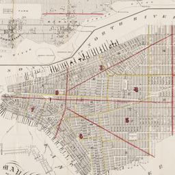
97. Map of the City of New York, from the Battery to 80th Street, showing the original topography of Manhattan Island
Viele, Egbert L. 1825-1902
- Name: Viele, Egbert L. 1825-1902
- Collection Name: Seymour B. Durst Old York Library Collection
- Date: 1866?]
- Item in Context: https://dlc.library.columbia.edu/durst/cul:cc2fqz613t
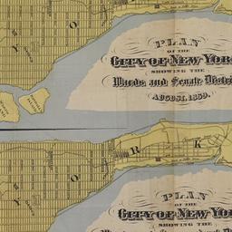
98. Map of the City of New York, showing its political divisions and subdivisions, August 1869
- Collection Name: Seymour B. Durst Old York Library Collection
- Date: 1869]
- Item in Context: https://dlc.library.columbia.edu/durst/cul:612jm63xtf
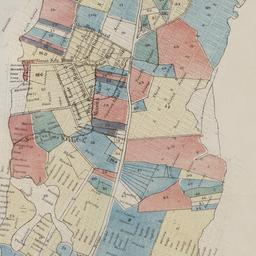
99. Map of the city of New York showing the original high water lines and the location of the different farms and estates
Hayward, George, approximately 1800-
- Name: Hayward, George, approximately 1800-
- Collection Name: Seymour B. Durst Old York Library Collection
- Date: 1852]
- Item in Context: https://dlc.library.columbia.edu/durst/cul:zpc866t1jn
100. Map of the city of New York showing the proposed route of the "arcade" underground railway
G.W. & C.B. Colton & Co
- Collection Name: Seymour B. Durst Old York Library Collection
- Date: [1870?]
- Item in Context: https://dlc.library.columbia.edu/durst/cul:tdz08kprtg