Search Results Header
Search Constraints
Showing results for: Name Viele, Egbert L. 1825-1902 Remove constraint Name: Viele, Egbert L. 1825-1902 Format/Genre maps Remove constraint Format/Genre: mapsSearch Results
Notice: Access to some items may be restricted because of copyright. Members of the Columbia Community can log in and learn about the Terms of Use.

1. 1783, Manhattan Island at the close of the Revolution showing the American city with its landmarks and the Revolutionary fortifictions on the island
MacCoun, Townsend, 1845-1932
- Name: MacCoun, Townsend, 1845-1932
- Collection Name: Seymour B. Durst Old York Library Collection
- Date: c1909
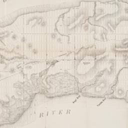
2. Map of the City of New York, from the Battery to 80th Street, showing the original topography of Manhattan Island
Viele, Egbert L. 1825-1902
- Name: Viele, Egbert L. 1825-1902
- Collection Name: Seymour B. Durst Old York Library Collection
- Date: 1866?]
- Item in Context: https://dlc.library.columbia.edu/durst/cul:cc2fqz613t
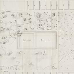
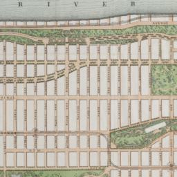
3. Map of the lands included in the Central Park
Viele, Egbert L. 1825-1902
- Name: Viele, Egbert L. 1825-1902
- Collection Name: Seymour B. Durst Old York Library Collection
- Date: 1856
- Item in Context: https://dlc.library.columbia.edu/durst/cul:z34tmpg4hf
4. Map of the lands included in the Central Park, from a topographical survey, June 17th, 1856 ; Plan for the improvement of the Central Park, adopted by the Commissioners, June 3rd, 1856
Viele, Egbert L. 1825-1902
- Name: Viele, Egbert L. 1825-1902
- Collection Name: Seymour B. Durst Old York Library Collection
- Date: 1994]
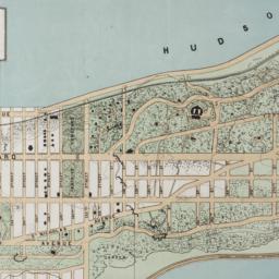
5. Topographical map of the City of New York showing original water courses and made land
Viele, Egbert L. 1825-1902
- Name: Viele, Egbert L. 1825-1902
- Collection Name: Seymour B. Durst Old York Library Collection
- Date: c1865
- Item in Context: https://dlc.library.columbia.edu/durst/cul:qv9s4mw6px
6. The Transval of New York
Viele, Egbert L. 1825-1902
- Name: Viele, Egbert L. 1825-1902
- Collection Name: Seymour B. Durst Old York Library Collection
- Date: 1880]
- Item in Context: https://dlc.library.columbia.edu/durst/cul:wstqjq2bzb
7. The west end plateau of New York
Vielé, Herman K
- Name: Vielé, Herman K
- Collection Name: Seymour B. Durst Old York Library Collection
- Date: [1879]
- Item in Context: https://dlc.library.columbia.edu/durst/cul:37pvmcvdpv