Search Results Header
Search Results
Notice: Access to some items may be restricted because of copyright. Members of the Columbia Community can log in and learn about the Terms of Use.

1. China and Japan Map
Rosset, Barney
- Name: Rosset, Barney (Cartographer)
- Collection Name: Barney Rosset papers
- Date: School year 1935-1936

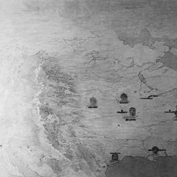
2. China and Japan Map-colored in
Rosset, Barney
- Name: Rosset, Barney (Cartographer)
- Collection Name: Barney Rosset papers
- Date: School year 1935-1936
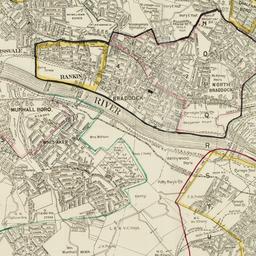
3. Map of Pittsburgh area, showing locations of the Carnegie Steel Mills
Carnegie Corporation of New York
- Collection Name: Carnegie Corporation of New York Records. Series III. Grants. III.A. Grant files, ca.1911-1988. Box no. 60
- Date: 1917
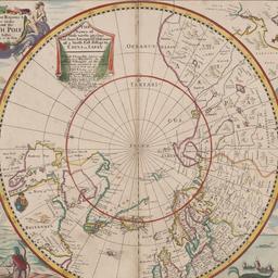
4. Mapp of Regions and Countreyes Under and About the North Pole
Seller, John, active 1658-1698
- Date: probably 1658-1698
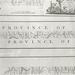
5. A Plan of the boundary lines between the Province of Maryland and the three lower counties on the Delaware with part of the parallel of latitude which is the boundary between the provinces of Maryland and Pennsylvania
- Collection Name: Historical Map Collection
- Date: 1768
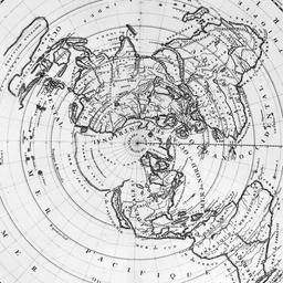
6. Planisphere terrestre ou sont marquees longitudes de divers lieux de la terre
Cassini, Giovanni Domenico, 1625-1712
- Name: Cassini, Giovanni Domenico, 1625-1712 (Cartographer)
- Collection Name: Historical Map Collection
- Date: 1696
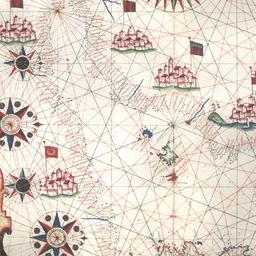
7. Portolan atlas of five charts of the the European and African Coasts of the Mediterranean and Atlantic
Oliva, Joan, active 1580-1615
- Name: Oliva, Joan, active 1580-1615 (Creator)
- Date: circa 1590
9. Ziegfeld Follies, June 21, 1915. Map of United States
Urban, Joseph, 1872-1933
- Name: Urban, Joseph, 1872-1933 (Designer)
- Collection Name: Joseph Urban Papers. Series III: New York, 1912-1933, undated. Subseries III.4: Ziegfeld Productions, 1915-1932. Ziegfeld Follies, June 21, 1915. Box no. 16, Folder no. 2
- Date: 1915