Search Results Header
Search Constraints
Showing results for: Format ephemera Remove constraint Format: ephemera Format objects Remove constraint Format: objects Format manuscripts Remove constraint Format: manuscripts Format maps Remove constraint Format: mapsSearch Results

301. Map of the borough of Brooklyn, New York
maps
- Published: Home Life Publishing Co: New York, N.Y. [1902]
- Format: maps
- Catalog Record: check availability
302. Map of the borough of Manhattan, city of New York showing new law tenement houses for which plans were filed during 1908
New York (N.Y.). Tenement House Department
maps
- Name: New York (N.Y.). Tenement House Department
- Published: s.n: New York?. 1908?]
- Format: maps
- Catalog Record: check availability
303. Map of the boundaries of the Fire Department of the City of New York
New York (N.Y.). Fire Department
maps
- Name: New York (N.Y.). Fire Department
- Published: s.n.]: New York. 1871
- Format: maps
- Online: click here for full-text
- Catalog Record: check availability
304. Map of the Brooklyn Elevated Railroad
maps
- Published: [publisher not identified]: New York?. [1885?]
- Format: maps
- Catalog Record: check availability
305. Map of the Central Park : showing the progress of the work up to January 1st 1860
maps
- Published: Lith. by Sarony, Major & Knapp: New York, N.Y. [1860]
- Format: maps
- Online: click here for full-text
- Catalog Record: check availability
306. Map of the Central Park, New York
maps
- Published: Frank Leslie: New York?. 1856]
- Format: maps
- Online: click here for full-text
- Catalog Record: check availability
307. Map of the Central Park showing the progress of the work up to January 1st, 1863
maps
- Published: Sarony Major & Knapp: New York. [1863]
- Format: maps
- Online: click here for full-text
- Catalog Record: check availability
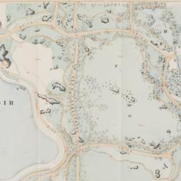
308. Map of the Central Park showing the progress of the work up to January 1st, 1864
maps
- Published: s.n: New York?. 1864]
- Format: maps
- Online: click here for full-text
- Catalog Record: check availability
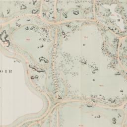
309. Map of the Central Park showing the progress of the work up to January 1st, 1865
maps
- Published: s.n: New York?. 1865]
- Format: maps
- Online: click here for full-text
- Catalog Record: check availability
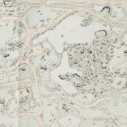
310. Map of the Central Park showing the progress of the work up to January 1st, 1866
maps
- Published: s.n: New York?. 1866]
- Format: maps
- Online: click here for full-text
- Catalog Record: check availability
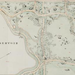
311. Map of the Central Park showing the progress of the work up to January 1st 1867
maps
- Published: s.n: New York. 1867?]
- Format: maps
- Online: click here for full-text
- Catalog Record: check availability
312. Map of the cities of New York, Brooklyn, Long Island City, Jersey City & Hoboken
Dripps, M
maps
- Name: Dripps, M
- Published: M. Dripps: New York. ca. 1870]
- Format: maps
- Catalog Record: check availability
313. Map of the city & county of New York
Hayward, George, approximately 1800-
maps
- Name: Hayward, George, approximately 1800-
- Published: Engraved for D.T. Valentine's manual for 1862, by Geo. Hayward: New York (N.Y.). [1861]
- Format: maps
- Online: click here for full-text
- Catalog Record: check availability
314. Map of the city & county of New York ; Upper part of the city and county of New York on a reduced scale
Hayward, George, approximately 1800-
maps
- Name: Hayward, George, approximately 1800-
- Published: Common Council]: New York. 1860
- Format: maps
- Catalog Record: check availability
315. A map of the city and county of New York : with the adjacent cities of Brooklyn and Jersey City, and the village of Williamsburg : with a street directory of the city of New York
Thayer, Bridgman & Fanning
maps
- Name: Thayer, Bridgman & Fanning
- Published: Thayer, Bridgman & Fanning: New York. 1853
- Format: maps
- Catalog Record: check availability
316. Map of the city and county of New York : with the adjacent country
Burr, David H., 1803-1875
maps
- Name: Burr, David H., 1803-1875
- Published: s.n: New York. 1829]
- Format: maps
- Online: click here for full-text
- Catalog Record: check availability
317. Map of the city of Chicago
maps
- Published: James Gordon Bennett: New York. 1871]
- Format: maps
- Online: click here for full-text
- Catalog Record: check availability

318. Map of the City of New York
W.C. Rogers & Co
maps
- Name: W.C. Rogers & Co
- Published: s.n.]: New York. 1868
- Format: maps
- Online: click here for full-text
- Catalog Record: check availability

319. Map of the City of New York : shewing the original high water ine and the location of the different farms and estates
Hayward, George, approximately 1800-
maps
- Name: Hayward, George, approximately 1800-
- Published: New York Common Council: New York. 1852]
- Format: maps
- Online: click here for full-text
- Catalog Record: check availability
320. Map of the City of New York : showing the streets, avenues, roads, public squares & places laid out, established, widened and retained, the new pier and bulkhead lines laid out and established by the Board of Commissioners of the Central Park, by and under authority of chapter 697 of the laws of the State of New York, passed April 24, 1867
New York (N.Y.). Board of Commissioners of the Central Park
maps
- Name: New York (N.Y.). Board of Commissioners of the Central Park
- Published: s.n: New York?. 1868-1872]
- Format: maps
- Catalog Record: check availability
321. Map of the city of New York : with the adjacent cities of Brooklyn & Jersey City & the village of Williamsburg
Phelps, Humphrey, active 19th century
maps
- Name: Phelps, Humphrey, active 19th century
- Published: H. Phelps: New York. 1845
- Format: maps
- Catalog Record: check availability
322. Map of the City of New York, 1856
Hayward, George, approximately 1800-
maps
- Name: Hayward, George, approximately 1800-
- Published: New York Common Council: New York. 1856]
- Format: maps
- Online: click here for full-text
- Catalog Record: check availability
323. Map of the City of New York Comprising all the late Improvements, Compiled and Corrected From Authentic Documents
maps
- Published: J. Langdon: New York. 1829
- Format: maps
- Catalog Record: check availability
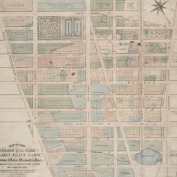
324. Map of the City of New York, from the Battery to 80th Street, showing the original topography of Manhattan Island
Viele, Egbert L. 1825-1902
maps
- Name: Viele, Egbert L. 1825-1902
- Published: s.n: New York. 1866?]
- Format: maps
- Online: click here for full-text
- Catalog Record: check availability
325. Map of the City of New York, showing its political divisions and subdivisions, August 1869
maps
- Published: s.n: New York?. 1869]
- Format: maps
- Catalog Record: check availability
326. Map of the city of New York showing the original high water lines and the location of the different farms and estates
Hayward, George, approximately 1800-
maps
- Name: Hayward, George, approximately 1800-
- Published: Common Council: New York. 1852]
- Format: maps
- Online: click here for full-text
- Catalog Record: check availability
327. Map of the city of New York showing the proposed route of the "arcade" underground railway
maps
- Published: G.W. & C.B. Colton: New York. [1870?]
- Format: maps
- Online: click here for full-text
- Catalog Record: check availability
328. Map of the city of New York with street directory : showing house-numbers, hotels, churches, banks, theatres, ferries, house-car, steam and elevated r.r'ds, &c
Dripps, M
maps
- Name: Dripps, M
- Published: M. Dripps: New York. [1880?]
- Format: maps
- Catalog Record: check availability
329. Map of the City of New York with the adjacent cities of Brooklyn & Jersey City & the Village of Williamsburg
Phelps, Humphrey, active 19th century
maps
- Name: Phelps, Humphrey, active 19th century
- Published: H. Phelps: New York. 1844
- Format: maps
- Catalog Record: check availability
330. Map of the City of New-York
Hayward, George, approximately 1800-
maps
- Name: Hayward, George, approximately 1800-
- Published: Common Council, 1854]: New York. 1854
- Format: maps
- Online: click here for full-text
- Catalog Record: check availability
331. Map of the city of New-York, 1853
Hayward, George, approximately 1800-
maps
- Name: Hayward, George, approximately 1800-
- Published: Common Council: New York, N.Y. 1853]
- Format: maps
- Online: click here for full-text
- Catalog Record: check availability

332. A map of the common lands between the three and six mile stones, belonging to the corporation of the city of New York
Goerck, Casimir Th., -1798
maps
- Name: Goerck, Casimir Th., -1798
- Published: Common Council: New York. 1861]
- Format: maps
- Online: click here for full-text
- Catalog Record: check availability
333. Map of the consolidated City of Brooklyn : comprising the City of Brooklyn, City of Williamsburgh and Town of Bushwick, Kings County, Long Island
Hayward, George, approximately 1800-
maps
- Name: Hayward, George, approximately 1800-
- Published: G. Hayward: New York. 1854
- Format: maps
- Online: click here for full-text
- Catalog Record: check availability
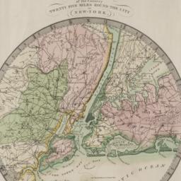
334. Map of the country twenty-five miles round the city of New-York
Burr, David H., 1803-1875
maps
- Name: Burr, David H., 1803-1875
- Published: David H. Burr: New York. 1831
- Format: maps
- Online: click here for full-text
- Catalog Record: check availability
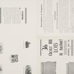
335. Map of the Dell, Chester Hill City of Mount Vernon N.Y
maps
- Published: George W. Bard Real Estate Company: Mount Vernon, N.Y. [1907]
- Format: maps
- Online: click here for full-text
- Catalog Record: check availability

336. Map of the five cities of New York, Brooklyn, Jersey City, Hoboken & Hudson City
Dripps, M
maps
- Name: Dripps, M
- Published: M. Dripps: New York?. 1860
- Format: maps
- Online: click here for full-text
- Catalog Record: check availability
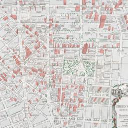
337. Map of the Greenwich Village section of New York City
Fahey, Lawrence
maps
- Name: Fahey, Lawrence
- Published: Lawrence Fahey: New York, N.Y. 1961
- Format: maps
- Online: click here for full-text
- Catalog Record: check availability
338. Map of the lands included in the Central Park
Viele, Egbert L. 1825-1902
maps
- Name: Viele, Egbert L. 1825-1902
- Published: s.n.]: New York. 1856
- Format: maps
- Online: click here for full-text
- Catalog Record: check availability
339. Map of the lands included in the Central Park, from a topographical survey, June 17th, 1856 ; Plan for the improvement of the Central Park, adopted by the Commissioners, June 3rd, 1856
Viele, Egbert L. 1825-1902
maps
- Name: Viele, Egbert L. 1825-1902
- Published: Greensward Foundation: New York. 1994]
- Format: maps
- Catalog Record: check availability
340. A map of the Lower East Side a guide to shops and services
Blutreich, Ira
maps
- Name: Blutreich, Ira
- Published: Iris' Art Studio: New York, N.Y. 1981, c1980
- Format: maps
- Catalog Record: check availability
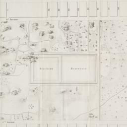
341. Map of the "Murray Hill Farm," "Ogden Place Farm," Lawrence & Astor, Wiswall & Price, Corporation, Wm. Wright, John Taylor and other property
Holmes, J. B
maps
- Name: Holmes, J. B
- Published: City Surveyor: New York. 1867]
- Format: maps
- Online: click here for full-text
- Catalog Record: check availability
342. Map of the Passaic and Croton water-sheds, water courses, storage reservoirs and sources of supply for the cities, towns, & villages within a radius of 50 miles from the City of New York
Bartlett, John Russell, 1805-1886
maps
- Name: Bartlett, John Russell, 1805-1886
- Published: J.R. Bartlett: New York. c1888
- Format: maps
- Online: click here for full-text
- Catalog Record: check availability
343. A map of the state of New York : exhibiting the situation and boundaries of several towns, wards, and counties and specifying in each town, ward, and county the whole population thereof, and in the several counties, the population upon which the apportionment of Senators and Members of Assembly is based with tables of apportionment
New York (State). Secretary's Office
maps
- Name: New York (State). Secretary's Office
- Published: [publisher not identified]: New York?. [1840?]
- Format: maps
- Catalog Record: check availability
344. Map of the State of New York : with the latest improvements showing all the canals, railroads, &c
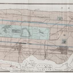
maps
- Published: J. Disturnell: New York. 1836
- Format: maps
- Online: click here for full-text
- Catalog Record: check availability
345. Map of the subway system of New York
Voorhies, Stephen J
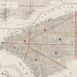
maps
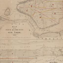
- Name: Voorhies, Stephen J
- Published: Union Dime Savings Bank: New York. 1940
- Format: maps
- Catalog Record: check availability
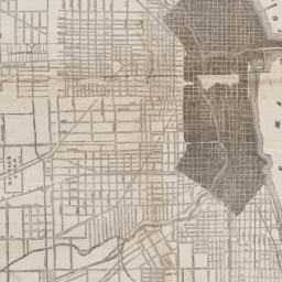
346. Map of the upper part of the Island of Manhattan above Eighty-Sixth Street arranged to illustrate the Battle of Harlem Heights
Shannon, Joseph
maps
- Name: Shannon, Joseph
- Published: s.n: New York?. 1868]
- Format: maps
- Online: click here for full-text
- Catalog Record: check availability
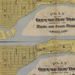
347. Map of the Wood Lawn Cemetery : incorporated December 29th, 1863
maps
- Published: s.n: New York. 1869?]
- Format: maps
- Online: click here for full-text
- Catalog Record: check availability
348. Map of Westchester County, State of New York
MacDonald, Chas
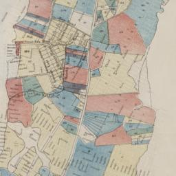
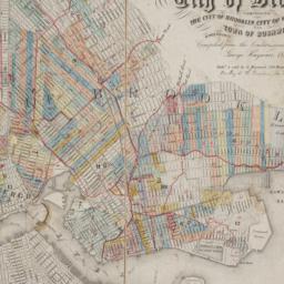
maps
- Name: MacDonald, Chas
- Published: E. Belcher Hyde Co: New York. 1925
- Format: maps
- Catalog Record: check availability
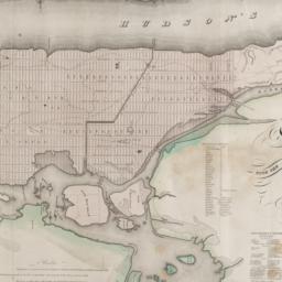
349. Map sections
maps
- Published: Oxford University Press: London?. between 1980 and 1990?]
- Format: maps
- Catalog Record: check availability

350. Map shewing a division of part of the real estate late of Nicholas W. Stuyvesant decd. among his heirs situated in the 11th Ward of the City of New York
Doughty, Saml. S
maps
- Name: Doughty, Saml. S
- Published: Miller & Co. Lithog: New York. 1834 May
- Format: maps
- Online: click here for full-text
- Catalog Record: check availability
351. [Map showing area bounded by Tompkins Street and 3rd Avenue between 23rd and 9th Streets]
maps
- Published: s.n: New York?. 18--?]
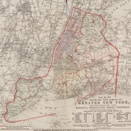
- Format: maps
- Online: click here for full-text
- Catalog Record: check availability
352. Map showing geologic formations along the proposed lines for distribution conduits
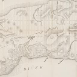
New York State Museum
maps
- Name: New York State Museum
- Published: State Museum: Albany. 1911]
- Format: maps
- Catalog Record: check availability
353. Map showing public parks in the Borough of the Bronx
Bronx (New York, N.Y.). Dept. of Parks
maps
- Name: Bronx (New York, N.Y.). Dept. of Parks
- Published: Bronx Dept. of Parks: Bronx (New York, N.Y.). [1926?]
- Format: maps
- Catalog Record: check availability
354. Map showing the limits of greater New York, as defined by the Municipal Consolidation Inquiry Commisssion appointed under the authority of Chapter 311, Laws of 1890 including the following cities, towns, etc
maps
- Published: E.C. Bridgman: New York?. 1890?]
- Format: maps
- Online: click here for full-text
- Catalog Record: check availability
355. Maps accompanying report of the New York Commerce Commission, 1900
maps
- Published: [s.n.]: New York. 1898-1900
- Format: maps
- Catalog Record: check availability
356. Maps accompanying the Report of the secretary of state of the enumeration of the inhabitants, 1915
New York (State). Secretary's Office
maps
- Name: New York (State). Secretary's Office
- Published: J.B. Lyon: Albany. 1916
- Format: maps
- Catalog Record: check availability
357. Maps of farms commonly called, the blue book, 1815
Sackersdorff, Otto
maps
- Name: Sackersdorff, Otto
- Published: [s.n.]: New York. 1868
- Format: maps
- Catalog Record: check availability
358. [Maps of land use in Lower Manhattan from 1609-1900]
maps
- Published: s.n: New York?. 19--]
- Format: maps
- Online: click here for full-text
- Catalog Record: check availability
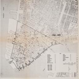
![[Maps of Manhattan]](https://archive.org/services/img/ldpd_11290413_000)
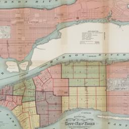
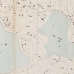
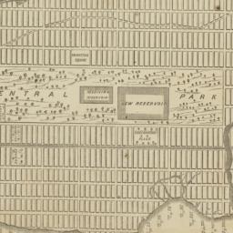
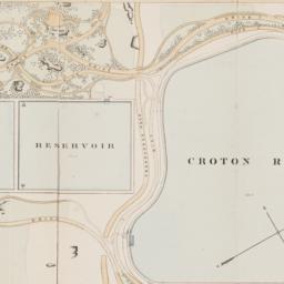
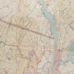
359. [Maps of Manhattan]
maps
- Published: s.n: New York?. ca. 1890]
- Format: maps
- Online: click here for full-text
- Catalog Record: check availability
360. Maps of New York City six maps in one
maps
- Published: Manhattan Postcard Publishing Co: Glendale, N.Y. 1985
- Format: maps
- Catalog Record: check availability