Search Results Header
Search Constraints
Showing results for: "Architecture" Remove constraint "Architecture" Format maps Remove constraint Format: maps Format manuscripts Remove constraint Format: manuscriptsSearch Results
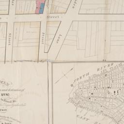
97. Map & plan of the proposed continuation of the widening & extension of William Street : from Maiden Lane to Chatham Street & the new line of said strt. as adopted between Wall St. & Maiden Lane, showing the situation of the property advertised by John R. Pitkin (No. 5 Broad Strt.)
maps
- Published: [publisher not identified]: N.Y.?. [183-?
- Format: maps
- Online: click here for full-text
- Catalog Record: check availability
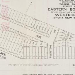
98. Map of 105 choice lots comprising the Waring Estate situated on Eastern Boulevard between Tremont Ave and Fort Schuyler Road Westchester Bronx, New York City
maps
- Published: s.n: New York. 1906]
- Format: maps
- Online: click here for full-text
- Catalog Record: check availability
99. Map of 158 building lots at Harlaem [sic] to be sold by James Bleeckeer & Sons on Wednesday January 15th at 12 o'clock at the Merchts Exchange
maps
- Published: P. Desbroy's: New York. [18--?]
- Format: maps
- Online: click here for full-text
- Catalog Record: check availability
100. Map of 500 lots of the estate of James Cordon Bennett, dec'd, located between Broadway and N.Y. Central and Hudson River, RR. and between W. 181st and W. 187th Streets borough of Manhattan City of New York
maps
- Published: s.n: New York. 1919]
- Format: maps
- Online: click here for full-text
- Catalog Record: check availability
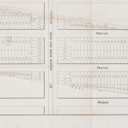
101. [Map of 50th Street to 53rd Street between 10th Avenue and 13th Avenue]
maps
- Published: s.n: New York?. 1851?]
- Format: maps
- Online: click here for full-text
- Catalog Record: check availability
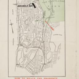
102. Map of 58 lots belonging to the Griswold Estate fronting on the continuation of Riverside Drive known as Fieldston Road and situated between Broadway and Riverdale Avenue, W. 246th Street and W. 253rd Street
maps
- Published: s.n: New. 1910]
- Format: maps
- Online: click here for full-text
- Catalog Record: check availability
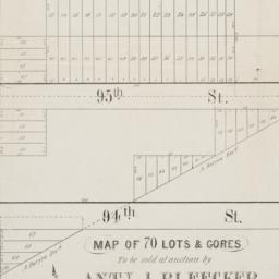
103. Map of 70 lots & gores to be sold at auction by Aty J. Bleecker on Monday 25th March 1850 at 12 o'clock at the Merchants Exchange
maps
- Published: Serrell & Perkins: New York. [1850]
- Format: maps
- Online: click here for full-text
- Catalog Record: check availability
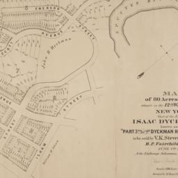
104. Map of 80 acres of land situate in the 12th Ward of the city of New York part of the estate of Isaac Dyckman, dec'd : known as the "Part 3rd of the Dyckman Homestead Property" to be sold by V.K. Stevenson Son & Co, B.P. Fairchild, Auctioneer, June 7th, 1871 at the Exchange Salesrooms, 111 Broadway, New York
maps
- Published: Major & Knapp Eng. Mfg. & Lith. Co: New York. [1871]
- Format: maps
- Online: click here for full-text
- Catalog Record: check availability

105. Map of Brooklyn and vicinity
Dripps, M
maps
- Name: Dripps, M
- Published: M. Dripps: New York. 1872
- Format: maps
- Catalog Record: check availability
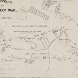
106. Map of Brooklyn at the time of the Revolutionary War
Johnson, Jeremiah, 1768-1852
maps
- Name: Johnson, Jeremiah, 1768-1852
- Published: George Hayward: N[ew] Y[ork]. [1858]
- Format: maps
- Online: click here for full-text
- Catalog Record: check availability
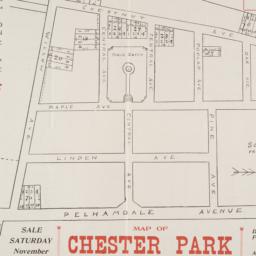
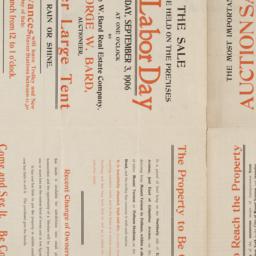
107. Map of Chester Park 41 lots to sold at auction by George W. Bard, auctioneer
maps
- Published: s.n: New York. 18--?]
- Format: maps
- Online: click here for full-text
- Catalog Record: check availability
108. Map of city of New-York
Hayward, George, approximately 1800-
maps
- Name: Hayward, George, approximately 1800-
- Published: G. Hayward: N.Y. 1842
- Format: maps
- Catalog Record: check availability
109. Map of Coney Island and Sheepshead Bay
Dripps, M
maps
- Name: Dripps, M
- Published: M. Dripp's: New York. 1879
- Format: maps
- Catalog Record: check availability
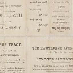
110. [Map of Hudson Avenue Tract in Newark]
maps
- Published: s.n: Newark, N.J.?. 18--?]
- Format: maps
- Online: click here for full-text
- Catalog Record: check availability
111. Map of land belonging to the Odell Realty Co. in the city of Yonkers, N.Y
maps
- Published: s.n: New York?. 1913?]
- Format: maps
- Online: click here for full-text
- Catalog Record: check availability
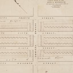
112. Map of land of Theodorus Bergen west of Third Avenue in the Eighth Ward of the city of Brooklyn : as surveyed December 1853 by T.G. Bergen
Bergen, Teunis G., 1806-1881
maps
- Name: Bergen, Teunis G., 1806-1881
- Format: maps
- Catalog Record: check availability
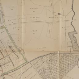
113. Map of Lincoln Manor City of Mount Vernon, Westchester Co., N.Y
maps
- Published: s.n: New York. 1906]
- Format: maps
- Online: click here for full-text
- Catalog Record: check availability
114. [Map of Lower Manhattan, Pine Street to Rosevelt St. between South Street and William Street]
maps
- Published: s.n: New York?. 1930?]
- Format: maps
- Catalog Record: check availability

115. Map of lower New York City showing the location of the Knickerbocker
maps
- Published: Hagstrom Map Co: New York?. 19--?]
- Format: maps
- Online: click here for full-text
- Catalog Record: check availability
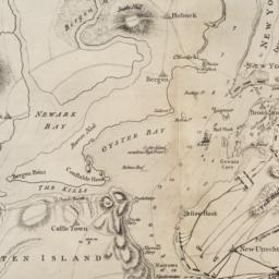
116. [Map of Manhattan, Brooklyn, Staten Island, Long Island, and New Jersey with references to the Battle on Long Island]
maps
- Published: s.n: New York?. 18--?]
- Format: maps
- Online: click here for full-text
- Catalog Record: check availability
117. Map of Mount Vernon and environs, Westchester Co., N.Y. : showing lot numbers, subdivisions of lots and property lines, also location of sewers, gas and water mains
Goldthwaite, Wm. M
maps
- Name: Goldthwaite, Wm. M
- Published: Wm. M. Goldthwaite: New York, N.Y. 1890
- Format: maps
- Catalog Record: check availability

118. A map of New England and New York
Speed, John, 1552?-1629
maps
- Name: Speed, John, 1552?-1629
- Published: Sold by Tho: London. [1676]
- Format: maps
- Online: click here for full-text
- Catalog Record: check availability
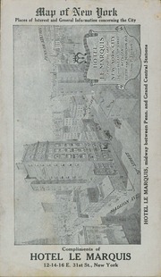
119. Map of New York : places of interest and general information concerning the city
maps
- Published: [publisher not identified]: New York?. [1920?]
- Format: maps
- Online: click here for full-text
- Catalog Record: check availability

120. Map of New York : places of interest and general information concerning the city
Ohman Map Co
maps
- Name: Ohman Map Co
- Published: Aug. R. Ohman Map Co: New York. c1913
- Format: maps
- Online: click here for full-text
- Catalog Record: check availability
Search Other Sources for: "Architecture"
Try your search in one of these related resources. (Search results will display in a new window.)
-
Avery Index to Architectural Periodicals
A comprehensive listing of journal articles published worldwide on architecture and design, archaeology, city planning, interior design, landscape architecture, and historic preservation. -
Brooklyn Historical Society Photography Collection
Search for individual photographs. Approximately 5,000 of our images are currently available online, but more images are added regularly. -
Brooklyn Public Library: Historic Brooklyn Photographs
Selection of more than ten thousand historic photographs from the Brooklyn Collection. -
CLIO: Columbia Libraries Catalog
Search for books, articles, journals, online resources and more. -
DLC: Columbia Libraries Digital Collections
A gateway to digital projects and online exhibitions that have been published on the web by Columbia University Libraries/Information Services (CUL/IS). -
Museum of the City of New York
Over 150,000 images and objects from the collections of the Museum of the City of New York.
Note: to come. -
New York Historical Society
Digital images from the library and museum collections. -
NYPL Digital Collections
Provides free and open access to over 800,000 images digitized from the The New York Public Library's vast collections.