Search Results Header
Search Constraints
Showing results for: "Manhattan (New York, N.Y.)" Remove constraint "Manhattan (New York, N.Y.)" Format maps Remove constraint Format: maps Borough Manhattan Remove constraint Borough: Manhattan City New York Remove constraint City: New YorkSearch Results
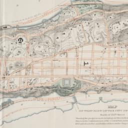
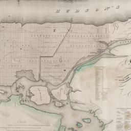
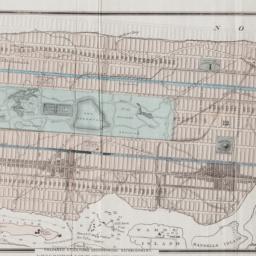
97. Map of that part of the city of New York north of 155th street : showing the progress made in laying out streets, roads, public squares and places, by the Commissioners of the Central Park, under Chap. 565 of Laws of 1865 and of new Pier and Bulkhead Laws under Chap. 697 of Laws of 1867
maps
- Published: Major & Knapp Eng. Mfg. & Lith. Co: N.Y. 1870
- Format: maps
- Online: click here for full-text
- Catalog Record: check availability
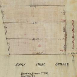
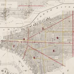
98. [Map of the area bounded by Forty Third Street and Broadway]
maps
- Published: [s.n.]: New York. 1880
- Format: maps
- Online: click here for full-text
- Catalog Record: check availability
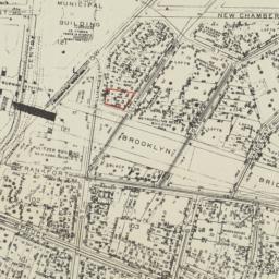
99. [Map of the area bounded by New Chambers Street, Peart Street, Beekman Street, and Nassau Street]
maps
- Published: s.n: New York?. 1914?]
- Format: maps
- Online: click here for full-text
- Catalog Record: check availability
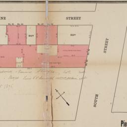
100. [Map of the area in Lower Manhattan bound by Pine Street, South Street, Wall Street and Front Street]
maps
- Published: s.n: New York?. 1895?]
- Format: maps
- Online: click here for full-text
- Catalog Record: check availability

101. Map of the borough of Manhattan, city of New York showing new law tenement houses for which plans were filed during 1908
New York (N.Y.). Tenement House Department
maps
- Name: New York (N.Y.). Tenement House Department
- Published: s.n: New York?. 1908?]
- Format: maps
- Catalog Record: check availability
102. Map of the boundaries of the Fire Department of the City of New York
New York (N.Y.). Fire Department
maps
- Name: New York (N.Y.). Fire Department
- Published: s.n.]: New York. 1871
- Format: maps
- Online: click here for full-text
- Catalog Record: check availability
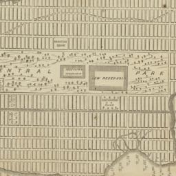
103. Map of the Central Park, New York
maps
- Published: Frank Leslie: New York?. 1856]
- Format: maps
- Online: click here for full-text
- Catalog Record: check availability
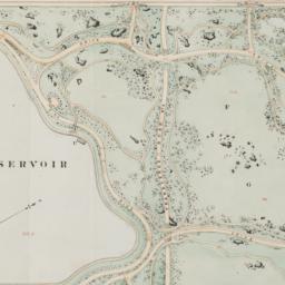
104. Map of the Central Park showing the progress of the work up to January 1st 1867
maps
- Published: s.n: New York. 1867?]
- Format: maps
- Online: click here for full-text
- Catalog Record: check availability
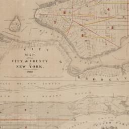
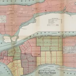
105. Map of the city & county of New York
Hayward, George, approximately 1800-
maps
- Name: Hayward, George, approximately 1800-
- Published: Engraved for D.T. Valentine's manual for 1862, by Geo. Hayward: New York (N.Y.). [1861]
- Format: maps
- Online: click here for full-text
- Catalog Record: check availability
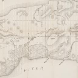
106. Map of the city & county of New York ; Upper part of the city and county of New York on a reduced scale
Hayward, George, approximately 1800-
maps
- Name: Hayward, George, approximately 1800-
- Published: Common Council]: New York. 1860
- Format: maps
- Catalog Record: check availability
107. A map of the city and county of New York : with the adjacent cities of Brooklyn and Jersey City, and the village of Williamsburg : with a street directory of the city of New York
Thayer, Bridgman & Fanning
maps
- Name: Thayer, Bridgman & Fanning
- Published: Thayer, Bridgman & Fanning: New York. 1853
- Format: maps
- Catalog Record: check availability
108. Map of the city and county of New York : with the adjacent country
Burr, David H., 1803-1875
maps
- Name: Burr, David H., 1803-1875
- Published: s.n: New York. 1829]
- Format: maps
- Online: click here for full-text
- Catalog Record: check availability

109. Map of the City of New York
W.C. Rogers & Co
maps
- Name: W.C. Rogers & Co
- Published: s.n.]: New York. 1868
- Format: maps
- Online: click here for full-text
- Catalog Record: check availability

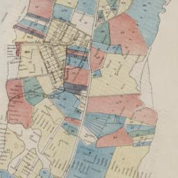
110. Map of the City of New York : shewing the original high water ine and the location of the different farms and estates
Hayward, George, approximately 1800-
maps
- Name: Hayward, George, approximately 1800-
- Published: New York Common Council: New York. 1852]
- Format: maps
- Online: click here for full-text
- Catalog Record: check availability
111. Map of the City of New York : showing the streets, avenues, roads, public squares & places laid out, established, widened and retained, the new pier and bulkhead lines laid out and established by the Board of Commissioners of the Central Park, by and under authority of chapter 697 of the laws of the State of New York, passed April 24, 1867
New York (N.Y.). Board of Commissioners of the Central Park
maps
- Name: New York (N.Y.). Board of Commissioners of the Central Park
- Published: s.n: New York?. 1868-1872]
- Format: maps
- Catalog Record: check availability
112. Map of the city of New York : with the adjacent cities of Brooklyn & Jersey City & the village of Williamsburg
Phelps, Humphrey, active 19th century
maps
- Name: Phelps, Humphrey, active 19th century
- Published: H. Phelps: New York. 1845
- Format: maps
- Catalog Record: check availability
113. Map of the City of New York, 1856
Hayward, George, approximately 1800-
maps
- Name: Hayward, George, approximately 1800-
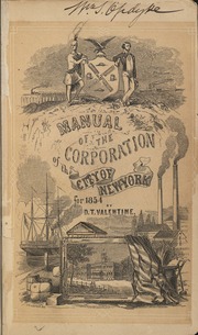
- Published: New York Common Council: New York. 1856]
- Format: maps
- Online: click here for full-text
- Catalog Record: check availability
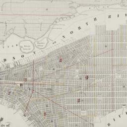
114. Map of the City of New York, from the Battery to 80th Street, showing the original topography of Manhattan Island
Viele, Egbert L. 1825-1902
maps
- Name: Viele, Egbert L. 1825-1902
- Published: s.n: New York. 1866?]
- Format: maps
- Online: click here for full-text
- Catalog Record: check availability
115. Map of the city of New York showing the original high water lines and the location of the different farms and estates
Hayward, George, approximately 1800-
maps
- Name: Hayward, George, approximately 1800-
- Published: Common Council: New York. 1852]
- Format: maps
- Online: click here for full-text
- Catalog Record: check availability
116. Map of the city of New York showing the proposed route of the "arcade" underground railway
maps
- Published: G.W. & C.B. Colton: New York. [1870?]
- Format: maps
- Online: click here for full-text
- Catalog Record: check availability
117. Map of the city of New York with street directory : showing house-numbers, hotels, churches, banks, theatres, ferries, house-car, steam and elevated r.r'ds, &c
Dripps, M
maps
- Name: Dripps, M
- Published: M. Dripps: New York. [1880?]
- Format: maps
- Catalog Record: check availability
118. Map of the City of New-York
Hayward, George, approximately 1800-
maps
- Name: Hayward, George, approximately 1800-
- Published: Common Council, 1854]: New York. 1854
- Format: maps
- Online: click here for full-text
- Catalog Record: check availability
119. Map of the city of New-York, 1853
Hayward, George, approximately 1800-
maps
- Name: Hayward, George, approximately 1800-
- Published: Common Council: New York, N.Y. 1853]
- Format: maps
- Online: click here for full-text
- Catalog Record: check availability

120. A map of the common lands between the three and six mile stones, belonging to the corporation of the city of New York
Goerck, Casimir Th., -1798
maps
- Name: Goerck, Casimir Th., -1798
- Published: Common Council: New York. 1861]
- Format: maps
- Online: click here for full-text
- Catalog Record: check availability
Search Other Sources for: "Manhattan (New York, N.Y.)"
Try your search in one of these related resources. (Search results will display in a new window.)
-
Avery Index to Architectural Periodicals
A comprehensive listing of journal articles published worldwide on architecture and design, archaeology, city planning, interior design, landscape architecture, and historic preservation. -
Brooklyn Historical Society Photography Collection
Search for individual photographs. Approximately 5,000 of our images are currently available online, but more images are added regularly. -
Brooklyn Public Library: Historic Brooklyn Photographs
Selection of more than ten thousand historic photographs from the Brooklyn Collection. -
CLIO: Columbia Libraries Catalog
Search for books, articles, journals, online resources and more. -
DLC: Columbia Libraries Digital Collections
A gateway to digital projects and online exhibitions that have been published on the web by Columbia University Libraries/Information Services (CUL/IS). -
Museum of the City of New York
Over 150,000 images and objects from the collections of the Museum of the City of New York.
Note: to come. -
New York Historical Society
Digital images from the library and museum collections. -
NYPL Digital Collections
Provides free and open access to over 800,000 images digitized from the The New York Public Library's vast collections.