Search Results Header
Search Constraints
Showing results for: Format maps Remove constraint Format: maps City New York Remove constraint City: New YorkSearch Results
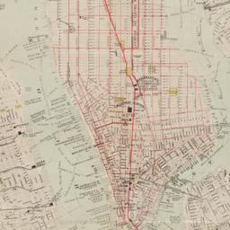
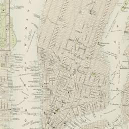
217. New map of New York City : from the latest surveys showing all the ferries and steamship docks, elevated, cable, and cross town car lines
Brooks Bank Note Co
maps
- Name: Brooks Bank Note Co
- Published: Broadway Central Hotel, Tilly Haynes, proprietor: New York. [189-?]
- Format: maps
- Online: click here for full-text
- Catalog Record: check availability

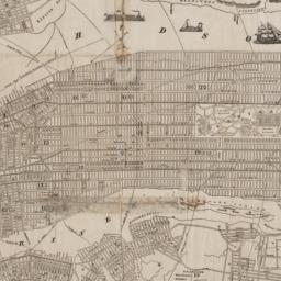
218. A new map of the City of New York : comprising all the late improvements, compiled and corrected from authentic documents, designed to accompany the Description of New York
Marks, Samuel
maps
- Name: Marks, Samuel
- Published: S. Marks: New York. 1827
- Format: maps
- Online: click here for full-text
- Catalog Record: check availability
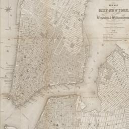
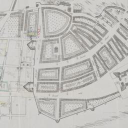
219. New map of the city of New York with part of Brooklyn & Williamsburg
Smith, J. Calvin
maps
- Name: Smith, J. Calvin
- Published: Published by H.S. Tanner map selr., 237 Broadway: New York. 1846
- Format: maps
- Online: click here for full-text
- Catalog Record: check availability
220. New York
maps
- Published: Letts, Son & Co: London. [1885?]
- Format: maps
- Online: click here for full-text
- Catalog Record: check availability
221. New York
maps
- Published: s.n: New York. between 1864 and 1869]
- Format: maps
- Online: click here for full-text
- Catalog Record: check availability
222. New York
maps
- Published: Letts, Son & Co: London. [1885?]
- Format: maps
- Online: click here for full-text
- Catalog Record: check availability

223. New York
Bollmann, Hermann, 1911-1971
maps
- Name: Bollmann, Hermann, 1911-1971
- Published: Pictorial Maps: New York. [1962?]
- Format: maps
- Catalog Record: check availability
224. New York : map of midtown Manhattan in detailed axonometric projection
Manhattan Map Company
maps
- Name: Manhattan Map Company
- Published: Manhattan Map Co: New York, N.Y. c1985
- Format: maps
- Catalog Record: check availability

225. New York, 1730 the English colonial city
MacCoun, Townsend, 1845-1932
maps
- Name: MacCoun, Townsend, 1845-1932
- Published: Townsend MacCoun: New York. 1909
- Format: maps
- Online: click here for full-text
- Catalog Record: check availability
226. The New York 1939 official World's Fair pictorial map
Sarg, Tony, 1882-1942
maps
- Name: Sarg, Tony, 1882-1942
- Published: The Fair?: New York. 1939]
- Format: maps
- Catalog Record: check availability
227. New York and Brooklyn
maps
- Published: s.n.]: S.l. c1867
- Format: maps
- Online: click here for full-text
- Catalog Record: check availability
228. New York and its surroundings : map of the metropolis from the Battery to One Hundred and Eighth Street, and parts of Brooklyn, Williamsburg, Greenpoint, Jersey City, and Hoboken
maps
- Published: Harper's Weekly: New York?. 1873
- Format: maps
- Catalog Record: check availability
229. New York City
Asher & Adams
maps
- Name: Asher & Adams
- Published: Asher & Adams: New York. 1871]
- Format: maps
- Online: click here for full-text
- Catalog Record: check availability
230. New York City and vicinity
maps
- Published: Advertising Unlimited, Inc: New York?. c1989
- Format: maps
- Catalog Record: check availability
231. New York City and vicinity
maps
- Published: Rand McNally & Co: Chicago?. 1981
- Format: maps
- Catalog Record: check availability
232. New York City East Village map
Finkel, Julie
maps
- Name: Finkel, Julie
- Published: Vermilion: New York City. 1983
- Format: maps
- Catalog Record: check availability
233. New York, city (lower part)
maps
- Published: s.n: S.l. 1889?]
- Format: maps
- Online: click here for full-text
- Catalog Record: check availability
234. New York City, Manhattan, Brooklyn, Bronx, Queens & Staten Island map
Rand McNally and Company
maps
- Name: Rand McNally and Company
- Published: Rand McNally & Co: Chicago. [1982?]
- Format: maps
- Catalog Record: check availability
235. New York city map
Phelps, Humphrey, active 19th century
maps
- Name: Phelps, Humphrey, active 19th century
- Published: H. Phelps: New York. c1857
- Format: maps
- Online: click here for full-text
- Catalog Record: check availability
236. New York city map
Miller, James
maps
- Name: Miller, James
- Published: J. Miller: New York. [1857?]
- Format: maps
- Catalog Record: check availability
237. [New York, city map of New York and five boroughs]
Falk-Verlag
maps
- Name: Falk-Verlag
- Published: Falk-Plan: New York. [1969], c1968
- Format: maps
- Catalog Record: check availability
238. New York City unfolds
VanDam (Firm)
maps
- Name: VanDam (Firm)
- Published: World Unfolds Pub: New York?. c1984
- Format: maps
- Catalog Record: check availability
239. New York City--5 maps in 1 : Manhattan streets, Midtown, Downtown, Greenwich Village, Manhattan subways
Hagstrom Map Company
maps
- Name: Hagstrom Map Company
- Published: Hagstrom Map Co: Maspeth, NY. c1995
- Format: maps
- Catalog Record: check availability
240. New York, Downtown, Manhattan-Jersey City-Brooklyn
Edward S. Gordon Company
maps
- Name: Edward S. Gordon Company
- Published: Edward S. Gordon Co: New York, NY. [1992?]
- Format: maps
- Catalog Record: check availability
241. New York, guide touristique et carte
New York Convention and Visitors Bureau, inc
maps
- Name: New York Convention and Visitors Bureau, inc
- Published: New York Convention and Visitors Bureau, Inc: New York, N.Y. [1978]
- Format: maps
- Catalog Record: check availability
242. The New York insider's Midhattan map with exclusive three dimensional effects
Siegel, Norman L
maps
- Name: Siegel, Norman L
- Published: Able David Victor: New York. c1975
- Format: maps
- Catalog Record: check availability
243. New York island & parts adjacent
Conder, Thomas, 1746 or 1747-1831
maps
- Name: Conder, Thomas, 1746 or 1747-1831
- Published: Printed for the author: London. 1788]
- Format: maps
- Online: click here for full-text
- Catalog Record: check availability
244. New York, map of midtown Manhattan : in detailed axonometric projection
Anderson Isometric Maps (Firm)
maps
- Name: Anderson Isometric Maps (Firm)
- Published: Anderson Isometric Maps: New York. c1980
- Format: maps
- Catalog Record: check availability
245. New York, picture and street map
Bollmann Bildkarten Verlag
maps
- Name: Bollmann Bildkarten Verlag
- Published: Bollmann-Bildkarten-Verlag: Braunschweig, Germany. [1984?]
- Format: maps
- Catalog Record: check availability
246. New York World's Fair
Hagstrom Company
maps
- Name: Hagstrom Company
- Published: Hagstrom Co: New York. [1938?]
- Format: maps
- Catalog Record: check availability
247. New York World's Fair : 1965 official souvenir map
Bollmann, Hermann, 1911-1971
maps
- Name: Bollmann, Hermann, 1911-1971
- Published: Time Inc: New York. c1965
- Format: maps
- Catalog Record: check availability
248. New Yorke, 1695
Miller, John, 1666-1724
maps
- Name: Miller, John, 1666-1724
- Published: Lith. G. Hayward: New York. [1852]
- Format: maps
- Online: click here for full-text
- Catalog Record: check availability
249. New-York, April 1852 drawn on an enlarged scale from map of district burnt by great fire of 16th Dec. 1835, as published in the Journal of Commerce Dec. 18th, 1835
maps
- Published: s.n: New York?. 1852?]
- Format: maps
- Online: click here for full-text
- Catalog Record: check availability
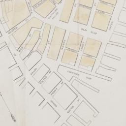
250. New-York city & county map : with vicinity entire, Brooklyn, Williamsburgh, Jersey City &c. in the 79th year of the independence of the United States
Magnus, Charles
maps
- Name: Magnus, Charles
- Published: Charles Magnus: New York. [1855?]
- Format: maps
- Online: click here for full-text
- Catalog Record: check availability
251. New-York city & county map with vicinity entire Brooklyn, Williamsburgh, Jersey City &c. ; Complete map of the City of New York
maps
- Published: Ch. Magnus: New York. [1850?]
- Format: maps
- Catalog Record: check availability
252. New-York City, County and vicinity
Dripps, M
maps
- Name: Dripps, M
- Published: s.n: New York?. 1866]
- Format: maps
- Online: click here for full-text
- Catalog Record: check availability
253. New-York City guide map showing business parts of Brooklyn, elevated rail roads, horse car and stage lines, hotels, churches, theatres, docks, piers, &c
maps
- Published: [publisher not identified]: New York?. [1884?]
- Format: maps
- Catalog Record: check availability
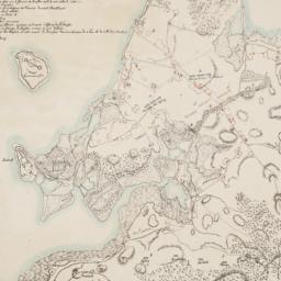
![The Nicolls [sic] map, 1664...](https://derivativo-2.library.columbia.edu/iiif/2/cul:d7wm37pvtw/featured/!256,256/0/native.jpg)
254. The Nicolls [sic] map, 1664-1668
Nicholls, Sutton
maps
- Name: Nicholls, Sutton
- Published: Lith. by G. Hayward for D.T. Valentine's Manual: N.Y., N.Y. 1863
- Format: maps
- Online: click here for full-text
- Catalog Record: check availability
255. Nieuw Amsterdam the Dutch Settlement in the New World that became New York following the plan sent October 6, 1660 by Governor Peter Stuyvesant to the West india Company in Holland with additions concerning persons, places and events until the year 1699
maps
- Published: Manning Exton: South Port, Conn. c1965
- Format: maps
- Catalog Record: check availability
256. Nostrand's indexed Bronx house number map
Nostrand, George J
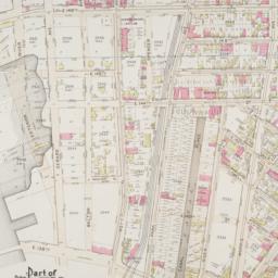
maps
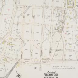
- Name: Nostrand, George J
- Published: George B. Nostrand: N.Y.C. [1939?]
- Format: maps
- Catalog Record: check availability
257. Nostrand's New York, part of Bronx indexed house number map
Nostrand, George J
maps
- Name: Nostrand, George J
- Published: George J. Nostrand: New York City. [between 1920 and 1934]
- Format: maps
- Catalog Record: check availability
258. Nostrand's New York, part of Bronx indexed house number map
Nostrand, George J
maps
- Name: Nostrand, George J
- Published: George J. Nostrand: N.Y.C. [i.e. New York]. 1934
- Format: maps
- Catalog Record: check availability
259. The official New York map of the stars' homes : tips on where to find stars ... maybe see the stars
Nalle, Willis
maps
- Name: Nalle, Willis
- Published: Beach House Products: New York. c1986
- Format: maps
- Catalog Record: check availability

260. One day's trucking to and from the New York Central's pier and inland stations south of Fifty-Ninth Street
maps
- Published: J.B. Lyon Co: Albany. 1920]
- Format: maps
- Online: click here for full-text
- Catalog Record: check availability
261. Outline and index map of New York City, Manhattan Island
maps
- Published: s.n: New York?. 18--?]
- Format: maps
- Online: click here for full-text
- Catalog Record: check availability
262. Outline and index map of New York City, New York
maps
- Published: G.W. Bromley & Co: New York?. 1879?]
- Format: maps
- Online: click here for full-text
- Catalog Record: check availability
263. Outline and index map of volume three, atlas of New York City, borough of Manhattan 59th St. to 110th St
maps
- Published: G.W. Bromley & Co: New York?. 1916?]
- Format: maps
- Online: click here for full-text
- Catalog Record: check availability

264. Outline map of Brooklyn, N.Y., showing present and original shoreline and marshy tracts
maps
- Published: s.n: New York?. 189-?]
- Format: maps
- Online: click here for full-text
- Catalog Record: check availability
265. Outline map of Manhattan island showing present and original shore lines and marshy tracts
maps
- Published: s.n: New York?. 189-?]
- Format: maps
- Online: click here for full-text
- Catalog Record: check availability
266. Part of College Point, town of Flushing, Queens Co
maps
- Published: Beers, Comstock & Cline: N.Y. 1873]
- Format: maps
- Online: click here for full-text
- Catalog Record: check availability
267. Part of Flushing, town of Flushing, Queens Co
maps
- Published: Beers, Comstock & Cline: N.Y. 1873]
- Format: maps
- Catalog Record: check availability
268. Part of Flushing, town of Flushing, Queens Co
maps
- Published: Beers, Comstock & Cline: N.Y. 1873]
- Format: maps
- Online: click here for full-text
- Catalog Record: check availability
269. Part of Flushing, town of Flushing, Queens Co., L.I
maps
- Published: Beers, Comstock & Cline: N.Y. 1873]
- Format: maps
- Online: click here for full-text
- Catalog Record: check availability
270. Part of New York in 1742 showing the site of the present park, the collect and the little collect ponds, and a portion of the west side of Broadway
Grim, David, 1736-1826
maps
- Name: Grim, David, 1736-1826
- Published: s.n: New York?. 1856?]
- Format: maps
- Catalog Record: check availability
271. A part of Roggeveen's map of New Netherland, Amsterdam, 1676
Roggeveen, Arent, -1679
maps
- Name: Roggeveen, Arent, -1679
- Published: Bowen & Co: Philad[elphi]a. [19--]
- Format: maps
- Online: click here for full-text
- Catalog Record: check availability
272. Part of Section 5, New York City
maps
- Published: s.n: New York?. 1891?]
- Format: maps
- Online: click here for full-text
- Catalog Record: check availability
273. Part of ward 23, section 10
maps
- Published: G.W. Bromley and Co: Philadelphia. 1897]
- Format: maps
- Online: click here for full-text
- Catalog Record: check availability
274. Part of ward 23, section 9
maps
- Published: G.W. Bromley and Co: Philadelphia. 1897]
- Format: maps
- Online: click here for full-text
- Catalog Record: check availability
275. Part of ward 23, section 9
maps
- Published: G.W. Bromley and Co: Philadelphia. 1897]
- Format: maps
- Online: click here for full-text
- Catalog Record: check availability
276. Part of ward 23, section 9
maps
- Published: G.W. Bromley and Co: Philadelphia. 1897]
- Format: maps
- Online: click here for full-text
- Catalog Record: check availability
277. Part of ward 23, section 9
maps
- Published: G.W. Bromley and Co: Philadelphia. 1897]
- Format: maps
- Online: click here for full-text
- Catalog Record: check availability
278. Part of ward 23, sections 9 & 10
maps
- Published: G.W. Bromley and Co: Philadelphia. 1897]
- Format: maps
- Online: click here for full-text
- Catalog Record: check availability
279. Part of ward 23, sections 9 & 10
maps
- Published: G.W. Bromley and Co: Philadelphia. 1897]
- Format: maps
- Online: click here for full-text
- Catalog Record: check availability
280. Part of ward 23, sections 9 & 10
maps
- Published: G.W. Bromley and Co: Philadelphia. 1897]
- Format: maps
- Online: click here for full-text
- Catalog Record: check availability
281. Part of ward 23, sections 9 & 10
maps
- Published: G.W. Bromley and Co: Philadelphia. 1897]
- Format: maps
- Online: click here for full-text
- Catalog Record: check availability
282. Part of ward 23, sections 9 & 11
maps
- Published: G.W. Bromley and Co: Philadelphia. 1897]
- Format: maps
- Online: click here for full-text
- Catalog Record: check availability
283. Part of ward 23, sections 9, 10, & 11
maps
- Published: G.W. Bromley and Co: Philadelphia. 1897]
- Format: maps
- Online: click here for full-text
- Catalog Record: check availability
284. Peremptory sale of valuable real estate : by Halliday & Jenkins on Tuesday, February 18th, 1845, at twelve o'clock at the Merchants' Exchange
maps
- Published: P. Miller: New York. 1845
- Format: maps
- Online: click here for full-text
- Catalog Record: check availability
285. Peremptory sale of valuable real estate in the 12th Ward of the city of New York to be sold at auction by Theodore H. Jenkins at the Merchants' Exch on Monday 1st of June 1835
maps
- Published: P.A. Mesier's: New York. [1835]
- Format: maps
- Online: click here for full-text
- Catalog Record: check availability
286. Plan de New-York (Etats-Unis)
maps
- Published: Becquet: Paris. [188-?]
- Format: maps
- Online: click here for full-text
- Catalog Record: check availability
287. Plan des redoutes et des lignes que les ennemis avoient auprès de Brookland, de ceux de Redhook, et l"isle de Gouveurner
Riepe, G
maps
- Name: Riepe, G
- Published: s.n: S.l. 187-?]
- Format: maps
- Online: click here for full-text
- Catalog Record: check availability
288. Plan of Central Park, New York City
Dripps, M
maps
- Name: Dripps, M
- Published: M. Dripps: N.Y. [186-?]
- Format: maps
- Catalog Record: check availability
289. Plan of New York and Brooklyn
maps
- Published: s.n: S.l. 186-?]
- Format: maps
- Online: click here for full-text
- Catalog Record: check availability
290. Plan of New York &c
Mitchell, S. Augustus, Jr
maps
- Name: Mitchell, S. Augustus, Jr
- Published: S. Augustus Mitchell, Jr: Philadelphia. c1866
- Format: maps
- Online: click here for full-text
- Catalog Record: check availability
291. Plan of New York &c
Mitchell, S. Augustus, Jr
maps
- Name: Mitchell, S. Augustus, Jr
- Published: S. Augustus Mitchell, Jr: Philadelphia. 1860
- Format: maps
- Online: click here for full-text
- Catalog Record: check availability
292. Plan of New York City from the Battery to Spuyten Duyvil Creek : showing every lot and building thereon : old farm lines, street numbers at the corners of blocks, railroads, steamboat landings, bulkhead and pier lines, etc., etc., etc
Dripps, M
maps
- Name: Dripps, M
- Published: Mathew Dripps: N.Y. 1867
- Format: maps
- Online: click here for full-text
- Catalog Record: check availability
293. Plan of New York city from the Battery to Spuyten Duyvil creek : showing every lot and building thereon; old farm lines, street numbers at the corners of blocks, railroads, steamboat landings, bulkhead and pier lines, etc
Dripps, M
maps
- Name: Dripps, M
- Published: M. Dripps: New York. 1868
- Format: maps
- Catalog Record: check availability
294. A Plan of New York Island, Part of Long Island, &c. shewing the Position of the American and British Armies, before, at, and after the Engagement of the Heights, August 27th, 1776
Lewis, Samuel, 1753 or 1754-1822
maps
- Name: Lewis, Samuel, 1753 or 1754-1822
- Published: Richard Phillips: London?. 1806
- Format: maps
- Online: click here for full-text
- Catalog Record: check availability
295. A Plan of New York Island, Part of Long Island, &c. shewing the Position of the American and British Armies, before, at, and after the Engagement of the Heights, August 27th, 1776
Lewis, Samuel, 1753 or 1754-1822
maps
- Name: Lewis, Samuel, 1753 or 1754-1822
- Published: C.P. Wayne: Philadelphia. [1806]
- Format: maps
- Catalog Record: check availability
296. Plan of the city of New York
maps
- Published: Andrew B. Graham, Co: Washington, D.C. 1857
- Format: maps
- Online: click here for full-text
- Catalog Record: check availability

297. Plan of the city of New York
Poppleton, Thomas H
maps
- Name: Poppleton, Thomas H
- Published: Prior & Dunning: New York. 1817
- Format: maps
- Online: click here for full-text
- Catalog Record: check availability
298. A plan of the city of New York : reduced from an actual survey
Maerschalck, Francis W., -1776
maps
- Name: Maerschalck, Francis W., -1776
- Published: Lith. of H.R. Robinson for D.T. Valentine's Manual: New York, N.Y. [1850]
- Format: maps
- Online: click here for full-text
- Catalog Record: check availability
299. A plan of the city of New York from an actual survey
Lyne, James
maps
- Name: Lyne, James
- Published: Charles Magnus: New York?. [18--?]
- Format: maps
- Online: click here for full-text
- Catalog Record: check availability
300. Plan of the city of New York in North America : surveyed in the years 1766 & 1767
Ratzer, Bernard
maps
- Name: Ratzer, Bernard
- Published: J.H. Colton: New York. 1853
- Format: maps
- Online: click here for full-text
- Catalog Record: check availability
301. Plan of the city of New York, with the recent and intended improvements
Bridges, William, -1814
maps
- Name: Bridges, William, -1814
- Published: Isaac Riley: New York. 1807
- Format: maps
- Online: click here for full-text
- Catalog Record: check availability
302. A plan of the city of New-York
Holland, Samuel, 1728-1801
maps
- Name: Holland, Samuel, 1728-1801
- Published: D.T. Valentine: New York, N.Y. 1863]
- Format: maps
- Online: click here for full-text
- Catalog Record: check availability
303. A plan of the city of New-York & its environs : to Greenwich, on the North or Hudsons River, and to Crown Point, on the East or Sound River, shewing the several streets, publick buildings, docks, fort & battery, with the true form & course of the commanding grounds, with and without the town
Montrésor, John, 1736-1799
maps
- Name: Montrésor, John, 1736-1799
- Published: Engraved from the original map by John Montresor for D.T. Valentine's Manual for 1855 by G. Hayward: New York, N.Y. [1855]
- Format: maps
- Online: click here for full-text
- Catalog Record: check availability
304. Plan of the island of New York in North America but only from the eastern side in the vicinity of the late Fort Washington, afterward Knyphausen, which was taken in the month of May 1779 from the Laurel HIll, but first drawn in the month of January 1781 in the hut encampment near Fort Knyphausen
maps
- Published: Common Council: New York. 1854]
- Format: maps
- Catalog Record: check availability
305. A plan of the north east environs of the city of New-York
Holland, Samuel, 1728-1801
maps
- Name: Holland, Samuel, 1728-1801
- Published: Engraved for D.T. Valentine's Manual for 1859 by Geo. Hayward: New York, N.Y. [1859]
- Format: maps
- Online: click here for full-text
- Catalog Record: check availability

306. A plan of the north east environs of the city of New-York performed by order of His Excellency the Earl of Loudon & ca. & ca
Holland, Samuel, 1728-1801
maps
- Name: Holland, Samuel, 1728-1801
- Published: George Hayward: New York. [1859]
- Format: maps
- Online: click here for full-text
- Catalog Record: check availability
307. Plans of Westchester, West Farms, Morrisania, Westchester Co., and part of New York County
maps
- Published: F.W. Beers: New York. 1867]
- Format: maps
- Online: click here for full-text
- Catalog Record: check availability
308. Prospect Park and the Brooklyn Botanic Garden
Colbert, George
maps
- Name: Colbert, George
- Published: Greensward Foundation: New York, N.Y.?. c1972
- Format: maps
- Catalog Record: check availability
309. Public parks boroughs of Manhattan and Richmond City of New York
maps
- Published: s.n: New York?. 1903?]
- Format: maps
- Catalog Record: check availability
310. Queens bus map
New York (State). Metropolitan Transportation Authority
maps
- Name: New York (State). Metropolitan Transportation Authority
- Published: New York City Transit Authority: New York. c1993
- Format: maps
- Catalog Record: check availability
311. Rand, McNally & Co.'s map of New York City, Brooklyn, Jersey City and vicinity
Rand McNally and Company
maps
- Name: Rand McNally and Company
- Published: Rand, McNally & Co: New York. 1891
- Format: maps
- Catalog Record: check availability
312. Rand, McNally & Co.'s map of New York City, Brooklyn, Jersey City and vicinity
Rand McNally and Company
maps
- Name: Rand McNally and Company
- Published: Rand McNally & Co: Chicago. 1889, c1888
- Format: maps
- Catalog Record: check availability
313. Rand McNally & Co.'s road map of the country around New York : including parts of northern and central New Jersey, Westchester County, Long Island, Staten Island, with the good roads specially marked
Rand McNally and Company
maps
- Name: Rand McNally and Company
- Published: Rand McNally: New York. c1894
- Format: maps
- Catalog Record: check availability
314. The Ratzer map of New York City, 1767
maps
- Published: Longmans, Green & Co: New York?. 18--?]
- Format: maps
- Online: click here for full-text
- Catalog Record: check availability
315. Riverside Park map and guide
Earth Environmental Group
maps
- Name: Earth Environmental Group
- Published: Earth Environmental Group: New York. c1983
- Format: maps
- Catalog Record: check availability
316. Robinson's atlas of the City of New York : Embracing all territory within its corporate limits from official records, private plans & actual surveys
Robinson, E
maps
- Name: Robinson, E
- Published: E. Robinson: New York. 1885
- Format: maps
- Catalog Record: check availability
317. The runner's map of Central Park
Williams, Ron
maps
- Name: Williams, Ron
- Published: New York. c1978
- Format: maps
- Catalog Record: check availability
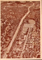
318. Saw Mill River Parkway widening in relation to New York City parkway system Triborough Bridge Authority
Triborough Bridge Authority
maps
- Name: Triborough Bridge Authority
- Published: Triborough Bridge Authority: New York. [1940]
- Format: maps
- Online: click here for full-text
- Catalog Record: check availability
319. Sherwood Park, Long Island being a sectional reprint from the Map of the Village of Queens, as surveyed by Mr. Geo. W. Dickerson
maps
- Published: Sherwood Land Association: New York. [18--?]
- Format: maps
- Catalog Record: check availability
320. Special places of the world. Manhattan
National Geographic Society (U.S.). Cartographic Division
maps
- Name: National Geographic Society (U.S.). Cartographic Division
- Published: National Geographic Society: Washington, D.C. c1990
- Format: maps
- Catalog Record: check availability
321. Streets of Soho and Tribeca map and guide
Mouly, Françoise
maps
- Name: Mouly, Françoise
- Published: Raw Books & Graphics: NYC, N.Y. [1985], c1984
- Format: maps
- Catalog Record: check availability
322. Streets of Soho map and guide : galleries, stores, restaurants & bars
Mouly, Françoise
maps
- Name: Mouly, Françoise
- Published: Raw Books: New York. [1979], c1978
- Format: maps
- Catalog Record: check availability
323. Streets of Soho map and guide : listings of galleries, shops, restaurants & bars
Mouly, Françoise
maps
- Name: Mouly, Françoise
- Published: Crass Publication: New York. c1977
- Format: maps
- Catalog Record: check availability
324. Streets of Soho map and guide the only up-to-date guide to Soho
Mouly, Françoise
maps
- Name: Mouly, Françoise
- Published: Raw Books: New York, N.Y. c1982
- Format: maps
- Catalog Record: check availability