Search Results Header
Search Constraints
Showing results for: "Streets" Remove constraint "Streets" Format maps Remove constraint Format: mapsSearch Results

1. 1609, the Island of Manhattan (Mannahtin) at the time of its discovery showing its elevations, water-courses, marshes, and shore line
MacCoun, Townsend, 1845-1932
maps
- Name: MacCoun, Townsend, 1845-1932
- Published: Townsend MacCoun: New York. c1909
- Format: maps
- Catalog Record: check availability
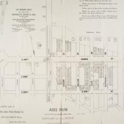
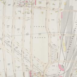
2. Adee Park east of Botanical Garden, Bronx Park : Borough of the Bronx, New York City
maps
- Published: s.n: New York?. 1906]
- Format: maps
- Online: click here for full-text
- Catalog Record: check availability

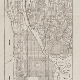
3. Asher & Adams' map of New York City
maps
- Published: Asher & Adams: New York?. between 1873 and 1883]
- Format: maps
- Online: click here for full-text
- Catalog Record: check availability
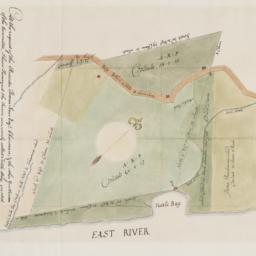
4. At the request of the recorder Thomas Jones Esqr. chairman, & the other gentlemen of the committee, I have surveyed the farm commonly called Tuttle Bay, granted by William Keist 23d of April 1646. unto George Holmes & Thomas Hall, and find the same to be agreeable to the above draft
Maerschalck, Francis W., -1776
maps
- Name: Maerschalck, Francis W., -1776
- Published: Common Council?: New York?. 1860?]
- Format: maps
- Online: click here for full-text
- Catalog Record: check availability
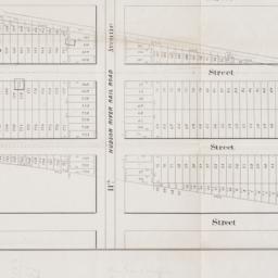
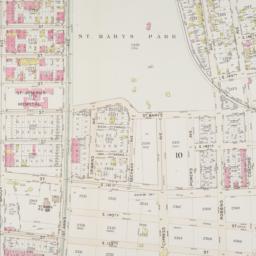
5. Atlas of Borough of the Bronx. from actual surveys and official plans / Sections 9 10 11 12 & 13
G.W. Bromley & Co
maps
- Name: G.W. Bromley & Co
- Published: G.W. Bromley & Co: Philadelphia. 1921
- Format: maps
- Catalog Record: check availability
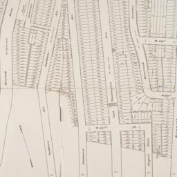
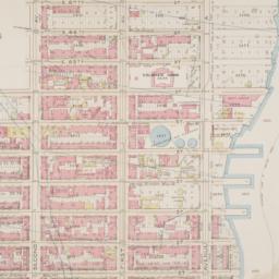
6. Atlas of the borough of Manhattan
G.W. Bromley & Co
maps
- Name: G.W. Bromley & Co
- Published: G.W. Bromley: New York. 1912
- Format: maps
- Online: click here for full-text click here for full-text click here for full-text
- Catalog Record: check availability
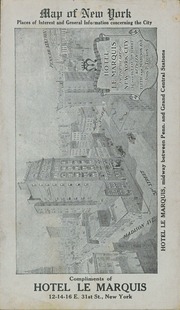
7. Atlas of the Borough of Manhattan, city of New York
G.W. Bromley & Co
maps
- Name: G.W. Bromley & Co
- Published: G. W. Bromley & Co: Philadelphia. [ca. 1921]
- Format: maps
- Catalog Record: check availability
8. Atlas of the Borough of the Bronx, City of New York : complete in five volumes
E. Belcher Hyde (Firm)
maps
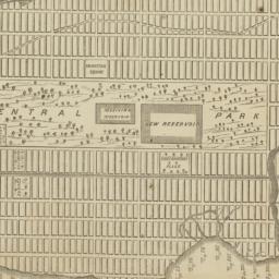
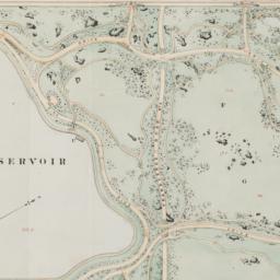
- Name: E. Belcher Hyde (Firm)
- Published: The Company: Brooklyn. 1900-1927 [v. 1, 1907]
- Format: maps
- Catalog Record: check availability
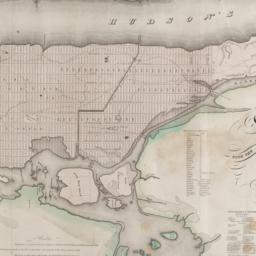
9. [Broad Street to Water Street south of Wall Street]
maps
- Published: s.n: New York?. 18--?]
- Format: maps
- Online: click here for full-text
- Catalog Record: check availability
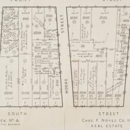
10. [Cadastral map of the area bound by South Street and Front Street between Whitehall Street and Broad Street]
maps
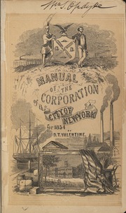
- Published: Chas. F. Noyes Co: New York. 1931?]
- Format: maps
- Online: click here for full-text
- Catalog Record: check availability
11. Citizens & travelers guide map in, to, and from the city of New York and adjacent places
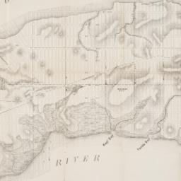
D.A. Edsall & Co
maps
- Name: D.A. Edsall & Co
- Published: D.A. Edsall & Co: New York. 1877
- Format: maps
- Catalog Record: check availability
12. City and county of New York
Bien, Joseph R
maps
- Name: Bien, Joseph R
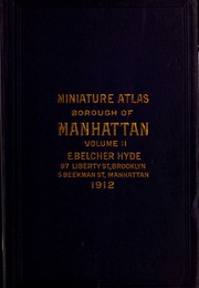
- Published: Julius Bien & Co: New York. 1891]
- Format: maps
- Online: click here for full-text
- Catalog Record: check availability

13. City of New York
Thomas, Cowperthwait & Co
maps
- Name: Thomas, Cowperthwait & Co
- Published: s.n.]: Philadelphia, Pa.?. 1850
- Format: maps
- Online: click here for full-text
- Catalog Record: check availability
14. City of New York
Burr, David H., 1803-1875
maps
- Name: Burr, David H., 1803-1875
- Published: J.H. Colton & Co: New York. 1839, c1833
- Format: maps
- Catalog Record: check availability
15. Cleartype street, house number, and transportation map of Manhattan (New York County, N.Y.)
American Map Company (New York, N.Y.)
maps
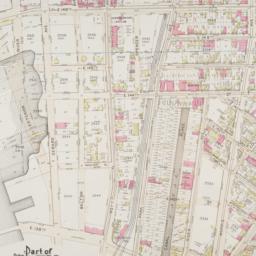
- Name: American Map Company (New York, N.Y.)
- Published: The Company: New York. [ca. 1948]
- Format: maps
- Catalog Record: check availability
16. Colton's Map of New York and the adjacent Cities
Colton, J. H. 1800-1893
maps
- Name: Colton, J. H. 1800-1893
- Published: Johnson & Browning: New York. c1855
- Format: maps
- Online: click here for full-text
- Catalog Record: check availability
17. Colton's New York City, Brooklyn, Jersey City, Hoboken, etc
Colton, G. Woolworth 1827-1901
maps
- Name: Colton, G. Woolworth 1827-1901
- Published: G.W. and C.B. Colton & Co: New York. 1875
- Format: maps
- Catalog Record: check availability
18. Complete map of the cities of New York, Brooklyn and Williamsburgh
maps
- Published: [s.n: New York. 1852]
- Format: maps
- Catalog Record: check availability
19. Cushman & Wakefield in Downtown Manhattan
Incentra International, Inc
maps
- Name: Incentra International, Inc
- Published: Cushman & Wakefield: New York. c1986
- Format: maps
- Catalog Record: check availability
20. C.W. Hobbs' guide map of New York City
Hobbs, C. W
maps
- Name: Hobbs, C. W
- Published: C.W. Hobbs: New York?. [between 1864 and 1884]
- Format: maps
- Online: click here for full-text
- Catalog Record: check availability
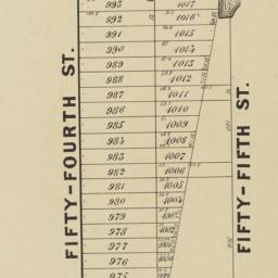
21. Extensive sale of lots of land located on Broadway, 7th 8th 9th, 10th and 11th Avenues and on 50th, 51st, 52d, 53d, and 54th Streets by order of the Supreme Court : under the direction of Philo. T. Ruggles, referee : Wednesday, June 18th, 1856, at 12 o'clock at the Merchants' Exchange
maps
- Published: Francis & Loutrel: New York?. [1856]
- Format: maps
- Online: click here for full-text
- Catalog Record: check availability
22. E-Z guide map of New York City : with patent indicator, showing at a glance the exact location of places of interest, railroad terminals, steamship piers, department stores and street locations
maps
- Published: Maull Co: Baltimore, Md. c1913
- Format: maps
- Catalog Record: check availability
23. E-Z guide map of New York City with patent indicator : showing at a glance the exact location of places of interest, railroad terminals, steamship piers, department stores and street locations
maps
- Published: Easy-Guide Mfg. Co: Baltimore, Md. c1916
- Format: maps
- Catalog Record: check availability
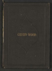
24. Green Wood Cemetery
maps
- Published: s.n.]: S.l. 1869
- Format: maps
- Online: click here for full-text
- Catalog Record: check availability

25. Green-Wood Cemetery
maps
- Published: s.n.]: New York?. 1887
- Format: maps
- Online: click here for full-text
- Catalog Record: check availability
26. Hagstrom's map of New York theatres, hotels, shopping district
Hagstrom Company
maps
- Name: Hagstrom Company
- Published: Hagstrom Co: New York. [1944]
- Format: maps
- Catalog Record: check availability
27. Hagstrom's Pocket atlas and general information guide of the City of New York : five boroughs--Manhattan, Bronx, Brooklyn, Queens, Richmond (Staten Island)
Hagstrom Company
maps
- Name: Hagstrom Company
- Published: Hagstrom: New York, N.Y. [1958], c1957
- Format: maps
- Catalog Record: check availability
28. Hamilton aerial map, Manhattan, New York City
Hamilton, W. L
maps
- Name: Hamilton, W. L
- Published: W.L. Hamilton: New York. [1927]
- Format: maps
- Catalog Record: check availability
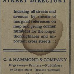
29. Hammond's new guide map of Manhattan and the Bronx
C.S. Hammond & Company
maps
- Name: C.S. Hammond & Company
- Published: C.S. Hammond & Co: New York. [between 1900 and 1930]
- Format: maps
- Catalog Record: check availability
30. Herald & Greeley Squares
maps
- Published: s.n: New York?. 1940]
- Format: maps
- Catalog Record: check availability
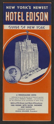
31. Hotel Edison, New York : part of Bronx and Queens showing World's Fair, indexed, house number map
Nostrand, George J
maps
- Name: Nostrand, George J
- Published: Hotel Edison?: New York?. 1939?]
- Format: maps
- Online: click here for full-text
- Catalog Record: check availability
32. Johnson's map of New York and the adjacent cities
Johnson and Ward
maps
- Name: Johnson and Ward
- Published: Johnson and Ward: New York. [1864?]
- Format: maps
- Online: click here for full-text
- Catalog Record: check availability
33. Johnson's New York and Brooklyn
Johnson, A. J. 1827-1884
maps
- Name: Johnson, A. J. 1827-1884
- Published: A.J. Johnson: New York. c1866
- Format: maps
- Online: click here for full-text
- Catalog Record: check availability
34. Manhattan on-street parking : a street by street guide to parking regulations from 72nd street to the Battery
Sandhill Publications (Firm)
maps
- Name: Sandhill Publications (Firm)
- Published: Sandhill Publications: Leonia, N.J. c1987
- Format: maps
- Catalog Record: check availability
35. Map & plan of the proposed continuation of the widening & extension of William Street : from Maiden Lane to Chatham Street & the new line of said strt. as adopted between Wall St. & Maiden Lane, showing the situation of the property advertised by John R. Pitkin (No. 5 Broad Strt.)
maps
- Published: [publisher not identified]: N.Y.?. [183-?
- Format: maps
- Online: click here for full-text
- Catalog Record: check availability
36. Map and guide to lower Manhattan : from shoreline to skyline
Port Authority of New York and New Jersey
maps
- Name: Port Authority of New York and New Jersey
- Published: Port Authority of NY & NJ: New York?. c1988
- Format: maps
- Catalog Record: check availability
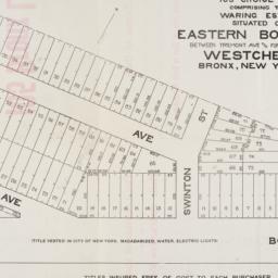
37. Map of 105 choice lots comprising the Waring Estate situated on Eastern Boulevard between Tremont Ave and Fort Schuyler Road Westchester Bronx, New York City
maps
- Published: s.n: New York. 1906]
- Format: maps
- Online: click here for full-text
- Catalog Record: check availability
38. Map of 158 building lots at Harlaem [sic] to be sold by James Bleeckeer & Sons on Wednesday January 15th at 12 o'clock at the Merchts Exchange
maps
- Published: P. Desbroy's: New York. [18--?]
- Format: maps
- Online: click here for full-text
- Catalog Record: check availability
39. Map of 500 lots of the estate of James Cordon Bennett, dec'd, located between Broadway and N.Y. Central and Hudson River, RR. and between W. 181st and W. 187th Streets borough of Manhattan City of New York
maps
- Published: s.n: New York. 1919]
- Format: maps
- Online: click here for full-text
- Catalog Record: check availability
40. [Map of 50th Street to 53rd Street between 10th Avenue and 13th Avenue]
maps
- Published: s.n: New York?. 1851?]
- Format: maps
- Online: click here for full-text
- Catalog Record: check availability
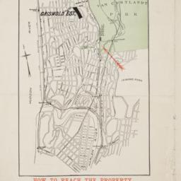
41. Map of 58 lots belonging to the Griswold Estate fronting on the continuation of Riverside Drive known as Fieldston Road and situated between Broadway and Riverdale Avenue, W. 246th Street and W. 253rd Street
maps
- Published: s.n: New. 1910]
- Format: maps
- Online: click here for full-text
- Catalog Record: check availability
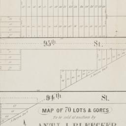
42. Map of 70 lots & gores to be sold at auction by Aty J. Bleecker on Monday 25th March 1850 at 12 o'clock at the Merchants Exchange
maps
- Published: Serrell & Perkins: New York. [1850]
- Format: maps
- Online: click here for full-text
- Catalog Record: check availability
43. [Map of Lower Manhattan, Pine Street to Rosevelt St. between South Street and William Street]
maps
- Published: s.n: New York?. 1930?]
- Format: maps
- Catalog Record: check availability
44. Map of New York
Trott, E. R
maps
- Name: Trott, E. R
- Published: Eugene R. Trott: New York. [191-?]
- Format: maps
- Catalog Record: check availability
45. Map of New York : places of interest and general information concerning the city
maps
- Published: [publisher not identified]: New York?. [1920?]
- Format: maps
- Online: click here for full-text
- Catalog Record: check availability

46. Map of New York : places of interest and general information concerning the city
Ohman Map Co
maps
- Name: Ohman Map Co
- Published: Aug. R. Ohman Map Co: New York. c1913
- Format: maps
- Online: click here for full-text
- Catalog Record: check availability

47. Map of New York and vicinity
Dripps, M
maps
- Name: Dripps, M
- Published: M. Dripps: N[ew] Y[ork]. c1865
- Format: maps
- Online: click here for full-text
- Catalog Record: check availability
48. Map of Prospect Hill late the seat of Francis B. Winthrop, Esqr., in the Twelfth Ward in the city of New York
maps
- Published: Lambert's Lithography: New York. [1879?]
- Format: maps
- Online: click here for full-text
- Catalog Record: check availability
49. Map of that part of the city of New York north of 155th street : showing the progress made in laying out streets, roads, public squares and places, by the Commissioners of the Central Park, under Chap. 565 of Laws of 1865 and of new Pier and Bulkhead Laws under Chap. 697 of Laws of 1867
maps
- Published: Major & Knapp Eng. Mfg. & Lith. Co: N.Y. 1870
- Format: maps
- Online: click here for full-text
- Catalog Record: check availability
50. [Map of the area bounded by Broadway and St. Nicholas from West 190th Street to West 193rd Street]
maps
- Published: Martin B. Brown Co: New York. [1907]
- Format: maps
- Online: click here for full-text
- Catalog Record: check availability
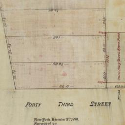
51. [Map of the area bounded by Forty Third Street and Broadway]
maps
- Published: [s.n.]: New York. 1880
- Format: maps
- Online: click here for full-text
- Catalog Record: check availability
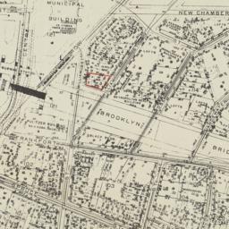
52. [Map of the area bounded by New Chambers Street, Peart Street, Beekman Street, and Nassau Street]
maps
- Published: s.n: New York?. 1914?]
- Format: maps
- Online: click here for full-text
- Catalog Record: check availability
53. [Map of the area in Long Island City from Vernon Ave. to Meadow St. between Sixth St. and Fourteenth St.]
maps
- Published: August R. Ohman & Co: New York. [1908]
- Format: maps
- Online: click here for full-text
- Catalog Record: check availability

54. [Map of the area in Lower Manhattan bound by Pine Street, South Street, Wall Street and Front Street]
maps
- Published: s.n: New York?. 1895?]
- Format: maps
- Online: click here for full-text
- Catalog Record: check availability
55. Map of the Central Park, New York
maps
- Published: Frank Leslie: New York?. 1856]
- Format: maps
- Online: click here for full-text
- Catalog Record: check availability
56. Map of the Central Park showing the progress of the work up to January 1st 1867
maps
- Published: s.n: New York. 1867?]
- Format: maps
- Online: click here for full-text
- Catalog Record: check availability
57. Map of the cities of New York, Brooklyn, Long Island City, Jersey City & Hoboken
Dripps, M
maps
- Name: Dripps, M
- Published: M. Dripps: New York. ca. 1870]
- Format: maps
- Catalog Record: check availability
58. A map of the city and county of New York : with the adjacent cities of Brooklyn and Jersey City, and the village of Williamsburg : with a street directory of the city of New York
Thayer, Bridgman & Fanning
maps
- Name: Thayer, Bridgman & Fanning
- Published: Thayer, Bridgman & Fanning: New York. 1853
- Format: maps
- Catalog Record: check availability
59. Map of the city and county of New York : with the adjacent country
Burr, David H., 1803-1875
maps
- Name: Burr, David H., 1803-1875
- Published: s.n: New York. 1829]
- Format: maps
- Online: click here for full-text
- Catalog Record: check availability

60. Map of the City of New York
W.C. Rogers & Co
maps
- Name: W.C. Rogers & Co
- Published: s.n.]: New York. 1868
- Format: maps
- Online: click here for full-text
- Catalog Record: check availability
61. Map of the City of New York : showing the streets, avenues, roads, public squares & places laid out, established, widened and retained, the new pier and bulkhead lines laid out and established by the Board of Commissioners of the Central Park, by and under authority of chapter 697 of the laws of the State of New York, passed April 24, 1867
New York (N.Y.). Board of Commissioners of the Central Park
maps
- Name: New York (N.Y.). Board of Commissioners of the Central Park
- Published: s.n: New York?. 1868-1872]
- Format: maps
- Catalog Record: check availability
62. Map of the city of New York : with the adjacent cities of Brooklyn & Jersey City & the village of Williamsburg
Phelps, Humphrey, active 19th century
maps
- Name: Phelps, Humphrey, active 19th century
- Published: H. Phelps: New York. 1845
- Format: maps
- Catalog Record: check availability
63. Map of the City of New York Comprising all the late Improvements, Compiled and Corrected From Authentic Documents
maps
- Published: J. Langdon: New York. 1829
- Format: maps
- Catalog Record: check availability
64. Map of the City of New York, from the Battery to 80th Street, showing the original topography of Manhattan Island
Viele, Egbert L. 1825-1902
maps
- Name: Viele, Egbert L. 1825-1902
- Published: s.n: New York. 1866?]
- Format: maps
- Online: click here for full-text
- Catalog Record: check availability
65. Map of the city of New York with street directory : showing house-numbers, hotels, churches, banks, theatres, ferries, house-car, steam and elevated r.r'ds, &c
Dripps, M
maps
- Name: Dripps, M
- Published: M. Dripps: New York. [1880?]
- Format: maps
- Catalog Record: check availability
66. Map of the City of New York with the adjacent cities of Brooklyn & Jersey City & the Village of Williamsburg
Phelps, Humphrey, active 19th century
maps
- Name: Phelps, Humphrey, active 19th century
- Published: H. Phelps: New York. 1844
- Format: maps
- Catalog Record: check availability
67. Map of the City of New-York
Hayward, George, approximately 1800-
maps
- Name: Hayward, George, approximately 1800-
- Published: Common Council, 1854]: New York. 1854
- Format: maps
- Online: click here for full-text
- Catalog Record: check availability
68. A map of the common lands between the three and six mile stones, belonging to the corporation of the city of New York
Goerck, Casimir Th., -1798
maps
- Name: Goerck, Casimir Th., -1798
- Published: Common Council: New York. 1861]
- Format: maps
- Online: click here for full-text
- Catalog Record: check availability
69. Map of the consolidated City of Brooklyn : comprising the City of Brooklyn, City of Williamsburgh and Town of Bushwick, Kings County, Long Island
Hayward, George, approximately 1800-
maps
- Name: Hayward, George, approximately 1800-
- Published: G. Hayward: New York. 1854
- Format: maps
- Online: click here for full-text
- Catalog Record: check availability

70. Map of the Greenwich Village section of New York City
Fahey, Lawrence
maps
- Name: Fahey, Lawrence
- Published: Lawrence Fahey: New York, N.Y. 1961
- Format: maps
- Online: click here for full-text
- Catalog Record: check availability
71. Map of the lands included in the Central Park
Viele, Egbert L. 1825-1902
maps
- Name: Viele, Egbert L. 1825-1902
- Published: s.n.]: New York. 1856
- Format: maps
- Online: click here for full-text
- Catalog Record: check availability
72. Map of the upper part of the Island of Manhattan above Eighty-Sixth Street arranged to illustrate the Battle of Harlem Heights
Shannon, Joseph
maps
- Name: Shannon, Joseph
- Published: s.n: New York?. 1868]
- Format: maps
- Online: click here for full-text
- Catalog Record: check availability
73. Map sections
maps
- Published: Oxford University Press: London?. between 1980 and 1990?]
- Format: maps
- Catalog Record: check availability

74. Map shewing a division of part of the real estate late of Nicholas W. Stuyvesant decd. among his heirs situated in the 11th Ward of the City of New York
Doughty, Saml. S
maps
- Name: Doughty, Saml. S
- Published: Miller & Co. Lithog: New York. 1834 May
- Format: maps
- Online: click here for full-text
- Catalog Record: check availability
75. [Map showing area bounded by Tompkins Street and 3rd Avenue between 23rd and 9th Streets]
maps
- Published: s.n: New York?. 18--?]
- Format: maps
- Online: click here for full-text
- Catalog Record: check availability
76. Maps of farms commonly called, the blue book, 1815
Sackersdorff, Otto
maps
- Name: Sackersdorff, Otto
- Published: [s.n.]: New York. 1868
- Format: maps
- Catalog Record: check availability
77. Maps of New York City six maps in one
maps
- Published: Manhattan Postcard Publishing Co: Glendale, N.Y. 1985
- Format: maps
- Catalog Record: check availability
78. Maps of the Commissioners of Central Park relative to the district between Fifty-Fifth Street and One Hundred and Fifty-Fifth Street, West of Eighth Avenue and around the Central Park
New York (N.Y.). Board of Commissioners of the Central Park
maps
- Name: New York (N.Y.). Board of Commissioners of the Central Park
- Published: s.n., 1868]: New York. 1868
- Format: maps
- Catalog Record: check availability
79. Metropolitan New York road map
Port of New York Authority
maps
- Name: Port of New York Authority
- Published: Port of New York Authority: New York?. c1938
- Format: maps
- Catalog Record: check availability
80. Midtown
Incentra International, Inc
maps
- Name: Incentra International, Inc
- Published: Edward S. Gordon Co: New York. [1990?]
- Format: maps
- Catalog Record: check availability
81. Mid-town Manhattan places of principal interest
Hagstrom Map Company
maps
- Name: Hagstrom Map Company
- Published: Hagstrom Co: New York, N.Y. c1979
- Format: maps
- Catalog Record: check availability
82. Miniature atlas of the borough of Manhattan : complete in two volumes
Hyde, E. Belcher
maps
- Name: Hyde, E. Belcher
- Published: E. Belcher Hyde: Brooklyn. 1912
- Format: maps
- Online: click here for full-text
- Catalog Record: check availability
83. A new & accurate plan of the City of New York in the State of New York in North America, published in 1797
New York (N.Y.). Common Council
maps
- Name: New York (N.Y.). Common Council
- Published: New York Common Council: New York. 1853]
- Format: maps
- Catalog Record: check availability
84. New Bond Paper Map of New York City
Matthews-Northrup Company
maps
- Name: Matthews-Northrup Company
- Published: Adolph Wittemann: New York. c1885
- Format: maps
- Catalog Record: check availability
85. New map of New York City : from the latest authentic surveys, showing all ferries, and all steamship docks both foreign and coastwise lines
Rand McNally and Company
maps
- Name: Rand McNally and Company
- Published: Rand, McNally & Co: Chicago. [1892]
- Format: maps
- Catalog Record: check availability
86. New map of New York City : from the latest surveys showing all the ferries and steamship docks, elevated, cable, and cross town car lines
Brooks Bank Note Co
maps
- Name: Brooks Bank Note Co
- Published: Broadway Central Hotel, Tilly Haynes, proprietor: New York. [189-?]
- Format: maps
- Online: click here for full-text
- Catalog Record: check availability
87. New map of the city of New York with part of Brooklyn & Williamsburg
Smith, J. Calvin
maps
- Name: Smith, J. Calvin
- Published: Published by H.S. Tanner map selr., 237 Broadway: New York. 1846
- Format: maps
- Online: click here for full-text
- Catalog Record: check availability
88. New York
Bollmann, Hermann, 1911-1971
maps
- Name: Bollmann, Hermann, 1911-1971
- Published: Pictorial Maps: New York. [1962?]
- Format: maps
- Catalog Record: check availability
89. New York, 1730 the English colonial city
MacCoun, Townsend, 1845-1932
maps
- Name: MacCoun, Townsend, 1845-1932
- Published: Townsend MacCoun: New York. 1909
- Format: maps
- Online: click here for full-text
- Catalog Record: check availability
90. New York and its surroundings : map of the metropolis from the Battery to One Hundred and Eighth Street, and parts of Brooklyn, Williamsburg, Greenpoint, Jersey City, and Hoboken
maps
- Published: Harper's Weekly: New York?. 1873
- Format: maps
- Catalog Record: check availability
91. New York City, Manhattan, Brooklyn, Bronx, Queens & Staten Island map
Rand McNally and Company
maps
- Name: Rand McNally and Company
- Published: Rand McNally & Co: Chicago. [1982?]
- Format: maps
- Catalog Record: check availability
92. New York city map
Phelps, Humphrey, active 19th century
maps
- Name: Phelps, Humphrey, active 19th century
- Published: H. Phelps: New York. c1857
- Format: maps
- Online: click here for full-text
- Catalog Record: check availability
93. New York City transit system rapid transit lines - flow chart
maps
- Published: s.n: New York?. 1954?]
- Format: maps
- Catalog Record: check availability
94. New York City--5 maps in 1 : Manhattan streets, Midtown, Downtown, Greenwich Village, Manhattan subways
Hagstrom Map Company
maps
- Name: Hagstrom Map Company
- Published: Hagstrom Map Co: Maspeth, NY. c1995
- Format: maps
- Catalog Record: check availability
95. New York, Downtown, Manhattan-Jersey City-Brooklyn
Edward S. Gordon Company
maps
- Name: Edward S. Gordon Company
- Published: Edward S. Gordon Co: New York, NY. [1992?]
- Format: maps
- Catalog Record: check availability
96. New York, picture and street map
Bollmann Bildkarten Verlag
maps
- Name: Bollmann Bildkarten Verlag
- Published: Bollmann-Bildkarten-Verlag: Braunschweig, Germany. [1984?]
- Format: maps
- Catalog Record: check availability
97. New Yorke, 1695
Miller, John, 1666-1724
maps
- Name: Miller, John, 1666-1724
- Published: Lith. G. Hayward: New York. [1852]
- Format: maps
- Online: click here for full-text
- Catalog Record: check availability
98. New-York, April 1852 drawn on an enlarged scale from map of district burnt by great fire of 16th Dec. 1835, as published in the Journal of Commerce Dec. 18th, 1835
maps
- Published: s.n: New York?. 1852?]
- Format: maps
- Online: click here for full-text
- Catalog Record: check availability
99. New-York, city, county and vicinity
Dripps, M
maps
- Name: Dripps, M
- Published: s.n.]: S.l. 1864
- Format: maps
- Catalog Record: check availability
100. New-York City guide map showing business parts of Brooklyn, elevated rail roads, horse car and stage lines, hotels, churches, theatres, docks, piers, &c
maps
- Published: [publisher not identified]: New York?. [1884?]
- Format: maps
- Catalog Record: check availability

101. One day's trucking to and from the New York Central's pier and inland stations south of Fifty-Ninth Street
maps
- Published: J.B. Lyon Co: Albany. 1920]
- Format: maps
- Online: click here for full-text
- Catalog Record: check availability
102. Outline and index map of New York City, Manhattan Island
maps
- Published: s.n: New York?. 18--?]
- Format: maps
- Online: click here for full-text
- Catalog Record: check availability
103. Outline and index map of volume three, atlas of New York City, borough of Manhattan 59th St. to 110th St
maps
- Published: G.W. Bromley & Co: New York?. 1916?]
- Format: maps
- Online: click here for full-text
- Catalog Record: check availability
104. Part of Section 5, New York City
maps
- Published: s.n: New York?. 1891?]
- Format: maps
- Online: click here for full-text
- Catalog Record: check availability
105. Part of the town of Scarsdale
maps
- Published: G.W. Bromley and Co: Philadelphia. 1910]
- Format: maps
- Online: click here for full-text
- Catalog Record: check availability
106. Part of ward 23, section 9
maps
- Published: G.W. Bromley and Co: Philadelphia. 1897]
- Format: maps
- Online: click here for full-text
- Catalog Record: check availability
107. Part of ward 23, section 9
maps
- Published: G.W. Bromley and Co: Philadelphia. 1897]
- Format: maps
- Online: click here for full-text
- Catalog Record: check availability
108. Part of ward 23, sections 9 & 10
maps
- Published: G.W. Bromley and Co: Philadelphia. 1897]
- Format: maps
- Online: click here for full-text
- Catalog Record: check availability
Search Other Sources for: "Streets"
Try your search in one of these related resources. (Search results will display in a new window.)
-
Avery Index to Architectural Periodicals
A comprehensive listing of journal articles published worldwide on architecture and design, archaeology, city planning, interior design, landscape architecture, and historic preservation. -
Brooklyn Historical Society Photography Collection
Search for individual photographs. Approximately 5,000 of our images are currently available online, but more images are added regularly. -
Brooklyn Public Library: Historic Brooklyn Photographs
Selection of more than ten thousand historic photographs from the Brooklyn Collection. -
CLIO: Columbia Libraries Catalog
Search for books, articles, journals, online resources and more. -
DLC: Columbia Libraries Digital Collections
A gateway to digital projects and online exhibitions that have been published on the web by Columbia University Libraries/Information Services (CUL/IS). -
Museum of the City of New York
Over 150,000 images and objects from the collections of the Museum of the City of New York.
Note: to come. -
New York Historical Society
Digital images from the library and museum collections. -
NYPL Digital Collections
Provides free and open access to over 800,000 images digitized from the The New York Public Library's vast collections.