Search Results Header
Search Constraints
Showing results for: "New York (State) Maps." Remove constraint "New York (State) Maps." Format maps Remove constraint Format: mapsSearch Results

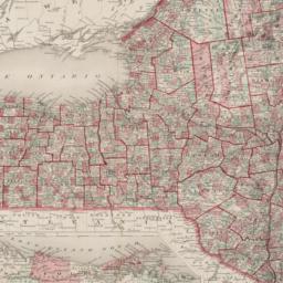
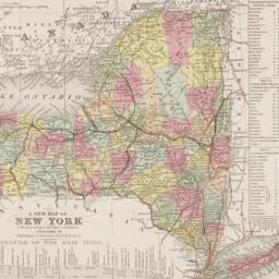
1. Asher & Adams new topographical map of the state of New York made from official records and actual surveys
Asher & Adams
maps
- Name: Asher & Adams
- Published: Asher & Adams: New York. 1869
- Format: maps
- Catalog Record: check availability
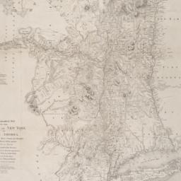
2. An atlas of the state of New York : containing a map of the state and of the several counties, projected and drawn by a uniform scale from documents deposited in the public offices of the state and other original & authentic information, under the superintendance & direction of Simeon DeWitt, Surveyor General, pursuant to an act of the legislature and also the physical geography of the state & of the several counties & statistical tables of the same
Burr, David H., 1803-1875
maps
- Name: Burr, David H., 1803-1875
- Published: Published by David H. Burr: New York. 1829
- Format: maps
- Catalog Record: check availability
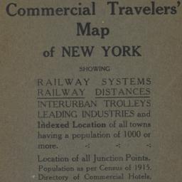
3. Blum's commercial travelers' map of New York
Blum, Max L
maps
- Name: Blum, Max L
- Published: Blum's Commercial Map Pub. Co: New York. c1920
- Format: maps
- Catalog Record: check availability
4. A chorographical map of the Province of New York in North America : divided into counties, manors, patents and townships ; exhibiting likewise all the private grants of land made and located in that Province ; compiled from actual surveys deposited in the Patent Office at New York, by order of His Excellency Major General William Tryon
Sauthier, Claude Joseph
maps
- Name: Sauthier, Claude Joseph
- Published: Richard H. Pease: Albany. 1849
- Format: maps
- Online: click here for full-text
- Catalog Record: check availability
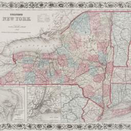
5. Colton's New York
maps
- Published: New York : G.W. and C.B. Colton & Co. 1867
- Format: maps
- Online: click here for full-text
- Catalog Record: check availability
6. Hammond's new and complete map of the country around New York
maps
- Published: C.S. Hammond & Co: New York. c1906
- Format: maps
- Catalog Record: check availability
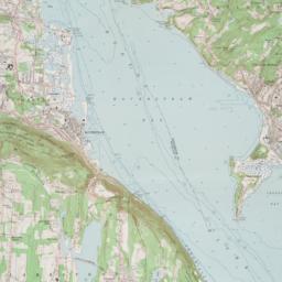
7. Haverstraw quadrangle, New York
Geological Survey (U.S.)
maps
- Name: Geological Survey (U.S.)
- Published: Geological Survey: Washington, D.C. 1964
- Format: maps
- Online: click here for full-text
- Catalog Record: check availability
8. Johnson's New York
Johnson, A. J. 1827-1884
maps
- Name: Johnson, A. J. 1827-1884
- Published: A.J. Johnson: New York. c1866
- Format: maps
- Online: click here for full-text
- Catalog Record: check availability

9. Map of land belonging to the Odell Realty Co. in the city of Yonkers, N.Y
maps
- Published: s.n: New York?. 1913?]
- Format: maps
- Online: click here for full-text
- Catalog Record: check availability

10. A map of New England and New York
Speed, John, 1552?-1629
maps
- Name: Speed, John, 1552?-1629
- Published: Sold by Tho: London. [1676]
- Format: maps
- Online: click here for full-text
- Catalog Record: check availability
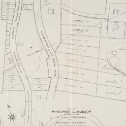
11. Map of Pinecrest-on-Hudson situated in the City of Yonkers and Village of Hastings Westchester Co
maps
- Published: s.n: New York?. 1907]
- Format: maps
- Online: click here for full-text
- Catalog Record: check availability
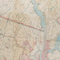
12. Map of the Passaic and Croton water-sheds, water courses, storage reservoirs and sources of supply for the cities, towns, & villages within a radius of 50 miles from the City of New York
Bartlett, John Russell, 1805-1886
maps
- Name: Bartlett, John Russell, 1805-1886
- Published: J.R. Bartlett: New York. c1888
- Format: maps
- Online: click here for full-text
- Catalog Record: check availability
13. A map of the state of New York : exhibiting the situation and boundaries of several towns, wards, and counties and specifying in each town, ward, and county the whole population thereof, and in the several counties, the population upon which the apportionment of Senators and Members of Assembly is based with tables of apportionment
New York (State). Secretary's Office
maps
- Name: New York (State). Secretary's Office
- Published: [publisher not identified]: New York?. [1840?]
- Format: maps
- Catalog Record: check availability
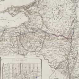
14. Map of the State of New York : with the latest improvements showing all the canals, railroads, &c
maps
- Published: J. Disturnell: New York. 1836
- Format: maps
- Online: click here for full-text
- Catalog Record: check availability
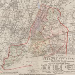
15. Map showing the limits of greater New York, as defined by the Municipal Consolidation Inquiry Commisssion appointed under the authority of Chapter 311, Laws of 1890 including the following cities, towns, etc
maps
- Published: E.C. Bridgman: New York?. 1890?]
- Format: maps
- Online: click here for full-text
- Catalog Record: check availability
16. Maps accompanying the Report of the secretary of state of the enumeration of the inhabitants, 1915
New York (State). Secretary's Office
maps
- Name: New York (State). Secretary's Office
- Published: J.B. Lyon: Albany. 1916
- Format: maps
- Catalog Record: check availability
17. A new map of New York : with its canals, roads & distances
Thomas, Cowperthwait & Co
maps
- Name: Thomas, Cowperthwait & Co
- Published: Thomas, Cowperthwait & Co: Philadelphia. 1850
- Format: maps
- Online: click here for full-text
- Catalog Record: check availability
18. New York
maps
- Published: [publisher not identified]: New York?. [1842?]
- Format: maps
- Catalog Record: check availability
19. New York
Buchon, J. A. C. 1791-1846
maps
- Name: Buchon, J. A. C. 1791-1846
- Published: Fonderie et Imprimerie de J. Carez: Paris. [1835?]
- Format: maps
- Online: click here for full-text
- Catalog Record: check availability

20. New York canals : Champlain Canal, Erie Canal, Oswego Canal, Cayuga and Seneca Canal
U.S. Lake Survey
maps
- Name: U.S. Lake Survey
- Published: U.S. Lake Survey: Detroit, Mich. [1948]
- Format: maps
- Online: click here for full-text
- Catalog Record: check availability

21. New York State barge canal system
U.S. Lake Survey
maps
- Name: U.S. Lake Survey
- Published: Dept. of the Army, Lake Survey District, Corps of Engineers: Detroit. 1948
- Format: maps
- Online: click here for full-text
- Catalog Record: check availability
22. Part of the town of Scarsdale
maps
- Published: G.W. Bromley and Co: Philadelphia. 1910]
- Format: maps
- Online: click here for full-text
- Catalog Record: check availability
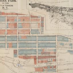
23. Property of the New York Real Estate Co. at Nepera Park in the city of Yonkers, N.Y. surveyed and drawn by M.K. Couzens Civ. Engineer, Yonkers, N.Y., April 15th, 1893
Couzens, M. K
maps
- Name: Couzens, M. K
- Published: s.n: New York?. 1893]
- Format: maps
- Online: click here for full-text
- Catalog Record: check availability
24. Town of Yonkers, Westchester Co., N.Y
maps
- Published: F.W. Beers: New York. 1868]
- Format: maps
- Online: click here for full-text
- Catalog Record: check availability
Search Other Sources for: "New York (State) Maps."
Try your search in one of these related resources. (Search results will display in a new window.)
-
Avery Index to Architectural Periodicals
A comprehensive listing of journal articles published worldwide on architecture and design, archaeology, city planning, interior design, landscape architecture, and historic preservation. -
Brooklyn Historical Society Photography Collection
Search for individual photographs. Approximately 5,000 of our images are currently available online, but more images are added regularly. -
Brooklyn Public Library: Historic Brooklyn Photographs
Selection of more than ten thousand historic photographs from the Brooklyn Collection. -
CLIO: Columbia Libraries Catalog
Search for books, articles, journals, online resources and more. -
DLC: Columbia Libraries Digital Collections
A gateway to digital projects and online exhibitions that have been published on the web by Columbia University Libraries/Information Services (CUL/IS). -
Museum of the City of New York
Over 150,000 images and objects from the collections of the Museum of the City of New York.
Note: to come. -
New York Historical Society
Digital images from the library and museum collections. -
NYPL Digital Collections
Provides free and open access to over 800,000 images digitized from the The New York Public Library's vast collections.