Search Results Header
Search Constraints
Showing results for: "Parks New York (State)" Remove constraint "Parks New York (State)" Format maps Remove constraint Format: mapsSearch Results
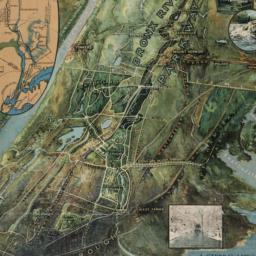
1. A general view of the Bronx River Parkway Reservation : as a connecting parkway between the park system of New York City, the Croton and Catskill watersheds, and the Harriman and Palisades Interstate Parks
New York (State). Bronx Parkway Commission
maps
- Name: New York (State). Bronx Parkway Commission
- Published: Bronx Parkway Commission: New York. 1915
- Format: maps
- Online: click here for full-text
- Catalog Record: check availability

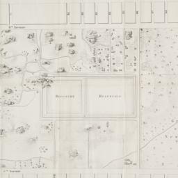
2. Guide map to the Brooklyn and Queens parks
maps
- Published: s.n: New York?. between 1925 and 1939]
- Format: maps
- Catalog Record: check availability
3. Manhattan on-street parking : a street by street guide to parking regulations from 72nd street to the Battery
Sandhill Publications (Firm)
maps
- Name: Sandhill Publications (Firm)
- Published: Sandhill Publications: Leonia, N.J. c1987
- Format: maps
- Catalog Record: check availability

4. Map of the City of New York
W.C. Rogers & Co
maps
- Name: W.C. Rogers & Co
- Published: s.n.]: New York. 1868
- Format: maps
- Online: click here for full-text
- Catalog Record: check availability
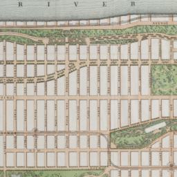
5. Map of the lands included in the Central Park
Viele, Egbert L. 1825-1902
maps
- Name: Viele, Egbert L. 1825-1902
- Published: s.n.]: New York. 1856
- Format: maps
- Online: click here for full-text
- Catalog Record: check availability
6. Map showing public parks in the Borough of the Bronx
Bronx (New York, N.Y.). Dept. of Parks
maps
- Name: Bronx (New York, N.Y.). Dept. of Parks
- Published: Bronx Dept. of Parks: Bronx (New York, N.Y.). [1926?]
- Format: maps
- Catalog Record: check availability
7. Plan of Central Park, New York City
Dripps, M
maps
- Name: Dripps, M
- Published: M. Dripps: N.Y. [186-?]
- Format: maps
- Catalog Record: check availability

8. Plan of New York &c
Mitchell, S. Augustus, Jr
maps
- Name: Mitchell, S. Augustus, Jr
- Published: S. Augustus Mitchell, Jr: Philadelphia. 1860
- Format: maps
- Online: click here for full-text
- Catalog Record: check availability
9. Public parks boroughs of Manhattan and Richmond City of New York
maps
- Published: s.n: New York?. 1903?]
- Format: maps
- Catalog Record: check availability
10. The west end plateau of New York
Vielé, Herman K
maps
- Name: Vielé, Herman K
- Published: Johnson, & Pratt: New York. [1879]
- Format: maps
- Online: click here for full-text
- Catalog Record: check availability
Search Other Sources for: "Parks New York (State)"
Try your search in one of these related resources. (Search results will display in a new window.)
-
Avery Index to Architectural Periodicals
A comprehensive listing of journal articles published worldwide on architecture and design, archaeology, city planning, interior design, landscape architecture, and historic preservation. -
Brooklyn Historical Society Photography Collection
Search for individual photographs. Approximately 5,000 of our images are currently available online, but more images are added regularly. -
Brooklyn Public Library: Historic Brooklyn Photographs
Selection of more than ten thousand historic photographs from the Brooklyn Collection. -
CLIO: Columbia Libraries Catalog
Search for books, articles, journals, online resources and more. -
DLC: Columbia Libraries Digital Collections
A gateway to digital projects and online exhibitions that have been published on the web by Columbia University Libraries/Information Services (CUL/IS). -
Museum of the City of New York
Over 150,000 images and objects from the collections of the Museum of the City of New York.
Note: to come. -
New York Historical Society
Digital images from the library and museum collections. -
NYPL Digital Collections
Provides free and open access to over 800,000 images digitized from the The New York Public Library's vast collections.