Search Results Header
Search Constraints
Showing results for: Format other Remove constraint Format: other Format maps Remove constraint Format: maps Format ephemera Remove constraint Format: ephemera Format objects Remove constraint Format: objects Format manuscripts Remove constraint Format: manuscripts Borough Manhattan Remove constraint Borough: ManhattanSearch Results

121. The Lincoln Building, 60 E. 42nd St. NYC
objects
- Published: Helmsley-Spear Inc: New York, N.Y. [1987]
- Format: objects
- Catalog Record: check availability

122. Long Island City, Queens Co. L.I
Beers, F. W
maps
- Name: Beers, F. W
- Published: Beers, Comstock & Cline: New York. 1873]
- Format: maps
- Online: click here for full-text
- Catalog Record: check availability

123. Lunatic Asylum, Manhattanville
Dick, Archibald L., approximately 1805-approximately 1855
ephemera
- Name: Dick, Archibald L., approximately 1805-approximately 1855
- Published: s.n: New York. 18--?]
- Format: ephemera
- Catalog Record: check availability
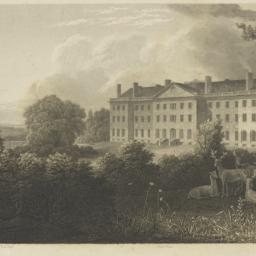
124. Lunatic Asylum, New York
Weir, Robert Walter, 1803-1889
ephemera
- Name: Weir, Robert Walter, 1803-1889
- Published: George P. Morris: New York. 1834]
- Format: ephemera
- Catalog Record: check availability
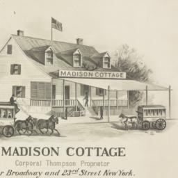
125. Madison Cottage Corporal Thompson proprietor : cor. Broadway and 23rd Street New York N.B. stages leave every 4 minutes
ephemera
- Published: [publisher not identified]: New York?. [between 1873 and 1900]
- Format: ephemera
- Catalog Record: check availability

126. Manhattan bus map
New York City Transit Authority
maps
- Name: New York City Transit Authority
- Published: New York City Transit Authority: Brooklyn, N.Y. c1995
- Format: maps
- Catalog Record: check availability
127. Manhattan bus map : 1989
Manhattan & Bronx Surface Transit Operating Authority
maps
- Name: Manhattan & Bronx Surface Transit Operating Authority
- Published: New York City Transit Authority: New York. c1989
- Format: maps
- Catalog Record: check availability
128. [Manhattan chizu]
Siegel, Norman L
maps
- Name: Siegel, Norman L
- Published: Able David Victor, Inc: New York, N.Y. c1975
- Format: maps
- Catalog Record: check availability
129. Manhattan land book
G.W. Bromley & Co
maps
- Name: G.W. Bromley & Co
- Published: G.W. Bromley & Co: New York. 1934
- Format: maps
- Catalog Record: check availability
130. Manhattan land book of the city of New York
G.W. Bromley & Co
maps
- Name: G.W. Bromley & Co
- Published: G.W. Bromley: New York. 1970
- Format: maps
- Catalog Record: check availability
131. Manhattan on-street parking : a street by street guide to parking regulations from 72nd street to the Battery
Sandhill Publications (Firm)
maps
- Name: Sandhill Publications (Firm)
- Published: Sandhill Publications: Leonia, N.J. c1987
- Format: maps
- Catalog Record: check availability
132. The Manhattan traveler subways, buses, places of interest
Tauranac, Ltd
maps
- Name: Tauranac, Ltd
- Published: Tauranac: New York. c1989
- Format: maps
- Catalog Record: check availability
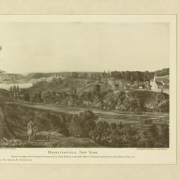
133. Manhattanville, New York
Endicott, George, 1802-1848
ephemera
- Name: Endicott, George, 1802-1848
- Published: Litho. of Endicott, 359, Broadway: New York. [c1834]
- Format: ephemera
- Catalog Record: check availability
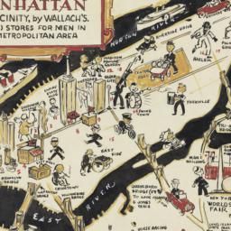
134. A man's map of Manhattan and vicinity by Wallach's
Voorhies, Stephen J
maps
- Name: Voorhies, Stephen J
- Format: maps
- Catalog Record: check availability

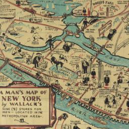
135. A man's map of New York by Wallach's
Voorhies, Stephen J
maps
- Name: Voorhies, Stephen J
- Format: maps
- Catalog Record: check availability
136. A man's map of New York by Wallach's
Voorhies, Stephen J
maps
- Name: Voorhies, Stephen J
- Format: maps
- Catalog Record: check availability
137. Map & plan of the proposed continuation of the widening & extension of William Street : from Maiden Lane to Chatham Street & the new line of said strt. as adopted between Wall St. & Maiden Lane, showing the situation of the property advertised by John R. Pitkin (No. 5 Broad Strt.)
maps
- Published: [publisher not identified]: N.Y.?. [183-?
- Format: maps
- Online: click here for full-text
- Catalog Record: check availability
138. Map and guide to lower Manhattan : from shoreline to skyline
Port Authority of New York and New Jersey
maps
- Name: Port Authority of New York and New Jersey
- Published: Port Authority of NY & NJ: New York?. c1988
- Format: maps
- Catalog Record: check availability
139. Map of 158 building lots at Harlaem [sic] to be sold by James Bleeckeer & Sons on Wednesday January 15th at 12 o'clock at the Merchts Exchange
maps
- Published: P. Desbroy's: New York. [18--?]
- Format: maps
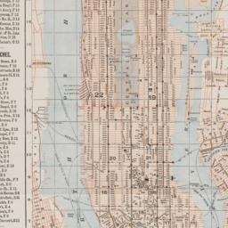
- Online: click here for full-text
- Catalog Record: check availability
140. Map of 500 lots of the estate of James Cordon Bennett, dec'd, located between Broadway and N.Y. Central and Hudson River, RR. and between W. 181st and W. 187th Streets borough of Manhattan City of New York
maps
- Published: s.n: New York. 1919]
- Format: maps
- Online: click here for full-text
- Catalog Record: check availability
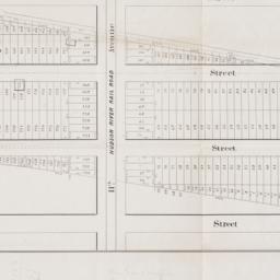
141. [Map of 50th Street to 53rd Street between 10th Avenue and 13th Avenue]
maps
- Published: s.n: New York?. 1851?]
- Format: maps
- Online: click here for full-text
- Catalog Record: check availability
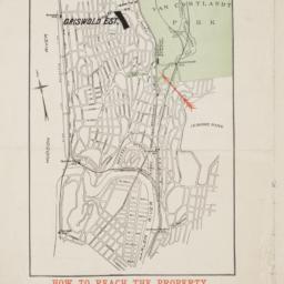
142. Map of 58 lots belonging to the Griswold Estate fronting on the continuation of Riverside Drive known as Fieldston Road and situated between Broadway and Riverdale Avenue, W. 246th Street and W. 253rd Street
maps
- Published: s.n: New. 1910]
- Format: maps
- Online: click here for full-text
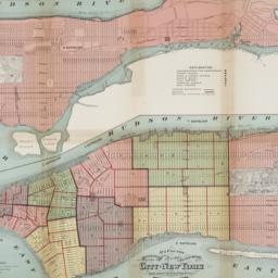
- Catalog Record: check availability
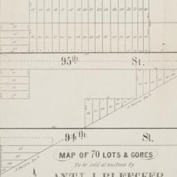
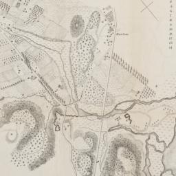
143. Map of 70 lots & gores to be sold at auction by Aty J. Bleecker on Monday 25th March 1850 at 12 o'clock at the Merchants Exchange
maps
- Published: Serrell & Perkins: New York. [1850]
- Format: maps
- Online: click here for full-text
- Catalog Record: check availability
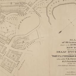
144. Map of 80 acres of land situate in the 12th Ward of the city of New York part of the estate of Isaac Dyckman, dec'd : known as the "Part 3rd of the Dyckman Homestead Property" to be sold by V.K. Stevenson Son & Co, B.P. Fairchild, Auctioneer, June 7th, 1871 at the Exchange Salesrooms, 111 Broadway, New York
maps
- Published: Major & Knapp Eng. Mfg. & Lith. Co: New York. [1871]
- Format: maps
- Online: click here for full-text
- Catalog Record: check availability
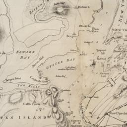
145. Map of city of New-York
Hayward, George, approximately 1800-
maps
- Name: Hayward, George, approximately 1800-
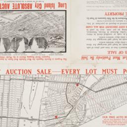
- Published: G. Hayward: N.Y. 1842
- Format: maps
- Catalog Record: check availability
146. Map of Harlem Heights and plain, 1814
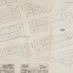
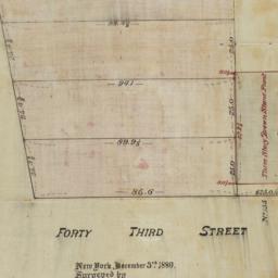
maps
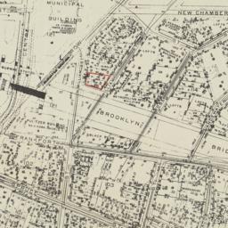
- Published: [publisher not identified]: Place of publication not identified. [1856?]
- Format: maps
- Catalog Record: check availability
147. [Map of Lower Manhattan, Pine Street to Rosevelt St. between South Street and William Street]
maps
- Published: s.n: New York?. 1930?]
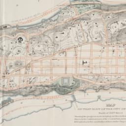
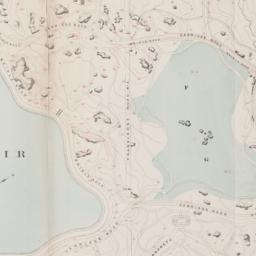
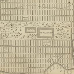
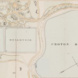
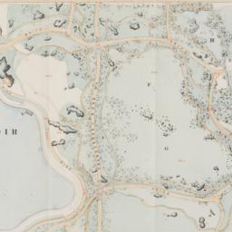
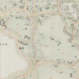
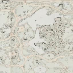
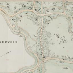
- Format: maps
- Catalog Record: check availability
148. [Map of Manhattan, Brooklyn, Staten Island, Long Island, and New Jersey with references to the Battle on Long Island]
maps
- Published: s.n: New York?. 18--?]
- Format: maps
- Online: click here for full-text
- Catalog Record: check availability
149. Map of Midtown Manhattan
maps
- Published: Cushman & Wakefield, Inc: New York, N.Y. 1966, c1956
- Format: maps
- Catalog Record: check availability
150. Map of New York
Trott, E. R
maps
- Name: Trott, E. R
- Published: Eugene R. Trott: New York. [191-?]
- Format: maps
- Catalog Record: check availability
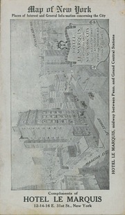
151. Map of New York : places of interest and general information concerning the city
maps
- Published: [publisher not identified]: New York?. [1920?]
- Format: maps
- Online: click here for full-text
- Catalog Record: check availability

152. Map of New York : places of interest and general information concerning the city
Ohman Map Co
maps
- Name: Ohman Map Co
- Published: Aug. R. Ohman Map Co: New York. c1913
- Format: maps
- Online: click here for full-text
- Catalog Record: check availability

153. Map of New York and vicinity
Dripps, M
maps
- Name: Dripps, M
- Published: M. Dripps: N[ew] Y[ork]. c1865
- Format: maps
- Online: click here for full-text
- Catalog Record: check availability
154. Map of New York and vicinity accompanying "Atlas of New York and vicinity."
maps
- Published: Beers, Ellis & Soule: New York. [1868]
- Format: maps
- Online: click here for full-text
- Catalog Record: check availability
155. Map of New York City
maps
- Published: Hunt & Eaton: New York?. c1891
- Format: maps
- Online: click here for full-text
- Catalog Record: check availability
156. Map of New York City
maps
- Published: s.n: New York?. 19--?]
- Format: maps
- Catalog Record: check availability
157. Map of New York City : showing portions of Brooklyn, Jersey City, and Westchester Co. ; Rand, McNally & Co.'s guide map of New York City
Rand McNally and Company
maps
- Name: Rand McNally and Company
- Published: Rand, McNally & Co: Chicago. [1895], c1892
- Format: maps
- Catalog Record: check availability
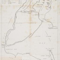
158. [Map of New York Harbor, New York Bay, and Staten Island]
maps
- Published: s.n: New York?. 18--?]
- Format: maps
- Online: click here for full-text
- Catalog Record: check availability
159. Map of New York I. : with the adjacent rocks and other remarkable parts of Hell-Gate
Kitchin, Thomas, 1718-1784
maps
- Name: Kitchin, Thomas, 1718-1784
- Published: Printed for R. Baldwin: London. [1778]
- Format: maps
- Online: click here for full-text
- Catalog Record: check availability
160. Map of New York places of interest and general information concerning the city
Trott, E. R
maps
- Name: Trott, E. R
- Published: E.R. Trott: New York. c1913
- Format: maps
- Catalog Record: check availability
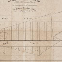
161. Map of property at Harlaem [sic] to be sold in one parcel on Tuesday the 3rd of February 1835 by James Bleecker & Sons at 11 o'clock
maps
- Published: P. Desobry's: New York. [1835]
- Format: maps
- Online: click here for full-text
- Catalog Record: check availability
162. Map of property belonging to the Courtney Development Company situate partly in the First and Second Wards, borough of Queens, city of New York
maps
- Published: s.n: New York. 1913]
- Format: maps
- Online: click here for full-text
- Catalog Record: check availability
163. Map of Prospect Hill late the seat of Francis B. Winthrop, Esqr., in the Twelfth Ward in the city of New York
maps
- Published: Lambert's Lithography: New York. [1879?]
- Format: maps
- Online: click here for full-text
- Catalog Record: check availability
164. Map of that part of the city of New York north of 155th street : showing the progress made in laying out streets, roads, public squares and places, by the Commissioners of the Central Park, under Chap. 565 of Laws of 1865 and of new Pier and Bulkhead Laws under Chap. 697 of Laws of 1867
maps
- Published: Major & Knapp Eng. Mfg. & Lith. Co: N.Y. 1870
- Format: maps
- Online: click here for full-text
- Catalog Record: check availability
165. [Map of the area bounded by Broadway and St. Nicholas from West 190th Street to West 193rd Street]
maps
- Published: Martin B. Brown Co: New York. [1907]
- Format: maps
- Online: click here for full-text
- Catalog Record: check availability
166. [Map of the area bounded by Forty Third Street and Broadway]
maps
- Published: [s.n.]: New York. 1880
- Format: maps
- Online: click here for full-text
- Catalog Record: check availability
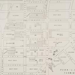
167. [Map of the area bounded by New Chambers Street, Peart Street, Beekman Street, and Nassau Street]
maps
- Published: s.n: New York?. 1914?]
- Format: maps
- Online: click here for full-text
- Catalog Record: check availability
168. [Map of the area in Long Island City from Vernon Ave. to Meadow St. between Sixth St. and Fourteenth St.]
maps
- Published: August R. Ohman & Co: New York. [1908]
- Format: maps
- Online: click here for full-text
- Catalog Record: check availability
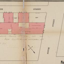
169. [Map of the area in Lower Manhattan bound by Pine Street, South Street, Wall Street and Front Street]
maps
- Published: s.n: New York?. 1895?]
- Format: maps
- Online: click here for full-text
- Catalog Record: check availability
170. Map of the bays, harbors, and rivers around New York : showing the channels, soundings, lighthouses, buoys &c., and the complete topography of the surrounding country : including Hempstead, Sandy-Hook, South-Amboy, Newark, Yonkers, N. Rochelle & Glen Cove
Bache, A. D. 1806-1867
maps
- Name: Bache, A. D. 1806-1867
- Published: M. Dripps: New York. [1866]
- Format: maps
- Catalog Record: check availability
171. Map of the borough of Manhattan, city of New York showing new law tenement houses for which plans were filed during 1908
New York (N.Y.). Tenement House Department
maps
- Name: New York (N.Y.). Tenement House Department
- Published: s.n: New York?. 1908?]
- Format: maps
- Catalog Record: check availability
172. Map of the boundaries of the Fire Department of the City of New York
New York (N.Y.). Fire Department
maps
- Name: New York (N.Y.). Fire Department
- Published: s.n.]: New York. 1871
- Format: maps
- Online: click here for full-text
- Catalog Record: check availability
173. Map of the Central Park : showing the progress of the work up to January 1st 1860
maps
- Published: Lith. by Sarony, Major & Knapp: New York, N.Y. [1860]
- Format: maps
- Online: click here for full-text
- Catalog Record: check availability
174. Map of the Central Park, New York
maps
- Published: Frank Leslie: New York?. 1856]
- Format: maps
- Online: click here for full-text
- Catalog Record: check availability
175. Map of the Central Park showing the progress of the work up to January 1st, 1863
maps
- Published: Sarony Major & Knapp: New York. [1863]
- Format: maps
- Online: click here for full-text
- Catalog Record: check availability
176. Map of the Central Park showing the progress of the work up to January 1st, 1864
maps
- Published: s.n: New York?. 1864]
- Format: maps
- Online: click here for full-text
- Catalog Record: check availability
177. Map of the Central Park showing the progress of the work up to January 1st, 1865
maps
- Published: s.n: New York?. 1865]
- Format: maps
- Online: click here for full-text
- Catalog Record: check availability
178. Map of the Central Park showing the progress of the work up to January 1st, 1866
maps
- Published: s.n: New York?. 1866]
- Format: maps
- Online: click here for full-text
- Catalog Record: check availability
179. Map of the Central Park showing the progress of the work up to January 1st 1867
maps
- Published: s.n: New York. 1867?]
- Format: maps
- Online: click here for full-text
- Catalog Record: check availability
180. Map of the cities of New York, Brooklyn, Long Island City, Jersey City & Hoboken
Dripps, M
maps
- Name: Dripps, M
- Published: M. Dripps: New York. ca. 1870]
- Format: maps
- Catalog Record: check availability