Search Results Header
Search Constraints
Showing results for: Format other Remove constraint Format: other Format maps Remove constraint Format: maps Format objects Remove constraint Format: objects Format manuscripts Remove constraint Format: manuscripts Format music Remove constraint Format: musicSearch Results

25. Atlas of the Metropolitan District and adjacent country comprising the counties of New York, Kings, Richmond, Westchester and part of Queens in the State of New York, the county of Hudson and parts of the counties of Bergen, Passaic, Essex and Union in the State of New Jersey : showing in a series of maps the relative geographical position, the topography, hydrography and economic features of this area
Bien, Joseph R
maps
- Name: Bien, Joseph R
- Published: J. Bien: New York. 1891
- Format: maps
- Catalog Record: check availability
26. An atlas of the state of New York : containing a map of the state and of the several counties, projected and drawn by a uniform scale from documents deposited in the public offices of the state and other original & authentic information, under the superintendance & direction of Simeon DeWitt, Surveyor General, pursuant to an act of the legislature and also the physical geography of the state & of the several counties & statistical tables of the same
Burr, David H., 1803-1875
maps
- Name: Burr, David H., 1803-1875
- Published: Published by David H. Burr: New York. 1829
- Format: maps
- Catalog Record: check availability
27. Atlas of Westchester County New York
Bien, Joseph R
maps
- Name: Bien, Joseph R
- Published: Julius Bien: New York. 1893
- Format: maps
- Catalog Record: check availability
28. Atlas of Westchester County, New York : from actual surveys and official records
G.W. Bromley & Co
maps
- Name: G.W. Bromley & Co
- Published: G.W. & W.S. Bromley: New York. 1881
- Format: maps
- Catalog Record: check availability

29. Atlas of Westchester County, N.Y.; pocket, desk and automobile edition
Bromley, George Washington
maps
- Name: Bromley, George Washington
- Published: G.W. Bromley & Co: New York. 1914
- Format: maps
- Online: click here for full-text click here for full-text
- Catalog Record: check availability
30. Attacks of Fort Washington by His Majesty's forces under the command of Genl. Sir Willm Howe K.B. 16 Novr. 1776
maps
- Published: Lith. for D.T. Valentine's Manual for 1861 by Geo. Hayward: New York. [1861]
- Format: maps
- Online: click here for full-text
- Catalog Record: check availability
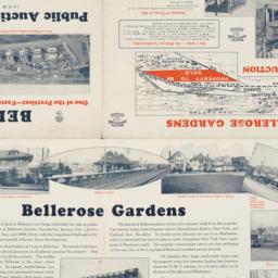
31. Auction map of Bellerose Gardens West in Nassau County, Long Island, N.Y. June 7th, 1926
maps
- Published: Realty Associates: Brooklyn, N.Y. [1926]
- Format: maps
- Online: click here for full-text
- Catalog Record: check availability

32. [Autograph book
Swayze, Mabel T
manuscripts
- Name: Swayze, Mabel T
- Format: manuscripts
- Catalog Record: check availability
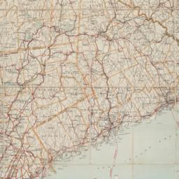
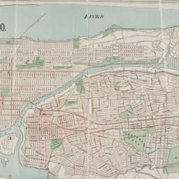
33. Automobile map of Hudson River district south
maps
- Published: Geo. H. Walker & Co: Boston. c1907
- Format: maps
- Online: click here for full-text
- Catalog Record: check availability
34. Bay & port of New-York, capital of New-York
Bellin, Jacques Nicolas, 1703-1772
maps
- Name: Bellin, Jacques Nicolas, 1703-1772
- Published: Common Council: New York. 1861]
- Format: maps
- Catalog Record: check availability
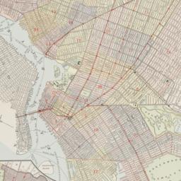
35. Bird's eye view map of New York and vicinity
C.S. Hammond & Company
maps
- Name: C.S. Hammond & Company
- Published: C.S. Hammond & Co: New York. c1909
- Format: maps
- Catalog Record: check availability
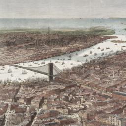
36. Bird's-eye view of the southern end of New York and Brooklyn, showing the projected suspension-bridge over the East River, from the western terminus in Printing-House Square, New York
Davis, Theodore R
maps
- Name: Davis, Theodore R
- Published: New York. 1870]
- Format: maps
- Online: click here for full-text
- Catalog Record: check availability
37. Block book of Twenty-Third Ward, New York City : for the use of real estate dealers, owners, lawyers, savings banks, insurance companies, and others intersted in New York City real estate : showing lots with their frontage and depths marked in feet an inches, block and ward numbers according to the tax maps in the City Assessor's office
Lediard, P. M
maps
- Name: Lediard, P. M
- Published: William T. Comstock: New York. [1920?]
- Format: maps
- Catalog Record: check availability
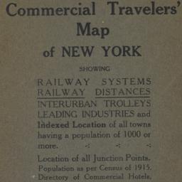
38. Blum's commercial travelers' map of New York
Blum, Max L
maps
- Name: Blum, Max L
- Published: Blum's Commercial Map Pub. Co: New York. c1920
- Format: maps
- Catalog Record: check availability
39. BMT Lines Rapid Transit Division
maps
- Published: BMT Lines: Brooklyn, N.Y. 1939]
- Format: maps
- Catalog Record: check availability
40. Boroughs of Manhattan and the Bronx showing the electric service of the New York Edison Co
maps
- Published: Bormay & Co: New York. [1902?]
- Format: maps
- Online: click here for full-text
- Catalog Record: check availability
41. Bowles's new pocket map of North America [facsimile] : divided into it's provinces, colonies, states, &c
Palairet, Jean, 1697-1774
maps
- Name: Palairet, Jean, 1697-1774
- Published: s.n: United States?. 1975?]
- Format: maps
- Catalog Record: check availability

42. Brewster & Company, Inc. (Bldg.) Rolls-Royce of America, Inc. (Ten.) (Garage) Long Island City New York
Associated Factory Mutual Fire Insurances Companies
maps
- Name: Associated Factory Mutual Fire Insurances Companies
- Published: Associated Factory Fire Insurance Companies: Boston, Mass. [1932]
- Format: maps
- Online: click here for full-text
- Catalog Record: check availability
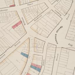
43. [Broad Street to Water Street south of Wall Street]
maps
- Published: s.n: New York?. 18--?]
- Format: maps
- Online: click here for full-text
- Catalog Record: check availability
44. Bronx bus map : February 1995
New York City Transit Authority
maps
- Name: New York City Transit Authority
- Published: New York City Transit Authority: Brooklyn, NY. 1995
- Format: maps
- Catalog Record: check availability
45. Brooklyn
maps
- Published: E.F. Fisk: New York. [1890?]
- Format: maps
- Online: click here for full-text
- Catalog Record: check availability
46. Brooklyn bus map
New York City Transit Authority
maps
- Name: New York City Transit Authority
- Published: New York City Transit Authority: Brooklyn. c1994
- Format: maps
- Catalog Record: check availability
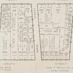
47. [Cadastral map of the area bound by South Street and Front Street between Whitehall Street and Broad Street]
maps
- Published: Chas. F. Noyes Co: New York. 1931?]
- Format: maps
- Online: click here for full-text
- Catalog Record: check availability
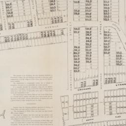
48. [Cadastral map of the lots at auction in the area between Broadway and Archer Avenue in White Plains, New York]
maps
- Published: American Photograph Company: New York. [1908]
- Format: maps
- Online: click here for full-text
- Catalog Record: check availability