Search Results Header
Search Constraints
Showing results for: Format other Remove constraint Format: other Format maps Remove constraint Format: maps Format objects Remove constraint Format: objects Format music Remove constraint Format: music Format postcards Remove constraint Format: postcards Neighborhood Washington Heights North Remove constraint Neighborhood: Washington Heights NorthSearch Results
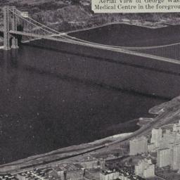
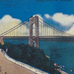
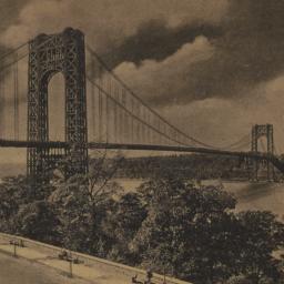
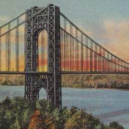
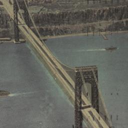
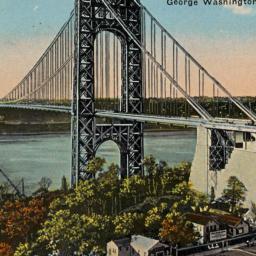
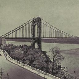
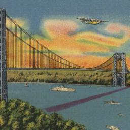
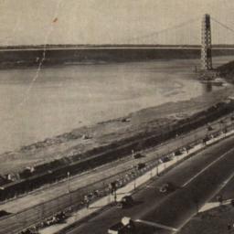
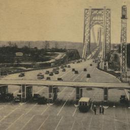
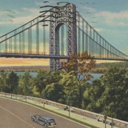
1. Aerial View of George Washington Bridge, New York City Medical Centre in the foreground, New Jersey Palisades opposite
postcards
- Format: postcards

4. Attacks of Fort Washington by His Majesty's forces under the command of Genl. Sir Willm Howe K.B. 16 Novr. 1776
maps
- Published: Lith. for D.T. Valentine's Manual for 1861 by Geo. Hayward: New York. [1861]
- Format: maps
- Online: click here for full-text
- Catalog Record: check availability
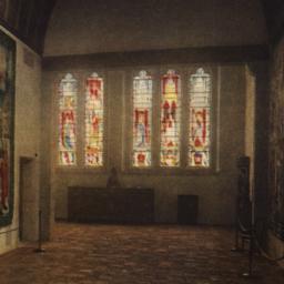
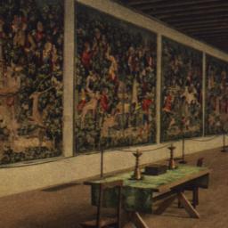
7. The Boppard Room Showing Stained-Glass Windows View from the Burgos Tapestry Hall
postcards
- Format: postcards
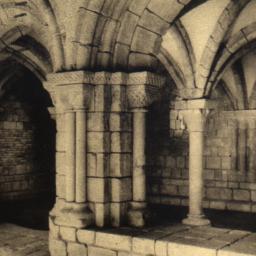
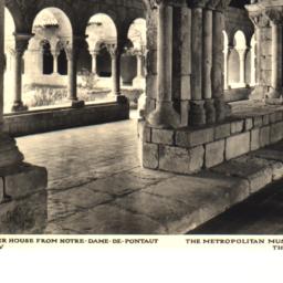
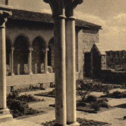
9. Chapter House from Notre-Dame-de-Pontaut, General View, the Metropolitan Museum of Art
postcards
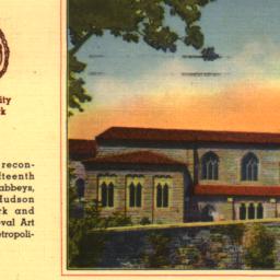
- Format: postcards
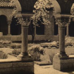
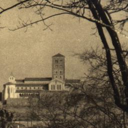
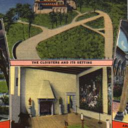
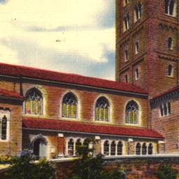
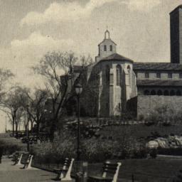
17. The Cloisters in Fort Tryon Park, New York City Branch of Metropolitan Museum of Art
postcards
- Format: postcards
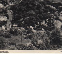
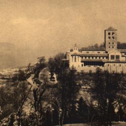
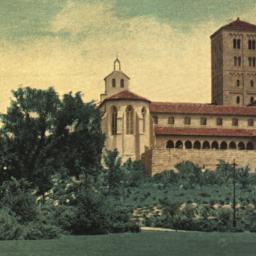
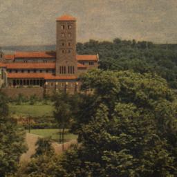
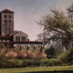
20. The Cloisters View from the Southeast, the Metropolitan Museum of Art
postcards
- Format: postcards

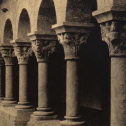
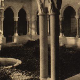
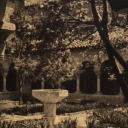
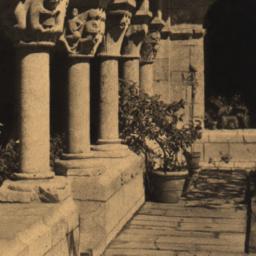
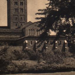
24. Exterior Arcade from Monastery at Cuxa the Cloisters Metropolitan Museum of Art
postcards
- Format: postcards
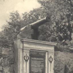
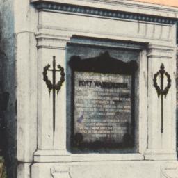
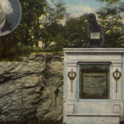
25. Fort Washington Memorial, New York.
postcards
- Published: H. Hagemeister. Postmark date: 1909
- Format: postcards
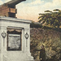
27. Fort Washington, Washington Heights, New York City.
postcards
- Published: American News Company
- Format: postcards
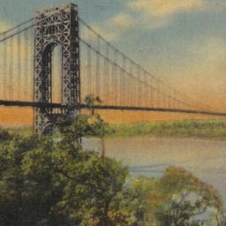
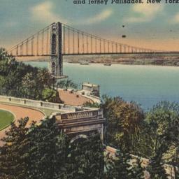
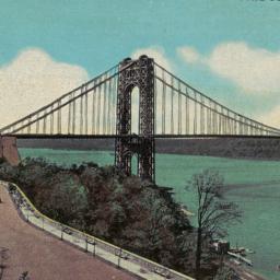
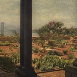
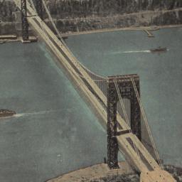
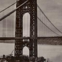
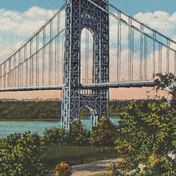
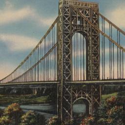
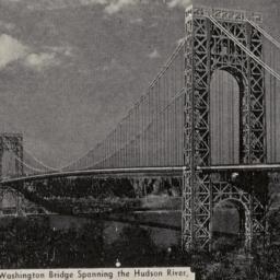
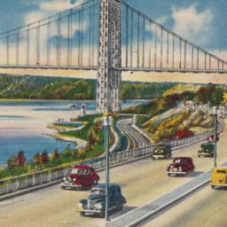
35. George Washington Bridge, Fort Tryon Park, Riverside Drive, Hudson River and Jersey Palisades, New York City
postcards
- Format: postcards

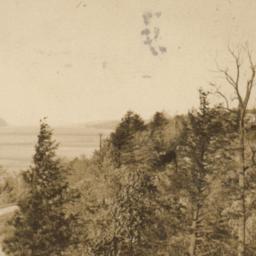
57. Henry Hudson Parkway Along Riverside Drive N.Y.
postcards
- Published: Manhattan Postcard. Postmark date: 1938
- Format: postcards
60. "Hudson View Gardens", 183rd St. and Pinehurst Ave., NYC (Two Blocks West of Broadway)
postcards
- Format: postcards
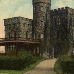
63. Libby Castle, Fort Washington Park, New York.
postcards
- Published: Leighton and Valentine Company
- Format: postcards
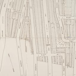
64. Map of 500 lots of the estate of James Cordon Bennett, dec'd, located between Broadway and N.Y. Central and Hudson River, RR. and between W. 181st and W. 187th Streets borough of Manhattan City of New York
maps
- Published: s.n: New York. 1919]
- Format: maps
- Online: click here for full-text
- Catalog Record: check availability

65. Metropolitan highways, New York -- New Jersey
Port of New York Authority
maps
- Name: Port of New York Authority
- Published: Port of New York Authority: New York. c1948
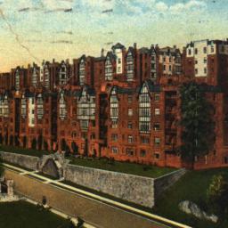
- Format: maps
- Catalog Record: check availability
66. Metropolitan New York road map
Port of New York Authority
maps
- Name: Port of New York Authority
- Published: Port of New York Authority: New York?. c1938
- Format: maps
- Catalog Record: check availability
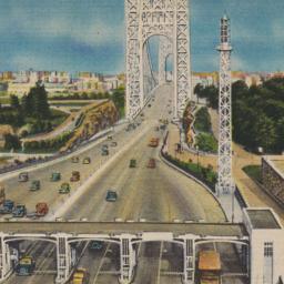
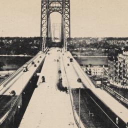
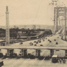
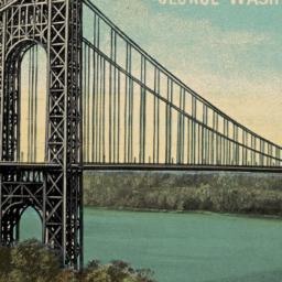
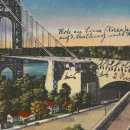
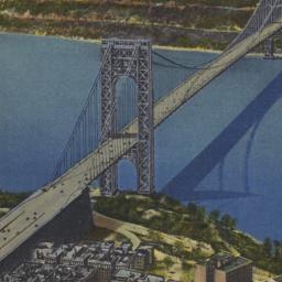
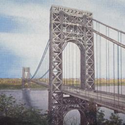
67. N. J. Entrance to George Washington Bridge Connecting New Jersey and New York
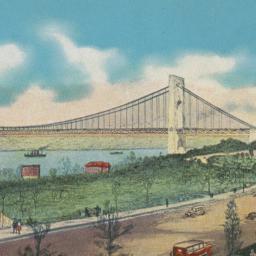
postcards
- Format: postcards
68. Plan of the island of New York in North America but only from the eastern side in the vicinity of the late Fort Washington, afterward Knyphausen, which was taken in the month of May 1779 from the Laurel HIll, but first drawn in the month of January 1781 in the hut encampment near Fort Knyphausen
maps
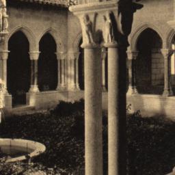
- Published: Common Council: New York. 1854]
- Format: maps
- Catalog Record: check availability
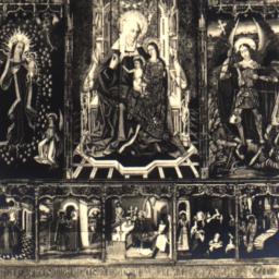
69. Retable: Saint Anne, the Virgin, and Saint Michael Spanish, XV Century, the Cloisters
postcards
- Format: postcards
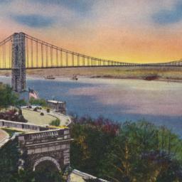
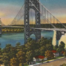
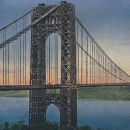
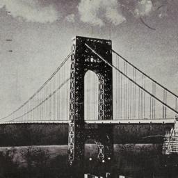
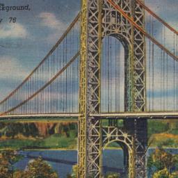
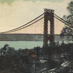
70. Riverside Drive, George Washington Bridge and Hudson River, New York City
postcards
- Format: postcards
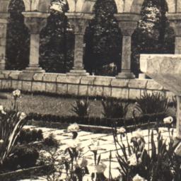
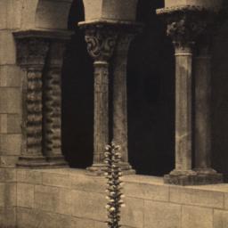
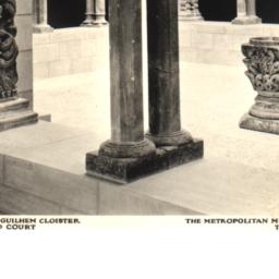
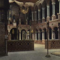
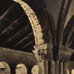
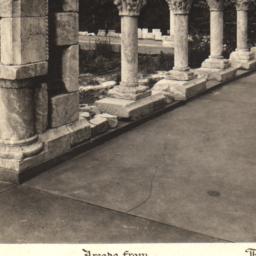
74. St.-Guilhem Cloister Arcades and Court the Metropolitan Museum of Art the Cloisters
postcards
- Format: postcards

77. A topographical map of the north part of New-York Island : exhibiting the plan of Fort Washington now Fort Knyphausen, with the rebels lines to the southward which where [sic] forced by the troops under the command of the Rt. Honble. Earl Percy on the 16th. Novr. 1776, and survey'd immediately after by order of his Lordship, to which is added the attack made to the north by the Hessians, surveyed by order of Lieut. Genl. Knyphausen
Sauthier, Claude Joseph
maps
- Name: Sauthier, Claude Joseph
- Published: D.T. Valentine?: N.Y.?. 1859]
- Format: maps
- Catalog Record: check availability
78. A topographical map of the northn. part of New York Island, exhibiting the plan of Fort Washington, now Fort Knyphausen, with the rebels lines to the southward, which were forced by the troops under the command of the Rt. Honble. Earl Percy on the 16th. Novr. 1776, and survey'd immediately after by order of His Lordship
Sauthier, Claude Joseph
maps
- Name: Sauthier, Claude Joseph
- Published: W. Faden: London. 1777
- Format: maps
- Online: click here for full-text
- Catalog Record: check availability