Search Results Header
Search Constraints
Showing results for: Format other Remove constraint Format: other Format periodicals Remove constraint Format: periodicals Format maps Remove constraint Format: maps Format ephemera Remove constraint Format: ephemera Format objects Remove constraint Format: objects Borough Queens Remove constraint Borough: QueensSearch Results

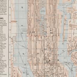
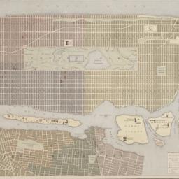
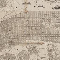
1. Asher & Adams' map of New York City
maps
- Published: Asher & Adams: New York?. between 1873 and 1883]
- Format: maps
- Online: click here for full-text
- Catalog Record: check availability
2. Astoria : part of Long Island City, town of Newtown, Queens Co., L.I
Beers, F. W
maps
- Name: Beers, F. W
- Published: Beers, Comstock & Cline: New York. 1873]
- Format: maps
- Online: click here for full-text
- Catalog Record: check availability

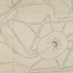
3. BMT Lines Rapid Transit Division
maps
- Published: BMT Lines: Brooklyn, N.Y. 1939]
- Format: maps
- Catalog Record: check availability
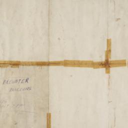
4. Brewster & Company, Inc. (Bldg.) Rolls-Royce of America, Inc. (Ten.) (Garage) Long Island City New York
Associated Factory Mutual Fire Insurances Companies
maps
- Name: Associated Factory Mutual Fire Insurances Companies
- Published: Associated Factory Fire Insurance Companies: Boston, Mass. [1932]
- Format: maps
- Online: click here for full-text
- Catalog Record: check availability

5. [Collection of materials about the Queens Museum]
Queens Museum
ephemera
- Name: Queens Museum
- Published: New York. ca. 1988]
- Format: ephemera
- Catalog Record: check availability
6. Colton's Map of New York and the adjacent Cities
Colton, J. H. 1800-1893
maps
- Name: Colton, J. H. 1800-1893
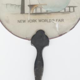
- Published: Johnson & Browning: New York. c1855
- Format: maps
- Online: click here for full-text
- Catalog Record: check availability
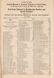
7. A Copy of the annual record of assessed valuation of real estate in the City of New York for the fiscal year ... Real estate indicated by identification numbers and special franchises : Boroughs of Manhattan, the Bronx, Brooklyn, Queens and Richmond
periodicals
- Published: City record]: New York City. 1947-
- Format: periodicals
- Online: click here for full-text
- Catalog Record: check availability
8. The emergency map, family emergency map of New York City + emergency care guide : detailed 5-borough map with more than 70 hospitals, locations, 24-hour emergency rooms, special facilities, volunteer ambulance corps areas and phone numbers, directory of most-used emergency phone numbers, illustrated guide to basic emergency care procedures
Hagstrom Map Company
maps
- Name: Hagstrom Map Company
- Published: Hagstrom Map Co: Maspeth, N.Y. c1984
- Format: maps
- Catalog Record: check availability
9. Flushing Nurseries Incorporated
ephemera
- Published: s.n: New York?. 19--?]
- Format: ephemera
- Catalog Record: check availability
10. Greater New York
National Geographic Society (U.S.). Cartographic Division
maps
- Name: National Geographic Society (U.S.). Cartographic Division
- Published: The Society: Washington. 1964
- Format: maps
- Catalog Record: check availability
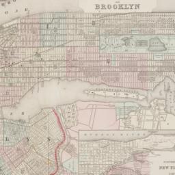
11. Guide map to the Brooklyn and Queens parks
maps
- Published: s.n: New York?. between 1925 and 1939]
- Format: maps
- Catalog Record: check availability
12. Hagstrom's New York City : sites to see ... select walking tours to take
Hagstrom Map Company
maps
- Name: Hagstrom Map Company
- Published: Hagstrom Co: New York City, N.Y. [between 1970 and 1980?]
- Format: maps
- Catalog Record: check availability
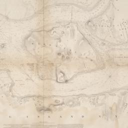
13. Hell Gate and its approaches
United States Coast Survey
maps
- Name: United States Coast Survey
- Published: U.S. Coast Survey: Washington. 1853
- Format: maps
- Online: click here for full-text
- Catalog Record: check availability
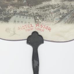
14. Hotel Astor, New York
objects
- Published: s.n: New York?. between 1904 and 1967]
- Format: objects
- Catalog Record: check availability
15. How to see the New York World's Fair quickly, comfortably, completely
New York World's Fair 1964-1965 Corporation
maps
- Name: New York World's Fair 1964-1965 Corporation
- Published: New York World's Fair 1964-1965 Corp: New York?. 1964
- Format: maps
- Catalog Record: check availability
16. Hunters Point, part of Long Island City
maps
- Published: Beers, Comstock & Cline: N.Y. 1873]
- Format: maps
- Online: click here for full-text click here for full-text
- Catalog Record: check availability
17. John F. Kennedy International Airport bus map
Tauranac, Ltd
maps
- Name: Tauranac, Ltd
- Published: Port Authority of NY & NJ, Office of Ground Transportation: New York. c1991
- Format: maps
- Catalog Record: check availability
18. Johnson's New York and Brooklyn
Johnson, A. J. 1827-1884
maps
- Name: Johnson, A. J. 1827-1884
- Published: A.J. Johnson: New York. c1866
- Format: maps
- Online: click here for full-text
- Catalog Record: check availability
19. Lain's business directory of Brooklyn, Kings County, Long Island City, Jamaica, Far Rockaway, Flushing, College Point, Hempstead, Newton and Whitestone
periodicals
- Published: Lain & Co: Brooklyn. -1890
- Format: periodicals
- Online: click here for full-text
- Catalog Record: check availability
20. Layout of first six runways municipal airport at Idlewild
ephemera
- Published: Department of Marine and Aviation: New York. 1944]
- Format: ephemera
- Catalog Record: check availability
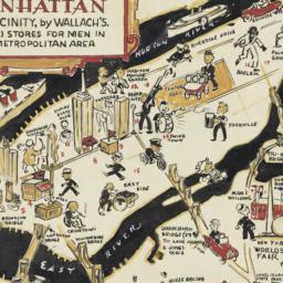
21. A man's map of Manhattan and vicinity by Wallach's
Voorhies, Stephen J
maps
- Name: Voorhies, Stephen J
- Format: maps
- Catalog Record: check availability
22. A man's map of New York by Wallach's
Voorhies, Stephen J
maps
- Name: Voorhies, Stephen J
- Format: maps
- Catalog Record: check availability
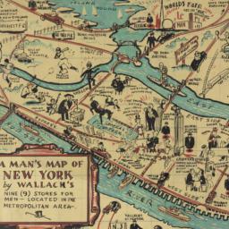
23. A man's map of New York by Wallach's
Voorhies, Stephen J
maps
- Name: Voorhies, Stephen J
- Format: maps
- Catalog Record: check availability
24. Map of New York City
maps
- Published: Hunt & Eaton: New York?. c1891
- Format: maps
- Online: click here for full-text
- Catalog Record: check availability
25. Map of Stratton Bluffs at College Point on Flushing Bay, New York
maps
- Published: John Meddle & Son: New York. [1891]
- Format: maps
- Online: click here for full-text
- Catalog Record: check availability
26. A map of the city and county of New York : with the adjacent cities of Brooklyn and Jersey City, and the village of Williamsburg : with a street directory of the city of New York
Thayer, Bridgman & Fanning
maps
- Name: Thayer, Bridgman & Fanning
- Published: Thayer, Bridgman & Fanning: New York. 1853
- Format: maps
- Catalog Record: check availability
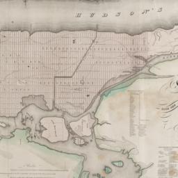
27. Map of the city and county of New York : with the adjacent country
Burr, David H., 1803-1875
maps
- Name: Burr, David H., 1803-1875
- Published: s.n: New York. 1829]
- Format: maps
- Online: click here for full-text
- Catalog Record: check availability
28. Map of the subway system of New York
Voorhies, Stephen J
maps
- Name: Voorhies, Stephen J
- Published: Union Dime Savings Bank: New York. 1940
- Format: maps
- Catalog Record: check availability
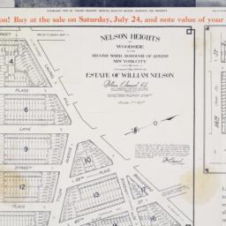
29. Nelson Heights at Woodside in the Second Ward, borough of Queens, New York City
maps
- Published: William Kennely, Inc: New York. [1926]
- Format: maps
- Online: click here for full-text
- Catalog Record: check availability
30. New Bond Paper Map of New York City
Matthews-Northrup Company
maps
- Name: Matthews-Northrup Company
- Published: Adolph Wittemann: New York. c1885
- Format: maps
- Catalog Record: check availability
31. New York
maps
- Published: Letts, Son & Co: London. [1885?]
- Format: maps
- Online: click here for full-text
- Catalog Record: check availability
32. The New York 1939 official World's Fair pictorial map
Sarg, Tony, 1882-1942
maps
- Name: Sarg, Tony, 1882-1942
- Published: The Fair?: New York. 1939]
- Format: maps
- Catalog Record: check availability
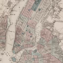
33. New York and Brooklyn
maps
- Published: s.n.]: S.l. c1867
- Format: maps
- Online: click here for full-text
- Catalog Record: check availability
34. New York City
Asher & Adams
maps
- Name: Asher & Adams
- Published: Asher & Adams: New York. 1871]
- Format: maps
- Online: click here for full-text
- Catalog Record: check availability
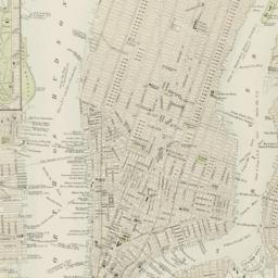
35. New York, city (lower part)
maps
- Published: s.n: S.l. 1889?]
- Format: maps
- Online: click here for full-text
- Catalog Record: check availability
36. New York City, Manhattan, Brooklyn, Bronx, Queens & Staten Island map
Rand McNally and Company
maps
- Name: Rand McNally and Company
- Published: Rand McNally & Co: Chicago. [1982?]
- Format: maps
- Catalog Record: check availability
37. New York city map
Phelps, Humphrey, active 19th century
maps
- Name: Phelps, Humphrey, active 19th century
- Published: H. Phelps: New York. c1857
- Format: maps
- Online: click here for full-text
- Catalog Record: check availability
38. New York city map
Miller, James
maps
- Name: Miller, James
- Published: J. Miller: New York. [1857?]
- Format: maps
- Catalog Record: check availability
39. [New York, city map of New York and five boroughs]
Falk-Verlag
maps
- Name: Falk-Verlag
- Published: Falk-Plan: New York. [1969], c1968
- Format: maps
- Catalog Record: check availability
40. New York, picture and street map
Bollmann Bildkarten Verlag
maps
- Name: Bollmann Bildkarten Verlag
- Published: Bollmann-Bildkarten-Verlag: Braunschweig, Germany. [1984?]
- Format: maps
- Catalog Record: check availability
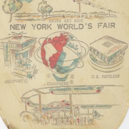
41. New York World's Fair
objects
- Published: s.n: New York?. 1964?]
- Format: objects
- Catalog Record: check availability
42. New York World's Fair
Hagstrom Company
maps
- Name: Hagstrom Company
- Published: Hagstrom Co: New York. [1938?]
- Format: maps
- Catalog Record: check availability
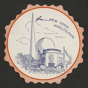
43. New York World's Fair
objects
- Published: s.n: New York?. 1939?]
- Format: objects
- Catalog Record: check availability
44. New York World's Fair
objects
- Published: s.n: New York?. 1940?]
- Format: objects
- Online: click here for full-text
- Catalog Record: check availability
45. New York World's Fair : 1965 official souvenir map
Bollmann, Hermann, 1911-1971
maps
- Name: Bollmann, Hermann, 1911-1971
- Published: Time Inc: New York. c1965
- Format: maps
- Catalog Record: check availability
46. New York World's Fair 1939
ephemera
- Published: s.n: New York?. 1984?]
- Format: ephemera
- Catalog Record: check availability
47. New York World's Fair 1939 scrap book : officially licensed
ephemera
- Published: The Saalfield Pub. Co: Akron, OH. 1939
- Format: ephemera
- Catalog Record: check availability

48. [New York World's Fair Brazil pamphlets]
New York World's Fair New York, N.Y.) (1939-1940
ephemera
- Name: New York World's Fair New York, N.Y.) (1939-1940
- Published: Comp. Carioca de Artes Graphicas: Brazil. 1939
- Format: ephemera
- Online: click here for full-text
- Catalog Record: check availability
49. New York World's Fair bulletin
periodicals
- Published: The Fair: New York. 1936-
- Format: periodicals
- Catalog Record: check availability
50. New-York City, County and vicinity
Dripps, M
maps
- Name: Dripps, M
- Published: s.n: New York?. 1866]
- Format: maps
- Online: click here for full-text
- Catalog Record: check availability
51. Part of College Point, town of Flushing, Queens Co
maps
- Published: Beers, Comstock & Cline: N.Y. 1873]
- Format: maps
- Online: click here for full-text
- Catalog Record: check availability
52. Part of Flushing, town of Flushing, Queens Co
maps
- Published: Beers, Comstock & Cline: N.Y. 1873]
- Format: maps
- Catalog Record: check availability
53. Part of Flushing, town of Flushing, Queens Co
maps
- Published: Beers, Comstock & Cline: N.Y. 1873]
- Format: maps
- Online: click here for full-text
- Catalog Record: check availability
54. Part of Flushing, town of Flushing, Queens Co., L.I
maps
- Published: Beers, Comstock & Cline: N.Y. 1873]
- Format: maps
- Online: click here for full-text
- Catalog Record: check availability
55. Plan de New-York (Etats-Unis)
maps
- Published: Becquet: Paris. [188-?]
- Format: maps
- Online: click here for full-text
- Catalog Record: check availability
56. Plan of New York and Brooklyn
maps
- Published: s.n: S.l. 186-?]
- Format: maps
- Online: click here for full-text
- Catalog Record: check availability
57. Quarterly review
New York City Cancer Committee
periodicals
- Name: New York City Cancer Committee
- Published: New York. Between 1936 and 1945
- Format: periodicals
- Catalog Record: check availability
58. Queens bus map
New York (State). Metropolitan Transportation Authority
maps
- Name: New York (State). Metropolitan Transportation Authority
- Published: New York City Transit Authority: New York. c1993
- Format: maps
- Catalog Record: check availability
59. Rand, McNally & Co.'s map of New York City, Brooklyn, Jersey City and vicinity
Rand McNally and Company
maps
- Name: Rand McNally and Company
- Published: Rand, McNally & Co: New York. 1891
- Format: maps
- Catalog Record: check availability
60. Sherwood Park, Long Island being a sectional reprint from the Map of the Village of Queens, as surveyed by Mr. Geo. W. Dickerson
maps
- Published: Sherwood Land Association: New York. [18--?]
- Format: maps
- Catalog Record: check availability