Search Results Header
Search Constraints
Showing results for: "Streets" Remove constraint "Streets" Borough Manhattan Remove constraint Borough: Manhattan Borough Brooklyn Remove constraint Borough: BrooklynSearch Results

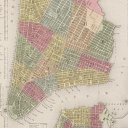
1. Asher & Adams' map of New York City
maps
- Published: Asher & Adams: New York?. between 1873 and 1883]
- Format: maps
- Online: click here for full-text
- Catalog Record: check availability

2. Buildings in New York
Boston Diatite Company
ephemera
- Name: Boston Diatite Company
- Published: Boston Diatite Company: Boston. between 1870 and 1876]
- Format: ephemera
- Catalog Record: check availability
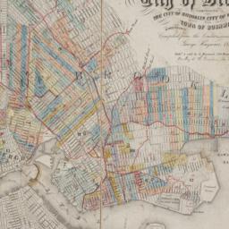
3. City and county of New York
Bien, Joseph R
maps
- Name: Bien, Joseph R
- Published: Julius Bien & Co: New York. 1891]
- Format: maps
- Online: click here for full-text
- Catalog Record: check availability
4. City of New York
Thomas, Cowperthwait & Co
maps
- Name: Thomas, Cowperthwait & Co
- Published: s.n.]: Philadelphia, Pa.?. 1850
- Format: maps
- Online: click here for full-text
- Catalog Record: check availability

5. City of New York
Burr, David H., 1803-1875
maps
- Name: Burr, David H., 1803-1875
- Published: J.H. Colton & Co: New York. 1839, c1833
- Format: maps
- Catalog Record: check availability
6. Colton's Map of New York and the adjacent Cities
Colton, J. H. 1800-1893
maps
- Name: Colton, J. H. 1800-1893
- Published: Johnson & Browning: New York. c1855
- Format: maps
- Online: click here for full-text
- Catalog Record: check availability
7. Colton's New York City, Brooklyn, Jersey City, Hoboken, etc
Colton, G. Woolworth 1827-1901
maps
- Name: Colton, G. Woolworth 1827-1901
- Published: G.W. and C.B. Colton & Co: New York. 1875
- Format: maps
- Catalog Record: check availability

8. Contract drawings, route no. 9-0-2, Brooklyn Loop lines, Centre Street from Pearl to Canal : A2-3, B1-4-5-6-7, C1 to 14, D3-4-5, E4 to 13
New York (State). Board of Rapid Transit Railroad Commissioners
books
- Name: New York (State). Board of Rapid Transit Railroad Commissioners
- Published: s.n.]: New York. 1907
- Format: books
- Catalog Record: check availability
9. Contract drawings, route no. 9-0-3, Brooklyn Loop lines, Centre Street from Canal St. to Broome St. : map and profile, A4, B1-8-9-10, C1 to12, D6, E8-14-15-16-17
New York (State). Board of Rapid Transit Railroad Commissioners
books
- Name: New York (State). Board of Rapid Transit Railroad Commissioners
- Published: s.n.]: New York. 1907
- Format: books
- Catalog Record: check availability
10. The establishment of public parks in the city of New York
Davis, Gherardi, 1858-1941
books
- Name: Davis, Gherardi, 1858-1941
- Published: s.n: New York. [1897?]
- Format: books
- Online: click here for full-text
- Catalog Record: check availability

11. Glimpses of old New-York : the rare old prints are from the private collections of Robert Goelet [and others]
Brown, Henry Collins, 1862-1961
books
- Name: Brown, Henry Collins, 1862-1961
- Published: Priv. print. for the subscribers [by Lent & Graff.]: New York. 1917
- Format: books
- Online: click here for full-text
- Catalog Record: check availability

12. Historical sketch of the Fulton Ferry, and its associated ferries
Pierrepont, Henry Evelyn, 1808-1888
books
- Name: Pierrepont, Henry Evelyn, 1808-1888
- Published: Eagle Job and Book Printing Department: Brooklyn. 1879
- Format: books
- Online: click here for full-text
- Catalog Record: check availability
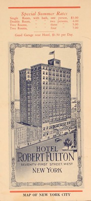
13. Hotel Robert Fulton : Seventy-First Street, West : New York
Hotel Robert Fulton (New York, N.Y.)
books
- Name: Hotel Robert Fulton (New York, N.Y.)
- Published: [publisher not identified]: New York?. [1926?]
- Format: books
- Online: click here for full-text
- Catalog Record: check availability
14. Johnson's map of New York and the adjacent cities
Johnson and Ward
maps
- Name: Johnson and Ward
- Published: Johnson and Ward: New York. [1864?]
- Format: maps
- Online: click here for full-text
- Catalog Record: check availability
15. Johnson's New York and Brooklyn
Johnson, A. J. 1827-1884
maps
- Name: Johnson, A. J. 1827-1884
- Published: A.J. Johnson: New York. c1866
- Format: maps
- Online: click here for full-text
- Catalog Record: check availability

16. Map of New York and vicinity
Dripps, M
maps
- Name: Dripps, M
- Published: M. Dripps: N[ew] Y[ork]. c1865
- Format: maps
- Online: click here for full-text
- Catalog Record: check availability
17. Map of the cities of New York, Brooklyn, Long Island City, Jersey City & Hoboken
Dripps, M
maps
- Name: Dripps, M
- Published: M. Dripps: New York. ca. 1870]
- Format: maps
- Catalog Record: check availability
18. A map of the city and county of New York : with the adjacent cities of Brooklyn and Jersey City, and the village of Williamsburg : with a street directory of the city of New York
Thayer, Bridgman & Fanning
maps
- Name: Thayer, Bridgman & Fanning
- Published: Thayer, Bridgman & Fanning: New York. 1853
- Format: maps
- Catalog Record: check availability
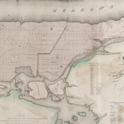
19. Map of the city and county of New York : with the adjacent country
Burr, David H., 1803-1875
maps
- Name: Burr, David H., 1803-1875
- Published: s.n: New York. 1829]
- Format: maps
- Online: click here for full-text
- Catalog Record: check availability
20. A map of the city and county of New York with the adjacent cities of Brooklyn and Jersey City, and the village of Williamsburg : with a street directory of the city of New York
books
- Published: Ensign & Thayer: New York. 1852
- Format: books
- Catalog Record: check availability

21. Map of the City of New York
W.C. Rogers & Co
maps
- Name: W.C. Rogers & Co
- Published: s.n.]: New York. 1868
- Format: maps
- Online: click here for full-text
- Catalog Record: check availability
22. Map of the city of New York : with the adjacent cities of Brooklyn & Jersey City & the village of Williamsburg
Phelps, Humphrey, active 19th century
maps
- Name: Phelps, Humphrey, active 19th century
- Published: H. Phelps: New York. 1845
- Format: maps
- Catalog Record: check availability
23. Map of the consolidated City of Brooklyn : comprising the City of Brooklyn, City of Williamsburgh and Town of Bushwick, Kings County, Long Island
Hayward, George, approximately 1800-
maps
- Name: Hayward, George, approximately 1800-
- Published: G. Hayward: New York. 1854
- Format: maps
- Online: click here for full-text
- Catalog Record: check availability
24. New Bond Paper Map of New York City
Matthews-Northrup Company
maps
- Name: Matthews-Northrup Company
- Published: Adolph Wittemann: New York. c1885
- Format: maps
- Catalog Record: check availability
Search Other Sources for: "Streets"
Try your search in one of these related resources. (Search results will display in a new window.)
-
Avery Index to Architectural Periodicals
A comprehensive listing of journal articles published worldwide on architecture and design, archaeology, city planning, interior design, landscape architecture, and historic preservation. -
Brooklyn Historical Society Photography Collection
Search for individual photographs. Approximately 5,000 of our images are currently available online, but more images are added regularly. -
Brooklyn Public Library: Historic Brooklyn Photographs
Selection of more than ten thousand historic photographs from the Brooklyn Collection. -
CLIO: Columbia Libraries Catalog
Search for books, articles, journals, online resources and more. -
DLC: Columbia Libraries Digital Collections
A gateway to digital projects and online exhibitions that have been published on the web by Columbia University Libraries/Information Services (CUL/IS). -
Museum of the City of New York
Over 150,000 images and objects from the collections of the Museum of the City of New York.
Note: to come. -
New York Historical Society
Digital images from the library and museum collections. -
NYPL Digital Collections
Provides free and open access to over 800,000 images digitized from the The New York Public Library's vast collections.