Search Results Header
Search Constraints
Showing results for: "Piers" Remove constraint "Piers" Borough Manhattan Remove constraint Borough: Manhattan City New York Remove constraint City: New YorkSearch Results

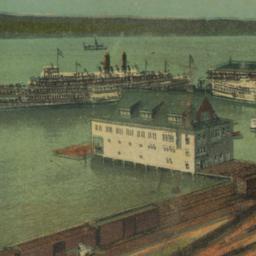
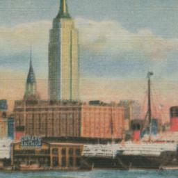
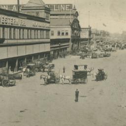
25. Greater New York Shipping on West Street
postcards
- Published: Raphael Tuck and Sons
- Format: postcards

26. Hamilton aerial map, Manhattan, New York City
Hamilton, W. L
maps
- Name: Hamilton, W. L
- Published: W.L. Hamilton: New York. [1927]
- Format: maps
- Catalog Record: check availability

28. Hudson Boat Club, Recreation Pier and Steamboat Landing, 127th & 128th Sts. and Hudson
postcards
- Format: postcards
35. Map of city of New-York
Hayward, George, approximately 1800-
maps
- Name: Hayward, George, approximately 1800-
- Published: G. Hayward: N.Y. 1842
- Format: maps
- Catalog Record: check availability

36. Map of New York : places of interest and general information concerning the city
Ohman Map Co
maps
- Name: Ohman Map Co
- Published: Aug. R. Ohman Map Co: New York. c1913
- Format: maps
- Online: click here for full-text
- Catalog Record: check availability
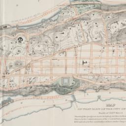
37. Map of that part of the city of New York north of 155th street : showing the progress made in laying out streets, roads, public squares and places, by the Commissioners of the Central Park, under Chap. 565 of Laws of 1865 and of new Pier and Bulkhead Laws under Chap. 697 of Laws of 1867
maps
- Published: Major & Knapp Eng. Mfg. & Lith. Co: N.Y. 1870
- Format: maps
- Online: click here for full-text
- Catalog Record: check availability
38. Map of the cities of New York, Brooklyn, Long Island City, Jersey City & Hoboken
Dripps, M
maps
- Name: Dripps, M
- Published: M. Dripps: New York. ca. 1870]
- Format: maps
- Catalog Record: check availability
39. Map of the city & county of New York ; Upper part of the city and county of New York on a reduced scale
Hayward, George, approximately 1800-
maps
- Name: Hayward, George, approximately 1800-
- Published: Common Council]: New York. 1860
- Format: maps
- Catalog Record: check availability
40. A map of the city and county of New York : with the adjacent cities of Brooklyn and Jersey City, and the village of Williamsburg : with a street directory of the city of New York
Thayer, Bridgman & Fanning
maps
- Name: Thayer, Bridgman & Fanning
- Published: Thayer, Bridgman & Fanning: New York. 1853
- Format: maps
- Catalog Record: check availability
41. Map of the City of New York : showing the streets, avenues, roads, public squares & places laid out, established, widened and retained, the new pier and bulkhead lines laid out and established by the Board of Commissioners of the Central Park, by and under authority of chapter 697 of the laws of the State of New York, passed April 24, 1867
New York (N.Y.). Board of Commissioners of the Central Park
maps
- Name: New York (N.Y.). Board of Commissioners of the Central Park
- Published: s.n: New York?. 1868-1872]
- Format: maps
- Catalog Record: check availability
42. Map of the City of New-York
Hayward, George, approximately 1800-
maps
- Name: Hayward, George, approximately 1800-
- Published: Common Council, 1854]: New York. 1854
- Format: maps
- Online: click here for full-text
- Catalog Record: check availability
43. Map of the city of New-York, 1853
Hayward, George, approximately 1800-
maps
- Name: Hayward, George, approximately 1800-
- Published: Common Council: New York, N.Y. 1853]
- Format: maps
- Online: click here for full-text
- Catalog Record: check availability
44. Maps of the Commissioners of Central Park relative to the district between Fifty-Fifth Street and One Hundred and Fifty-Fifth Street, West of Eighth Avenue and around the Central Park
New York (N.Y.). Board of Commissioners of the Central Park
maps
- Name: New York (N.Y.). Board of Commissioners of the Central Park
- Published: s.n., 1868]: New York. 1868
- Format: maps
- Catalog Record: check availability
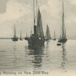
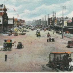
45. Misty Morning on New York Bay
postcards
- Published: Rotograph Company. Postmark date: 1906
- Format: postcards
Search Other Sources for: "Piers"
Try your search in one of these related resources. (Search results will display in a new window.)
-
Avery Index to Architectural Periodicals
A comprehensive listing of journal articles published worldwide on architecture and design, archaeology, city planning, interior design, landscape architecture, and historic preservation. -
Brooklyn Historical Society Photography Collection
Search for individual photographs. Approximately 5,000 of our images are currently available online, but more images are added regularly. -
Brooklyn Public Library: Historic Brooklyn Photographs
Selection of more than ten thousand historic photographs from the Brooklyn Collection. -
CLIO: Columbia Libraries Catalog
Search for books, articles, journals, online resources and more. -
DLC: Columbia Libraries Digital Collections
A gateway to digital projects and online exhibitions that have been published on the web by Columbia University Libraries/Information Services (CUL/IS). -
Museum of the City of New York
Over 150,000 images and objects from the collections of the Museum of the City of New York.
Note: to come. -
New York Historical Society
Digital images from the library and museum collections. -
NYPL Digital Collections
Provides free and open access to over 800,000 images digitized from the The New York Public Library's vast collections.