Search Results Header
Search Constraints
Showing results for: "Rivers New York (State) New York" Remove constraint "Rivers New York (State) New York" Borough Manhattan Remove constraint Borough: ManhattanSearch Results

1. 1783, Manhattan Island at the close of the Revolution showing the American city with its landmarks and the Revolutionary fortifictions on the island
MacCoun, Townsend, 1845-1932
maps
- Name: MacCoun, Townsend, 1845-1932
- Published: L.L. Poates Engr'g Co: New York. c1909
- Format: maps
- Catalog Record: check availability
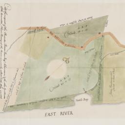
2. At the request of the recorder Thomas Jones Esqr. chairman, & the other gentlemen of the committee, I have surveyed the farm commonly called Tuttle Bay, granted by William Keist 23d of April 1646. unto George Holmes & Thomas Hall, and find the same to be agreeable to the above draft
Maerschalck, Francis W., -1776
maps
- Name: Maerschalck, Francis W., -1776
- Published: Common Council?: New York?. 1860?]
- Format: maps
- Online: click here for full-text
- Catalog Record: check availability
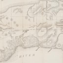
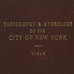
3. Map of the City of New York, from the Battery to 80th Street, showing the original topography of Manhattan Island
Viele, Egbert L. 1825-1902
maps
- Name: Viele, Egbert L. 1825-1902
- Published: s.n: New York. 1866?]
- Format: maps
- Online: click here for full-text
- Catalog Record: check availability
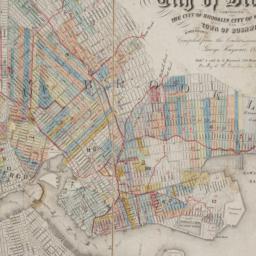
4. Map of the consolidated City of Brooklyn : comprising the City of Brooklyn, City of Williamsburgh and Town of Bushwick, Kings County, Long Island
Hayward, George, approximately 1800-
maps
- Name: Hayward, George, approximately 1800-
- Published: G. Hayward: New York. 1854
- Format: maps
- Online: click here for full-text
- Catalog Record: check availability
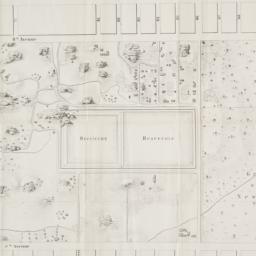
5. Map of the lands included in the Central Park
Viele, Egbert L. 1825-1902
maps
- Name: Viele, Egbert L. 1825-1902
- Published: s.n.]: New York. 1856
- Format: maps
- Online: click here for full-text
- Catalog Record: check availability

6. Plan of the city of New York in North America : surveyed in the years 1766 & 1767
Ratzer, Bernard
maps
- Name: Ratzer, Bernard
- Published: J.H. Colton: New York. 1853
- Format: maps
- Online: click here for full-text
- Catalog Record: check availability
7. Topographical map of the City of New York showing original water courses and made land
Viele, Egbert L. 1825-1902
maps
- Name: Viele, Egbert L. 1825-1902
- Published: Ferd. Mayer & Co. lith: New York. c1865
- Format: maps
- Catalog Record: check availability
Search Other Sources for: "Rivers New York (State) New York"
Try your search in one of these related resources. (Search results will display in a new window.)
-
Avery Index to Architectural Periodicals
A comprehensive listing of journal articles published worldwide on architecture and design, archaeology, city planning, interior design, landscape architecture, and historic preservation. -
Brooklyn Historical Society Photography Collection
Search for individual photographs. Approximately 5,000 of our images are currently available online, but more images are added regularly. -
Brooklyn Public Library: Historic Brooklyn Photographs
Selection of more than ten thousand historic photographs from the Brooklyn Collection. -
CLIO: Columbia Libraries Catalog
Search for books, articles, journals, online resources and more. -
DLC: Columbia Libraries Digital Collections
A gateway to digital projects and online exhibitions that have been published on the web by Columbia University Libraries/Information Services (CUL/IS). -
Museum of the City of New York
Over 150,000 images and objects from the collections of the Museum of the City of New York.
Note: to come. -
New York Historical Society
Digital images from the library and museum collections. -
NYPL Digital Collections
Provides free and open access to over 800,000 images digitized from the The New York Public Library's vast collections.