Search Results Header
Search Results

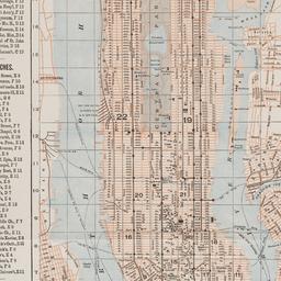
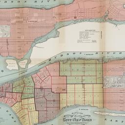
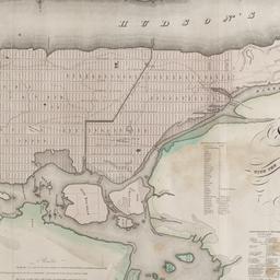
49. Map of New York and vicinity
Dripps, M
maps
- Name: Dripps, M
- Published: M. Dripps: N[ew] Y[ork]. c1865
- Format: maps
- Online: click here for full-text
- Catalog Record: check availability
50. Map of New York City
maps
- Published: Hunt & Eaton: New York?. c1891
- Format: maps
- Online: click here for full-text
- Catalog Record: check availability
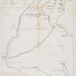
51. [Map of New York Harbor, New York Bay, and Staten Island]
maps
- Published: s.n: New York?. 18--?]
- Format: maps
- Online: click here for full-text
- Catalog Record: check availability
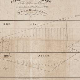
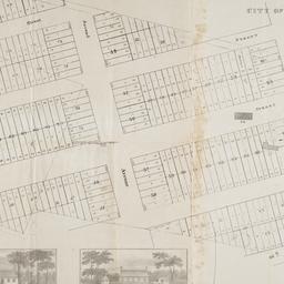
52. Map of property at Harlaem [sic] to be sold in one parcel on Tuesday the 3rd of February 1835 by James Bleecker & Sons at 11 o'clock
maps
- Published: P. Desobry's: New York. [1835]
- Format: maps
- Online: click here for full-text
- Catalog Record: check availability
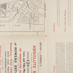
53. Map of property belonging to the Courtney Development Company situate partly in the First and Second Wards, borough of Queens, city of New York
maps
- Published: s.n: New York. 1913]
- Format: maps
- Online: click here for full-text
- Catalog Record: check availability
54. Map of Prospect Hill late the seat of Francis B. Winthrop, Esqr., in the Twelfth Ward in the city of New York
maps
- Published: Lambert's Lithography: New York. [1879?]
- Format: maps
- Online: click here for full-text
- Catalog Record: check availability
55. Map of Stratton Bluffs at College Point on Flushing Bay, New York
maps
- Published: John Meddle & Son: New York. [1891]
- Format: maps
- Online: click here for full-text
- Catalog Record: check availability
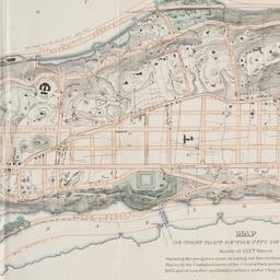
56. Map of that part of the city of New York north of 155th street : showing the progress made in laying out streets, roads, public squares and places, by the Commissioners of the Central Park, under Chap. 565 of Laws of 1865 and of new Pier and Bulkhead Laws under Chap. 697 of Laws of 1867
maps
- Published: Major & Knapp Eng. Mfg. & Lith. Co: N.Y. 1870
- Format: maps
- Online: click here for full-text
- Catalog Record: check availability
57. [Map of the area bounded by Broadway and St. Nicholas from West 190th Street to West 193rd Street]
maps
- Published: Martin B. Brown Co: New York. [1907]
- Format: maps
- Online: click here for full-text
- Catalog Record: check availability
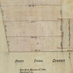
58. [Map of the area bounded by Forty Third Street and Broadway]
maps
- Published: [s.n.]: New York. 1880
- Format: maps
- Online: click here for full-text
- Catalog Record: check availability
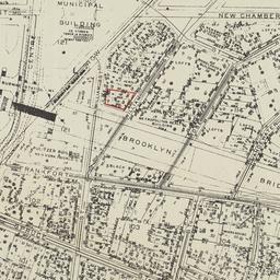
59. [Map of the area bounded by New Chambers Street, Peart Street, Beekman Street, and Nassau Street]
maps
- Published: s.n: New York?. 1914?]
- Format: maps
- Online: click here for full-text
- Catalog Record: check availability
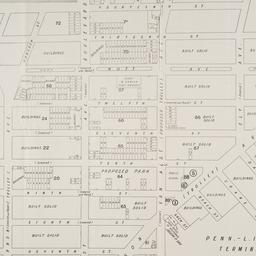
60. [Map of the area in Long Island City from Vernon Ave. to Meadow St. between Sixth St. and Fourteenth St.]
maps
- Published: August R. Ohman & Co: New York. [1908]
- Format: maps
- Online: click here for full-text
- Catalog Record: check availability
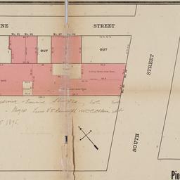
61. [Map of the area in Lower Manhattan bound by Pine Street, South Street, Wall Street and Front Street]
maps
- Published: s.n: New York?. 1895?]
- Format: maps
- Online: click here for full-text
- Catalog Record: check availability

62. Map of the bays, harbors, and rivers around New York : showing the channels, soundings, lighthouses, buoys &c., and the complete topography of the surrounding country : including Hempstead, Sandy-Hook, South-Amboy, Newark, Yonkers, N. Rochelle & Glen Cove
Bache, A. D. 1806-1867
maps
- Name: Bache, A. D. 1806-1867
- Published: M. Dripps: New York. [1866]
- Format: maps
- Catalog Record: check availability
63. Map of the boundaries of the Fire Department of the City of New York
New York (N.Y.). Fire Department
maps
- Name: New York (N.Y.). Fire Department
- Published: s.n.]: New York. 1871
- Format: maps
- Online: click here for full-text
- Catalog Record: check availability

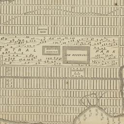
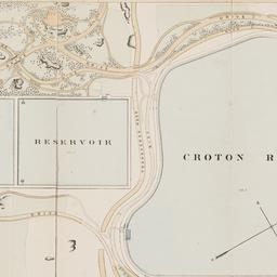
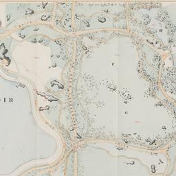
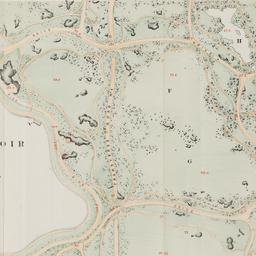
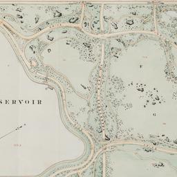
64. Map of the Central Park : showing the progress of the work up to January 1st 1860
maps
- Published: Lith. by Sarony, Major & Knapp: New York, N.Y. [1860]
- Format: maps
- Online: click here for full-text
- Catalog Record: check availability
65. Map of the Central Park, New York
maps
- Published: Frank Leslie: New York?. 1856]
- Format: maps
- Online: click here for full-text
- Catalog Record: check availability
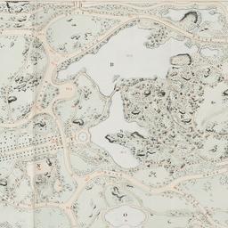
66. Map of the Central Park showing the progress of the work up to January 1st, 1863
maps
- Published: Sarony Major & Knapp: New York. [1863]
- Format: maps
- Online: click here for full-text
- Catalog Record: check availability
67. Map of the Central Park showing the progress of the work up to January 1st, 1864
maps
- Published: s.n: New York?. 1864]
- Format: maps
- Online: click here for full-text
- Catalog Record: check availability
68. Map of the Central Park showing the progress of the work up to January 1st, 1865
maps
- Published: s.n: New York?. 1865]
- Format: maps
- Online: click here for full-text
- Catalog Record: check availability
69. Map of the Central Park showing the progress of the work up to January 1st, 1866
maps
- Published: s.n: New York?. 1866]
- Format: maps
- Online: click here for full-text
- Catalog Record: check availability
70. Map of the Central Park showing the progress of the work up to January 1st 1867
maps
- Published: s.n: New York. 1867?]
- Format: maps
- Online: click here for full-text
- Catalog Record: check availability
71. Map of the city & county of New York
Hayward, George, approximately 1800-
maps
- Name: Hayward, George, approximately 1800-
- Published: Engraved for D.T. Valentine's manual for 1862, by Geo. Hayward: New York (N.Y.). [1861]
- Format: maps
- Online: click here for full-text
- Catalog Record: check availability
72. Map of the city and county of New York : with the adjacent country
Burr, David H., 1803-1875
maps
- Name: Burr, David H., 1803-1875
- Published: s.n: New York. 1829]
- Format: maps
- Online: click here for full-text
- Catalog Record: check availability