Search Results Header
Search Results
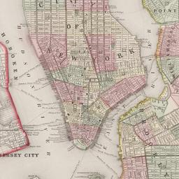
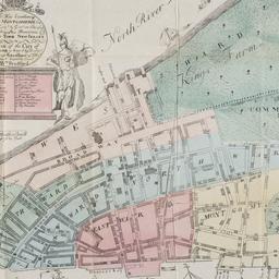
169. Plan of New York &c
Mitchell, S. Augustus, Jr
maps
- Name: Mitchell, S. Augustus, Jr
- Published: S. Augustus Mitchell, Jr: Philadelphia. c1866
- Format: maps
- Online: click here for full-text
- Catalog Record: check availability
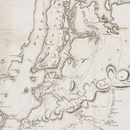
170. A Plan of New York Island, Part of Long Island, &c. shewing the Position of the American and British Armies, before, at, and after the Engagement of the Heights, August 27th, 1776
Lewis, Samuel, 1753 or 1754-1822
maps
- Name: Lewis, Samuel, 1753 or 1754-1822
- Published: Richard Phillips: London?. 1806
- Format: maps
- Online: click here for full-text
- Catalog Record: check availability
171. Plan of the city of New York
maps
- Published: Andrew B. Graham, Co: Washington, D.C. 1857
- Format: maps
- Online: click here for full-text
- Catalog Record: check availability

172. Plan of the city of New York
Poppleton, Thomas H
maps
- Name: Poppleton, Thomas H
- Published: Prior & Dunning: New York. 1817
- Format: maps
- Online: click here for full-text
- Catalog Record: check availability
173. A plan of the city of New York : reduced from an actual survey
Maerschalck, Francis W., -1776
maps
- Name: Maerschalck, Francis W., -1776
- Published: Lith. of H.R. Robinson for D.T. Valentine's Manual: New York, N.Y. [1850]
- Format: maps
- Online: click here for full-text
- Catalog Record: check availability
174. A plan of the city of New York from an actual survey
Lyne, James
maps
- Name: Lyne, James
- Published: Charles Magnus: New York?. [18--?]
- Format: maps
- Online: click here for full-text
- Catalog Record: check availability
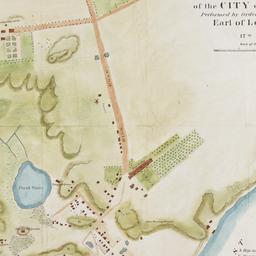
175. A plan of the north east environs of the city of New-York performed by order of His Excellency the Earl of Loudon & ca. & ca
Holland, Samuel, 1728-1801
maps
- Name: Holland, Samuel, 1728-1801
- Published: George Hayward: New York. [1859]
- Format: maps
- Online: click here for full-text
- Catalog Record: check availability
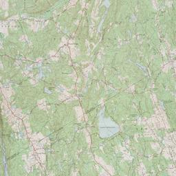
176. Pound Ridge quadrangle, New York - Connecticut
Geological Survey (U.S.)
maps
- Name: Geological Survey (U.S.)
- Published: The Survey: Washington, D.C. 1966
- Format: maps
- Online: click here for full-text
- Catalog Record: check availability
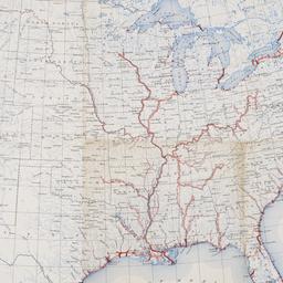
177. Principal waterways of the United States
United States. Army., Office of the Chief of Engineers
maps
- Name: United States. Army., Office of the Chief of Engineers
- Published: Army Map Service, Corps of Engineers, Dept. of the Army: Washington, D.C. 1949
- Format: maps
- Online: click here for full-text
- Catalog Record: check availability
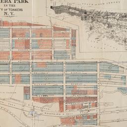
178. Property of the New York Real Estate Co. at Nepera Park in the city of Yonkers, N.Y. surveyed and drawn by M.K. Couzens Civ. Engineer, Yonkers, N.Y., April 15th, 1893
Couzens, M. K
maps
- Name: Couzens, M. K
- Published: s.n: New York?. 1893]
- Format: maps
- Online: click here for full-text
- Catalog Record: check availability

179. Rapid transit map for convenience in city-wide travel
maps
- Published: Hagstrom Company: New York. [192-?]
- Format: maps
- Online: click here for full-text
- Catalog Record: check availability
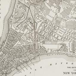
180. The Ratzer map of New York City, 1767
maps
- Published: Longmans, Green & Co: New York?. 18--?]
- Format: maps
- Online: click here for full-text
- Catalog Record: check availability
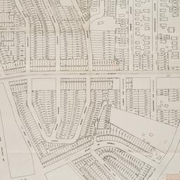
181. Sales map of property of the Mount Vernon Realty Corp'n. and the Bayne Realty Co
maps
- Published: s.n: New York?. 1924]
- Format: maps
- Online: click here for full-text
- Catalog Record: check availability
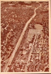
182. Saw Mill River Parkway widening in relation to New York City parkway system Triborough Bridge Authority
Triborough Bridge Authority
maps
- Name: Triborough Bridge Authority
- Published: Triborough Bridge Authority: New York. [1940]
- Format: maps
- Online: click here for full-text
- Catalog Record: check availability

183. Shelter Island
Shelter Island Chamber of Commerce
maps
- Name: Shelter Island Chamber of Commerce
- Published: Shelter Island Chamber of Commerce: New York. [1972?]
- Format: maps
- Online: click here for full-text
- Catalog Record: check availability
184. Sherwood Park, Long Island being a sectional reprint from the Map of the Village of Queens, as surveyed by Mr. Geo. W. Dickerson
maps
- Published: Sherwood Land Association: New York. [18--?]
- Format: maps
- Catalog Record: check availability
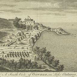
185. A south view of Oswego on Lake Ontario in North America
maps
- Published: s.n: London?. 1760?]
- Format: maps
- Online: click here for full-text
- Catalog Record: check availability
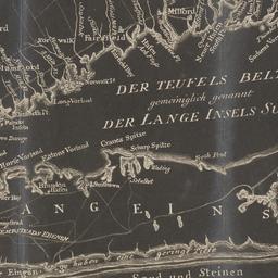
186. Der Teufels Belt gemeiniglich genannt der Lange Insels Sund
maps
- Published: s.n: S.l. 18--?]
- Format: maps
- Online: click here for full-text
- Catalog Record: check availability
187. This map of the city of New York and island of Manhattan, as laid out by the commissioners appointed by the legislature, April 3d, 1807 is respectfully dedicated to the mayor, aldermen and commonalty thereof
Bridges, William, -1814
maps
- Name: Bridges, William, -1814
- Published: s.n.]: New York. 1811
- Format: maps
- Online: click here for full-text
- Catalog Record: check availability
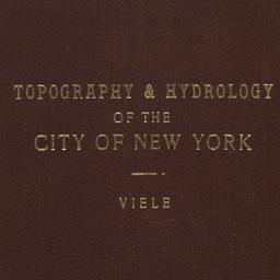
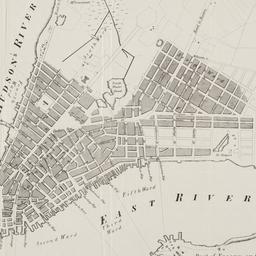
188. Topographical map of the City of New York showing original water courses and made land
Viele, Egbert L. 1825-1902
maps
- Name: Viele, Egbert L. 1825-1902
- Published: Ferd. Mayer & Co. lith: New York. c1865
- Format: maps
- Catalog Record: check availability
189. Town of North Salem and part of the town of Lewisboro
maps
- Published: G.W. Bromley & Co: Philadelphia. 1910]
- Format: maps
- Online: click here for full-text
- Catalog Record: check availability
190. Town of Westchester, Westchester Co., N.Y
maps
- Published: F.W. Beers: New York. 186-]
- Format: maps
- Online: click here for full-text click here for full-text
- Catalog Record: check availability
191. The Transval of New York
Viele, Egbert L. 1825-1902
maps
- Name: Viele, Egbert L. 1825-1902
- Published: Johnson & Co., printers: New York. 1880]
- Format: maps
- Online: click here for full-text
- Catalog Record: check availability
192. Valuable real estate for sale by Franklin & Jenkins : Wednesday, 22nd April 1835, at 12 o'clock at the Merch. Exch
maps
- Published: Miller & Co.'s Lith: New York. [1835]
- Format: maps
- Online: click here for full-text
- Catalog Record: check availability