Search Results Header
Search Results
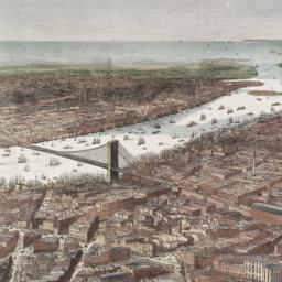
1. Bird's-eye view of the southern end of New York and Brooklyn, showing the projected suspension-bridge over the East River, from the western terminus in Printing-House Square, New York
Davis, Theodore R
maps
- Name: Davis, Theodore R
- Published: New York. 1870]
- Format: maps
- Online: click here for full-text
- Catalog Record: check availability
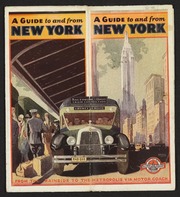
2. Into the heart of New York City by train & motor coach
Rand McNally and Company
maps
- Name: Rand McNally and Company
- Published: Rand McNally and Co: New York. [1933]
- Format: maps
- Online: click here for full-text
- Catalog Record: check availability

3. Map of New York : places of interest and general information concerning the city
Ohman Map Co
maps
- Name: Ohman Map Co
- Published: Aug. R. Ohman Map Co: New York. c1913
- Format: maps
- Online: click here for full-text
- Catalog Record: check availability
4. [Map of the area in Long Island City from Vernon Ave. to Meadow St. between Sixth St. and Fourteenth St.]
maps
- Published: August R. Ohman & Co: New York. [1908]
- Format: maps
- Online: click here for full-text
- Catalog Record: check availability
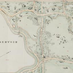
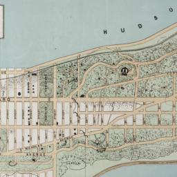
5. Map of the Central Park showing the progress of the work up to January 1st 1867
maps
- Published: s.n: New York. 1867?]
- Format: maps
- Online: click here for full-text
- Catalog Record: check availability
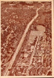
6. Saw Mill River Parkway widening in relation to New York City parkway system Triborough Bridge Authority
Triborough Bridge Authority
maps
- Name: Triborough Bridge Authority
- Published: Triborough Bridge Authority: New York. [1940]
- Format: maps
- Online: click here for full-text
- Catalog Record: check availability
7. This map of the city of New York and island of Manhattan, as laid out by the commissioners appointed by the legislature, April 3d, 1807 is respectfully dedicated to the mayor, aldermen and commonalty thereof
Bridges, William, -1814
maps
- Name: Bridges, William, -1814
- Published: s.n.]: New York. 1811
- Format: maps
- Online: click here for full-text
- Catalog Record: check availability
8. The Transval of New York
Viele, Egbert L. 1825-1902
maps
- Name: Viele, Egbert L. 1825-1902
- Published: Johnson & Co., printers: New York. 1880]
- Format: maps
- Online: click here for full-text
- Catalog Record: check availability
Search Other Sources for: "Bridges"
Try your search in one of these related resources. (Search results will display in a new window.)
-
Avery Index to Architectural Periodicals
A comprehensive listing of journal articles published worldwide on architecture and design, archaeology, city planning, interior design, landscape architecture, and historic preservation. -
Brooklyn Historical Society Photography Collection
Search for individual photographs. Approximately 5,000 of our images are currently available online, but more images are added regularly. -
Brooklyn Public Library: Historic Brooklyn Photographs
Selection of more than ten thousand historic photographs from the Brooklyn Collection. -
CLIO: Columbia Libraries Catalog
Search for books, articles, journals, online resources and more. -
DLC: Columbia Libraries Digital Collections
A gateway to digital projects and online exhibitions that have been published on the web by Columbia University Libraries/Information Services (CUL/IS). -
Museum of the City of New York
Over 150,000 images and objects from the collections of the Museum of the City of New York.
Note: to come. -
New York Historical Society
Digital images from the library and museum collections. -
NYPL Digital Collections
Provides free and open access to over 800,000 images digitized from the The New York Public Library's vast collections.