Search Results Header
Search Results

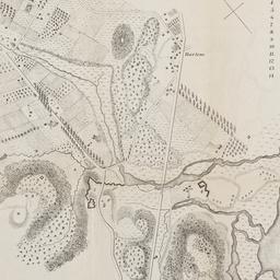
1. Map of 158 building lots at Harlaem [sic] to be sold by James Bleeckeer & Sons on Wednesday January 15th at 12 o'clock at the Merchts Exchange
maps
- Published: P. Desbroy's: New York. [18--?]
- Format: maps
- Online: click here for full-text
- Catalog Record: check availability
2. Map of Harlem Heights and plain, 1814
maps
- Published: [publisher not identified]: Place of publication not identified. [1856?]
- Format: maps
- Catalog Record: check availability
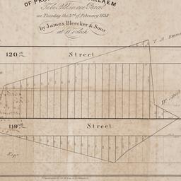
3. Map of property at Harlaem [sic] to be sold in one parcel on Tuesday the 3rd of February 1835 by James Bleecker & Sons at 11 o'clock
maps
- Published: P. Desobry's: New York. [1835]
- Format: maps
- Online: click here for full-text
- Catalog Record: check availability
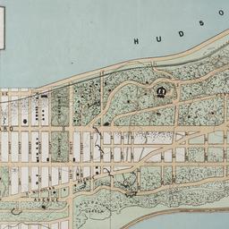
4. The Transval of New York
Viele, Egbert L. 1825-1902
maps
- Name: Viele, Egbert L. 1825-1902
- Published: Johnson & Co., printers: New York. 1880]
- Format: maps
- Online: click here for full-text
- Catalog Record: check availability
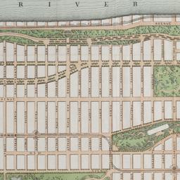
5. The west end plateau of New York
Vielé, Herman K
maps
- Name: Vielé, Herman K
- Published: Johnson, & Pratt: New York. [1879]
- Format: maps
- Online: click here for full-text
- Catalog Record: check availability