Search Results Header
Search Results
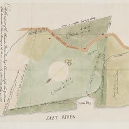
1. At the request of the recorder Thomas Jones Esqr. chairman, & the other gentlemen of the committee, I have surveyed the farm commonly called Tuttle Bay, granted by William Keist 23d of April 1646. unto George Holmes & Thomas Hall, and find the same to be agreeable to the above draft
Maerschalck, Francis W., -1776
maps
- Name: Maerschalck, Francis W., -1776
- Published: Common Council?: New York?. 1860?]
- Format: maps
- Online: click here for full-text
- Catalog Record: check availability
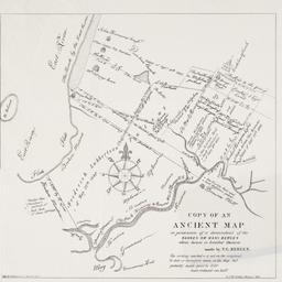
2. Copy of an ancient map in possession of a descendant of the Hannes or Han Bergen : whose house is located thereon
Bergen, Teunis G., 1806-1881
maps
- Name: Bergen, Teunis G., 1806-1881
- Published: Henry McCloskey?: N.Y.?. 1864]
- Format: maps
- Online: click here for full-text
- Catalog Record: check availability
3. [Deed for land in Windor Terrace, Brooklyn]
Riegel, George
books
- Name: Riegel, George
- Format: books
- Online: click here for full-text
- Catalog Record: check availability

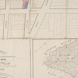
4. Hunters Point, part of Long Island City
maps
- Published: Beers, Comstock & Cline: N.Y. 1873]
- Format: maps
- Online: click here for full-text click here for full-text
- Catalog Record: check availability

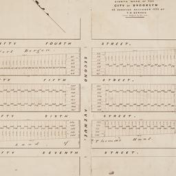
5. [Lease of ten lots on Broadway, Fourth Avenue and Thirteenth Street in Manhattan]
Astor, William B. 1792-1875
books
- Name: Astor, William B. 1792-1875
- Format: books
- Online: click here for full-text
- Catalog Record: check availability
6. Map & plan of the proposed continuation of the widening & extension of William Street : from Maiden Lane to Chatham Street & the new line of said strt. as adopted between Wall St. & Maiden Lane, showing the situation of the property advertised by John R. Pitkin (No. 5 Broad Strt.)
maps
- Published: [publisher not identified]: N.Y.?. [183-?
- Format: maps
- Online: click here for full-text
- Catalog Record: check availability
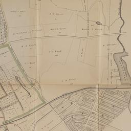
7. Map of land of Theodorus Bergen west of Third Avenue in the Eighth Ward of the city of Brooklyn : as surveyed December 1853 by T.G. Bergen
Bergen, Teunis G., 1806-1881
maps
- Name: Bergen, Teunis G., 1806-1881
- Format: maps
- Catalog Record: check availability
8. Map of Mount Vernon and environs, Westchester Co., N.Y. : showing lot numbers, subdivisions of lots and property lines, also location of sewers, gas and water mains
Goldthwaite, Wm. M
maps
- Name: Goldthwaite, Wm. M
- Published: Wm. M. Goldthwaite: New York, N.Y. 1890
- Format: maps
- Catalog Record: check availability

9. Map of the City of New York
W.C. Rogers & Co
maps
- Name: W.C. Rogers & Co
- Published: s.n.]: New York. 1868
- Format: maps
- Online: click here for full-text
- Catalog Record: check availability
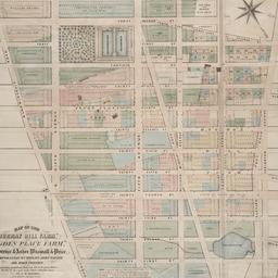
10. Map of the "Murray Hill Farm," "Ogden Place Farm," Lawrence & Astor, Wiswall & Price, Corporation, Wm. Wright, John Taylor and other property
Holmes, J. B
maps
- Name: Holmes, J. B
- Published: City Surveyor: New York. 1867]
- Format: maps
- Online: click here for full-text
- Catalog Record: check availability

11. Map shewing a division of part of the real estate late of Nicholas W. Stuyvesant decd. among his heirs situated in the 11th Ward of the City of New York
Doughty, Saml. S
maps
- Name: Doughty, Saml. S
- Published: Miller & Co. Lithog: New York. 1834 May
- Format: maps
- Online: click here for full-text
- Catalog Record: check availability
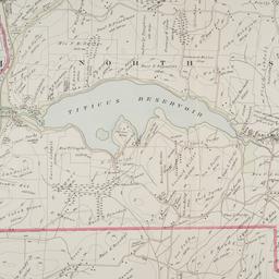
12. Town of North Salem and part of the town of Lewisboro
maps
- Published: G.W. Bromley & Co: Philadelphia. 1910]
- Format: maps
- Online: click here for full-text
- Catalog Record: check availability
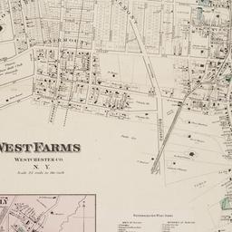
13. West Farms, Westchester Co., N.Y
Beers, F. W
maps
- Name: Beers, F. W
- Published: F.W. Beers: New York. 1868?]
- Format: maps
- Online: click here for full-text
- Catalog Record: check availability
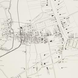
14. White Plains, Westchester Co., N.Y
maps
- Published: Harbor Hill Books: Harrison, N.Y. [19--?]
- Format: maps
- Online: click here for full-text
- Catalog Record: check availability