Search Results Header
Search Results

1. Freight terminal map of New York
Geo. H. Walker & Co
maps
- Name: Geo. H. Walker & Co
- Published: The Company: Boston. c1907
- Format: maps
- Online: click here for full-text
- Catalog Record: check availability

2. Map of the bays, harbors, and rivers around New York : showing the channels, soundings, lighthouses, buoys &c., and the complete topography of the surrounding country : including Hempstead, Sandy-Hook, South-Amboy, Newark, Yonkers, N. Rochelle & Glen Cove
Bache, A. D. 1806-1867
maps
- Name: Bache, A. D. 1806-1867
- Published: M. Dripps: New York. [1866]
- Format: maps
- Catalog Record: check availability
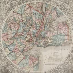
3. Map of the country thirty three miles around the city of New York
G.W. & C.B. Colton & Co
books
- Name: G.W. & C.B. Colton & Co
- Published: G.W. & C.B. Colton & Co: New York. c1846
- Format: books
- Catalog Record: check availability

4. Map of the five cities of New York, Brooklyn, Jersey City, Hoboken & Hudson City
Dripps, M
maps
- Name: Dripps, M
- Published: M. Dripps: New York?. 1860
- Format: maps
- Online: click here for full-text
- Catalog Record: check availability
5. New-York City, County and vicinity
Dripps, M
maps
- Name: Dripps, M
- Published: s.n: New York?. 1866]
- Format: maps
- Online: click here for full-text
- Catalog Record: check availability
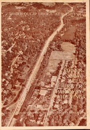
6. Saw Mill River Parkway widening in relation to New York City parkway system Triborough Bridge Authority
Triborough Bridge Authority
maps
- Name: Triborough Bridge Authority
- Published: Triborough Bridge Authority: New York. [1940]
- Format: maps
- Online: click here for full-text
- Catalog Record: check availability