Search Results Header
Search Results
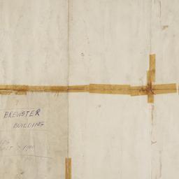
1. Brewster & Company, Inc. (Bldg.) Rolls-Royce of America, Inc. (Ten.) (Garage) Long Island City New York
Associated Factory Mutual Fire Insurances Companies
maps
- Name: Associated Factory Mutual Fire Insurances Companies
- Published: Associated Factory Fire Insurance Companies: Boston, Mass. [1932]
- Format: maps
- Online: click here for full-text
- Catalog Record: check availability
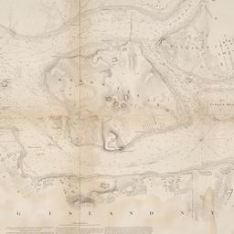
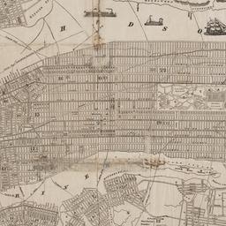
2. Hell Gate and its approaches
United States Coast Survey
maps
- Name: United States Coast Survey
- Published: U.S. Coast Survey: Washington. 1853
- Format: maps
- Online: click here for full-text
- Catalog Record: check availability

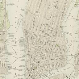
3. Hunters Point, part of Long Island City
maps
- Published: Beers, Comstock & Cline: N.Y. 1873]
- Format: maps
- Online: click here for full-text click here for full-text
- Catalog Record: check availability
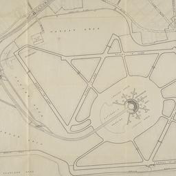
4. Layout of first six runways municipal airport at Idlewild
ephemera
- Published: Department of Marine and Aviation: New York. 1944]
- Format: ephemera
- Catalog Record: check availability
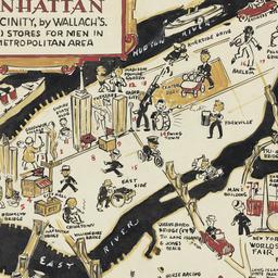
5. A man's map of Manhattan and vicinity by Wallach's
Voorhies, Stephen J
maps
- Name: Voorhies, Stephen J
- Format: maps
- Catalog Record: check availability
6. A man's map of New York by Wallach's
Voorhies, Stephen J
maps
- Name: Voorhies, Stephen J
- Format: maps
- Catalog Record: check availability
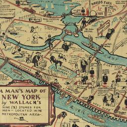
7. A man's map of New York by Wallach's
Voorhies, Stephen J
maps
- Name: Voorhies, Stephen J
- Format: maps
- Catalog Record: check availability
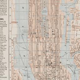
8. Map of New York City
maps
- Published: Hunt & Eaton: New York?. c1891
- Format: maps
- Online: click here for full-text
- Catalog Record: check availability
9. Map of Stratton Bluffs at College Point on Flushing Bay, New York
maps
- Published: John Meddle & Son: New York. [1891]
- Format: maps
- Online: click here for full-text
- Catalog Record: check availability
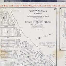
10. Nelson Heights at Woodside in the Second Ward, borough of Queens, New York City
maps
- Published: William Kennely, Inc: New York. [1926]
- Format: maps
- Online: click here for full-text
- Catalog Record: check availability
11. New York
maps
- Published: Letts, Son & Co: London. [1885?]
- Format: maps
- Online: click here for full-text
- Catalog Record: check availability
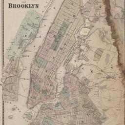
12. New York and Brooklyn
maps
- Published: s.n.]: S.l. c1867
- Format: maps
- Online: click here for full-text
- Catalog Record: check availability
13. New York City
Asher & Adams
maps
- Name: Asher & Adams
- Published: Asher & Adams: New York. 1871]
- Format: maps
- Online: click here for full-text
- Catalog Record: check availability
14. New York, city (lower part)
maps
- Published: s.n: S.l. 1889?]
- Format: maps
- Online: click here for full-text
- Catalog Record: check availability
15. New York city map
Phelps, Humphrey, active 19th century
maps
- Name: Phelps, Humphrey, active 19th century
- Published: H. Phelps: New York. c1857
- Format: maps
- Online: click here for full-text
- Catalog Record: check availability

16. [New York World's Fair Brazil pamphlets]
New York World's Fair New York, N.Y.) (1939-1940
ephemera
- Name: New York World's Fair New York, N.Y.) (1939-1940
- Published: Comp. Carioca de Artes Graphicas: Brazil. 1939
- Format: ephemera
- Online: click here for full-text
- Catalog Record: check availability
17. Plan of New York and Brooklyn
maps
- Published: s.n: S.l. 186-?]
- Format: maps
- Online: click here for full-text
- Catalog Record: check availability
18. Sherwood Park, Long Island being a sectional reprint from the Map of the Village of Queens, as surveyed by Mr. Geo. W. Dickerson
maps
- Published: Sherwood Land Association: New York. [18--?]
- Format: maps
- Catalog Record: check availability
Search Other Sources for: "Architecture"
Try your search in one of these related resources. (Search results will display in a new window.)
-
Avery Index to Architectural Periodicals
A comprehensive listing of journal articles published worldwide on architecture and design, archaeology, city planning, interior design, landscape architecture, and historic preservation. -
Brooklyn Historical Society Photography Collection
Search for individual photographs. Approximately 5,000 of our images are currently available online, but more images are added regularly. -
Brooklyn Public Library: Historic Brooklyn Photographs
Selection of more than ten thousand historic photographs from the Brooklyn Collection. -
CLIO: Columbia Libraries Catalog
Search for books, articles, journals, online resources and more. -
DLC: Columbia Libraries Digital Collections
A gateway to digital projects and online exhibitions that have been published on the web by Columbia University Libraries/Information Services (CUL/IS). -
Museum of the City of New York
Over 150,000 images and objects from the collections of the Museum of the City of New York.
Note: to come. -
New York Historical Society
Digital images from the library and museum collections. -
NYPL Digital Collections
Provides free and open access to over 800,000 images digitized from the The New York Public Library's vast collections.