Search Results Header
Search Results
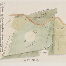
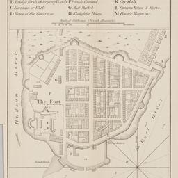
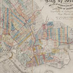
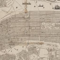
1. At the request of the recorder Thomas Jones Esqr. chairman, & the other gentlemen of the committee, I have surveyed the farm commonly called Tuttle Bay, granted by William Keist 23d of April 1646. unto George Holmes & Thomas Hall, and find the same to be agreeable to the above draft
Maerschalck, Francis W., -1776
maps
- Name: Maerschalck, Francis W., -1776
- Published: Common Council?: New York?. 1860?]
- Format: maps
- Online: click here for full-text
- Catalog Record: check availability
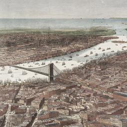
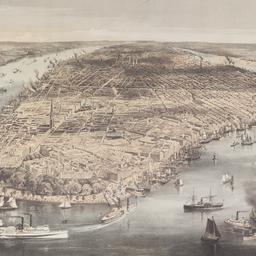
2. Bird's-eye view of the southern end of New York and Brooklyn, showing the projected suspension-bridge over the East River, from the western terminus in Printing-House Square, New York
Davis, Theodore R
maps
- Name: Davis, Theodore R
- Published: New York. 1870]
- Format: maps
- Online: click here for full-text
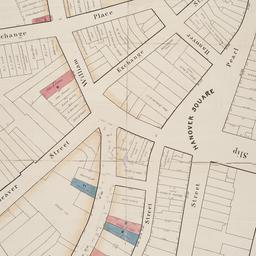
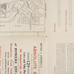
- Catalog Record: check availability
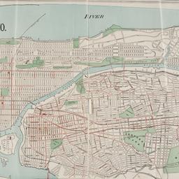
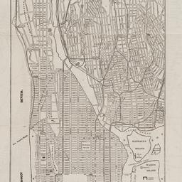
3. Boroughs of Manhattan and the Bronx showing the electric service of the New York Edison Co
maps
- Published: Bormay & Co: New York. [1902?]
- Format: maps
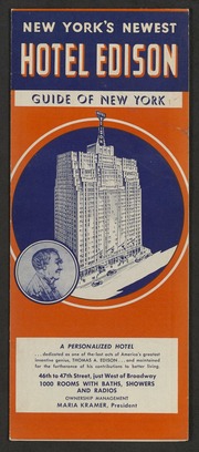
- Online: click here for full-text
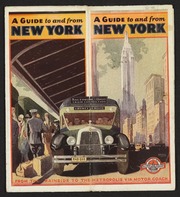
- Catalog Record: check availability
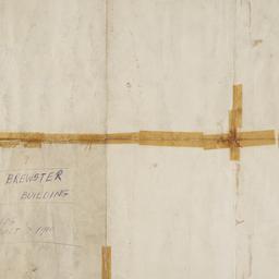
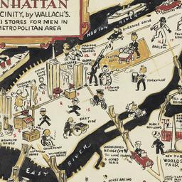
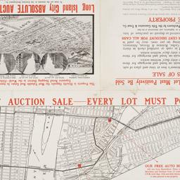
4. Brewster & Company, Inc. (Bldg.) Rolls-Royce of America, Inc. (Ten.) (Garage) Long Island City New York
Associated Factory Mutual Fire Insurances Companies
maps
- Name: Associated Factory Mutual Fire Insurances Companies
- Published: Associated Factory Fire Insurance Companies: Boston, Mass. [1932]
- Format: maps
- Online: click here for full-text
- Catalog Record: check availability
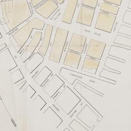
5. [Broad Street to Water Street south of Wall Street]
maps
- Published: s.n: New York?. 18--?]
- Format: maps
- Online: click here for full-text
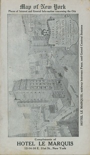
- Catalog Record: check availability
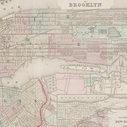
6. Brooklyn
maps
- Published: E.F. Fisk: New York. [1890?]
- Format: maps
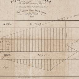
- Online: click here for full-text
- Catalog Record: check availability
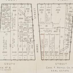
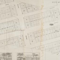
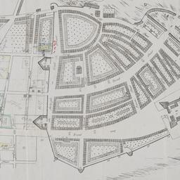
7. [Cadastral map of the area bound by South Street and Front Street between Whitehall Street and Broad Street]
maps
- Published: Chas. F. Noyes Co: New York. 1931?]
- Format: maps
- Online: click here for full-text
- Catalog Record: check availability
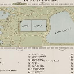
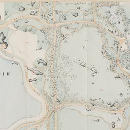
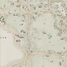
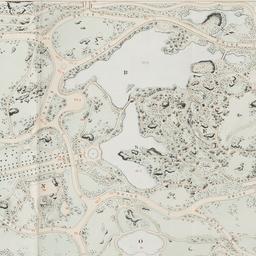
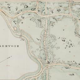
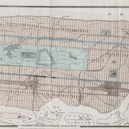
8. Central Park guide
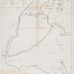
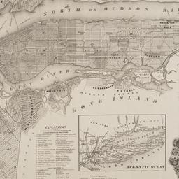
maps
- Published: s.n: New York?. 1868?]
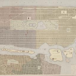
- Format: maps
- Online: click here for full-text
- Catalog Record: check availability
9. City of Manhattan or New York
Bellin, Jacques Nicolas, 1703-1772
maps
- Name: Bellin, Jacques Nicolas, 1703-1772
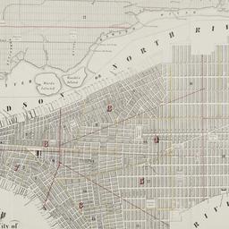
- Published: Common Council: New York. 1861]
- Format: maps
- Online: click here for full-text
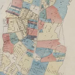
- Catalog Record: check availability
10. City of New York
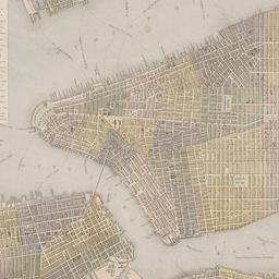
Parsons, Charles, 1821-1910
maps
- Name: Parsons, Charles, 1821-1910
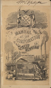
- Published: N. Currier: New York. 1856
- Format: maps
- Online: click here for full-text
- Catalog Record: check availability
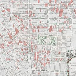
11. The city of New York
Williams, J. W., active 1879
maps
- Name: Williams, J. W., active 1879
- Published: New York. ©1879
- Format: maps
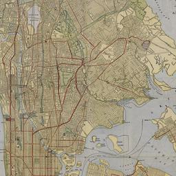
- Online: click here for full-text
- Catalog Record: check availability
12. City of New York
Thomas, Cowperthwait & Co
maps
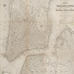
- Name: Thomas, Cowperthwait & Co
- Published: s.n.]: Philadelphia, Pa.?. 1850
- Format: maps
- Online: click here for full-text
- Catalog Record: check availability
13. City of New-York
Burr, David H., 1803-1875
maps
- Name: Burr, David H., 1803-1875
- Published: Republished by W.P. Stone: Ithaca, N.Y. 1838
- Format: maps
- Online: click here for full-text
- Catalog Record: check availability
14. Colton's map of the cities of New York, Brooklyn, Jersey City, Hoboken, etc
maps
- Published: G.W. & C.B. Colton & Co: New York. c1886
- Format: maps
- Online: click here for full-text
- Catalog Record: check availability
15. C.W. Hobbs' guide map of New York City
Hobbs, C. W
maps
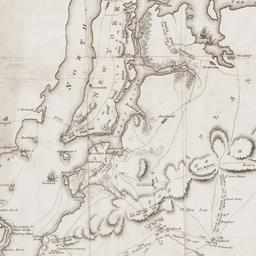
- Name: Hobbs, C. W
- Published: C.W. Hobbs: New York?. [between 1864 and 1884]
- Format: maps
- Online: click here for full-text
- Catalog Record: check availability
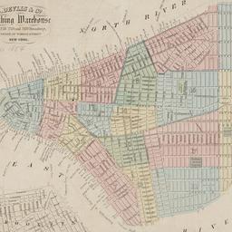
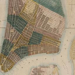
16. D. Devlin & Co., clothing warehouse
D. Devlin & Co
maps
- Name: D. Devlin & Co
- Published: James Mowlem & Co: N[ew] Y[ork]. [185-]
- Format: maps
- Online: click here for full-text
- Catalog Record: check availability
17. Extensive sale of lots of land located on Broadway, 7th 8th 9th, 10th and 11th Avenues and on 50th, 51st, 52d, 53d, and 54th Streets by order of the Supreme Court : under the direction of Philo. T. Ruggles, referee : Wednesday, June 18th, 1856, at 12 o'clock at the Merchants' Exchange
maps
- Published: Francis & Loutrel: New York?. [1856]
- Format: maps
- Online: click here for full-text
- Catalog Record: check availability
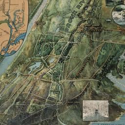
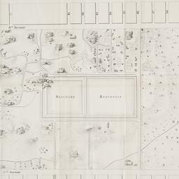
18. A general view of the Bronx River Parkway Reservation : as a connecting parkway between the park system of New York City, the Croton and Catskill watersheds, and the Harriman and Palisades Interstate Parks
New York (State). Bronx Parkway Commission
maps
- Name: New York (State). Bronx Parkway Commission
- Published: Bronx Parkway Commission: New York. 1915
- Format: maps
- Online: click here for full-text
- Catalog Record: check availability
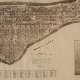
19. The Hamilton aerial map of Manhattan, New York City
Hamilton, W. L
maps
- Name: Hamilton, W. L
- Published: Hamilton Aeriel Maps: New York. c1928
- Format: maps
- Online: click here for full-text
- Catalog Record: check availability
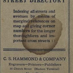
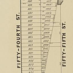
20. Hammond's new guide map of Manhattan and the Bronx
C.S. Hammond & Company
maps
- Name: C.S. Hammond & Company
- Published: C.S. Hammond & Co: New York. [between 1900 and 1930]
- Format: maps
- Catalog Record: check availability
21. Hammond's new guide map of Manhattan and the Bronx
C.S. Hammond & Company
maps
- Name: C.S. Hammond & Company
- Published: C.S. Hammond: New York. [1910] c1908
- Format: maps
- Catalog Record: check availability
22. Hotel Edison, New York : part of Bronx and Queens showing World's Fair, indexed, house number map
Nostrand, George J
maps
- Name: Nostrand, George J
- Published: Hotel Edison?: New York?. 1939?]
- Format: maps
- Online: click here for full-text
- Catalog Record: check availability
23. Into the heart of New York City by train & motor coach
Rand McNally and Company
maps
- Name: Rand McNally and Company
- Published: Rand McNally and Co: New York. [1933]
- Format: maps
- Online: click here for full-text
- Catalog Record: check availability
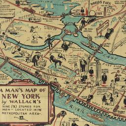
24. A man's map of Manhattan and vicinity by Wallach's
Voorhies, Stephen J
maps
- Name: Voorhies, Stephen J
- Format: maps
- Catalog Record: check availability
25. A man's map of New York by Wallach's
Voorhies, Stephen J
maps
- Name: Voorhies, Stephen J
- Format: maps
- Catalog Record: check availability
26. A man's map of New York by Wallach's
Voorhies, Stephen J
maps
- Name: Voorhies, Stephen J
- Format: maps
- Catalog Record: check availability
27. Map & plan of the proposed continuation of the widening & extension of William Street : from Maiden Lane to Chatham Street & the new line of said strt. as adopted between Wall St. & Maiden Lane, showing the situation of the property advertised by John R. Pitkin (No. 5 Broad Strt.)
maps
- Published: [publisher not identified]: N.Y.?. [183-?
- Format: maps
- Online: click here for full-text
- Catalog Record: check availability

28. Map of 158 building lots at Harlaem [sic] to be sold by James Bleeckeer & Sons on Wednesday January 15th at 12 o'clock at the Merchts Exchange
maps
- Published: P. Desbroy's: New York. [18--?]
- Format: maps
- Online: click here for full-text
- Catalog Record: check availability
29. Map of 500 lots of the estate of James Cordon Bennett, dec'd, located between Broadway and N.Y. Central and Hudson River, RR. and between W. 181st and W. 187th Streets borough of Manhattan City of New York
maps
- Published: s.n: New York. 1919]
- Format: maps
- Online: click here for full-text
- Catalog Record: check availability
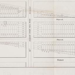
30. [Map of 50th Street to 53rd Street between 10th Avenue and 13th Avenue]
maps
- Published: s.n: New York?. 1851?]
- Format: maps
- Online: click here for full-text
- Catalog Record: check availability

31. Map of 58 lots belonging to the Griswold Estate fronting on the continuation of Riverside Drive known as Fieldston Road and situated between Broadway and Riverdale Avenue, W. 246th Street and W. 253rd Street
maps
- Published: s.n: New. 1910]
- Format: maps
- Online: click here for full-text
- Catalog Record: check availability
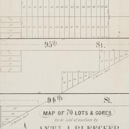
32. Map of 70 lots & gores to be sold at auction by Aty J. Bleecker on Monday 25th March 1850 at 12 o'clock at the Merchants Exchange
maps
- Published: Serrell & Perkins: New York. [1850]
- Format: maps
- Online: click here for full-text
- Catalog Record: check availability

33. Map of 80 acres of land situate in the 12th Ward of the city of New York part of the estate of Isaac Dyckman, dec'd : known as the "Part 3rd of the Dyckman Homestead Property" to be sold by V.K. Stevenson Son & Co, B.P. Fairchild, Auctioneer, June 7th, 1871 at the Exchange Salesrooms, 111 Broadway, New York
maps
- Published: Major & Knapp Eng. Mfg. & Lith. Co: New York. [1871]
- Format: maps
- Online: click here for full-text
- Catalog Record: check availability
34. Map of Harlem Heights and plain, 1814
maps
- Published: [publisher not identified]: Place of publication not identified. [1856?]
- Format: maps
- Catalog Record: check availability
35. [Map of Manhattan, Brooklyn, Staten Island, Long Island, and New Jersey with references to the Battle on Long Island]
maps
- Published: s.n: New York?. 18--?]
- Format: maps
- Online: click here for full-text
- Catalog Record: check availability
36. Map of New York
Trott, E. R
maps
- Name: Trott, E. R
- Published: Eugene R. Trott: New York. [191-?]
- Format: maps
- Catalog Record: check availability
37. Map of New York : places of interest and general information concerning the city
maps
- Published: [publisher not identified]: New York?. [1920?]
- Format: maps
- Online: click here for full-text
- Catalog Record: check availability

38. Map of New York : places of interest and general information concerning the city
Ohman Map Co
maps
- Name: Ohman Map Co
- Published: Aug. R. Ohman Map Co: New York. c1913
- Format: maps
- Online: click here for full-text
- Catalog Record: check availability

39. Map of New York and vicinity
Dripps, M
maps
- Name: Dripps, M
- Published: M. Dripps: N[ew] Y[ork]. c1865
- Format: maps
- Online: click here for full-text
- Catalog Record: check availability
40. Map of New York City
maps
- Published: Hunt & Eaton: New York?. c1891
- Format: maps
- Online: click here for full-text
- Catalog Record: check availability
41. [Map of New York Harbor, New York Bay, and Staten Island]
maps
- Published: s.n: New York?. 18--?]
- Format: maps
- Online: click here for full-text
- Catalog Record: check availability
42. Map of property at Harlaem [sic] to be sold in one parcel on Tuesday the 3rd of February 1835 by James Bleecker & Sons at 11 o'clock
maps
- Published: P. Desobry's: New York. [1835]
- Format: maps
- Online: click here for full-text
- Catalog Record: check availability
43. Map of property belonging to the Courtney Development Company situate partly in the First and Second Wards, borough of Queens, city of New York
maps
- Published: s.n: New York. 1913]
- Format: maps
- Online: click here for full-text
- Catalog Record: check availability
44. Map of Prospect Hill late the seat of Francis B. Winthrop, Esqr., in the Twelfth Ward in the city of New York
maps
- Published: Lambert's Lithography: New York. [1879?]
- Format: maps
- Online: click here for full-text
- Catalog Record: check availability
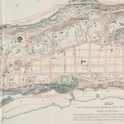
45. Map of that part of the city of New York north of 155th street : showing the progress made in laying out streets, roads, public squares and places, by the Commissioners of the Central Park, under Chap. 565 of Laws of 1865 and of new Pier and Bulkhead Laws under Chap. 697 of Laws of 1867
maps
- Published: Major & Knapp Eng. Mfg. & Lith. Co: N.Y. 1870
- Format: maps
- Online: click here for full-text
- Catalog Record: check availability
46. [Map of the area bounded by Broadway and St. Nicholas from West 190th Street to West 193rd Street]
maps
- Published: Martin B. Brown Co: New York. [1907]
- Format: maps
- Online: click here for full-text
- Catalog Record: check availability
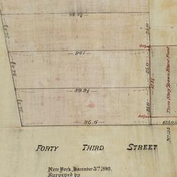
47. [Map of the area bounded by Forty Third Street and Broadway]
maps
- Published: [s.n.]: New York. 1880
- Format: maps
- Online: click here for full-text
- Catalog Record: check availability
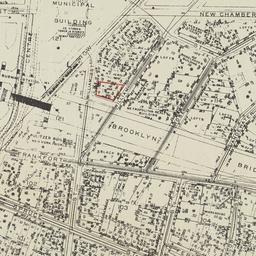
48. [Map of the area bounded by New Chambers Street, Peart Street, Beekman Street, and Nassau Street]
maps
- Published: s.n: New York?. 1914?]
- Format: maps
- Online: click here for full-text
- Catalog Record: check availability
49. [Map of the area in Long Island City from Vernon Ave. to Meadow St. between Sixth St. and Fourteenth St.]
maps
- Published: August R. Ohman & Co: New York. [1908]
- Format: maps
- Online: click here for full-text
- Catalog Record: check availability
50. [Map of the area in Lower Manhattan bound by Pine Street, South Street, Wall Street and Front Street]
maps
- Published: s.n: New York?. 1895?]
- Format: maps
- Online: click here for full-text
- Catalog Record: check availability

51. Map of the bays, harbors, and rivers around New York : showing the channels, soundings, lighthouses, buoys &c., and the complete topography of the surrounding country : including Hempstead, Sandy-Hook, South-Amboy, Newark, Yonkers, N. Rochelle & Glen Cove
Bache, A. D. 1806-1867
maps
- Name: Bache, A. D. 1806-1867
- Published: M. Dripps: New York. [1866]
- Format: maps
- Catalog Record: check availability
52. Map of the boundaries of the Fire Department of the City of New York
New York (N.Y.). Fire Department
maps
- Name: New York (N.Y.). Fire Department
- Published: s.n.]: New York. 1871
- Format: maps
- Online: click here for full-text
- Catalog Record: check availability

53. Map of the Central Park : showing the progress of the work up to January 1st 1860
maps
- Published: Lith. by Sarony, Major & Knapp: New York, N.Y. [1860]
- Format: maps
- Online: click here for full-text
- Catalog Record: check availability
54. Map of the Central Park, New York
maps
- Published: Frank Leslie: New York?. 1856]
- Format: maps
- Online: click here for full-text
- Catalog Record: check availability
55. Map of the Central Park showing the progress of the work up to January 1st, 1863
maps
- Published: Sarony Major & Knapp: New York. [1863]
- Format: maps
- Online: click here for full-text
- Catalog Record: check availability
56. Map of the Central Park showing the progress of the work up to January 1st, 1864
maps
- Published: s.n: New York?. 1864]
- Format: maps
- Online: click here for full-text
- Catalog Record: check availability
57. Map of the Central Park showing the progress of the work up to January 1st, 1865
maps
- Published: s.n: New York?. 1865]
- Format: maps
- Online: click here for full-text
- Catalog Record: check availability
58. Map of the Central Park showing the progress of the work up to January 1st, 1866
maps
- Published: s.n: New York?. 1866]
- Format: maps
- Online: click here for full-text
- Catalog Record: check availability
59. Map of the Central Park showing the progress of the work up to January 1st 1867
maps
- Published: s.n: New York. 1867?]
- Format: maps
- Online: click here for full-text
- Catalog Record: check availability
60. Map of the city & county of New York
Hayward, George, approximately 1800-
maps
- Name: Hayward, George, approximately 1800-
- Published: Engraved for D.T. Valentine's manual for 1862, by Geo. Hayward: New York (N.Y.). [1861]
- Format: maps
- Online: click here for full-text
- Catalog Record: check availability
61. Map of the city and county of New York : with the adjacent country
Burr, David H., 1803-1875
maps
- Name: Burr, David H., 1803-1875
- Published: s.n: New York. 1829]
- Format: maps
- Online: click here for full-text
- Catalog Record: check availability

62. Map of the City of New York
W.C. Rogers & Co
maps
- Name: W.C. Rogers & Co
- Published: s.n.]: New York. 1868
- Format: maps
- Online: click here for full-text
- Catalog Record: check availability

63. Map of the City of New York : shewing the original high water ine and the location of the different farms and estates
Hayward, George, approximately 1800-
maps
- Name: Hayward, George, approximately 1800-
- Published: New York Common Council: New York. 1852]
- Format: maps
- Online: click here for full-text
- Catalog Record: check availability
64. Map of the City of New York, 1856
Hayward, George, approximately 1800-
maps
- Name: Hayward, George, approximately 1800-
- Published: New York Common Council: New York. 1856]
- Format: maps
- Online: click here for full-text
- Catalog Record: check availability
65. Map of the City of New York, from the Battery to 80th Street, showing the original topography of Manhattan Island
Viele, Egbert L. 1825-1902
maps
- Name: Viele, Egbert L. 1825-1902
- Published: s.n: New York. 1866?]
- Format: maps
- Online: click here for full-text
- Catalog Record: check availability
66. Map of the city of New York showing the original high water lines and the location of the different farms and estates
Hayward, George, approximately 1800-
maps
- Name: Hayward, George, approximately 1800-
- Published: Common Council: New York. 1852]
- Format: maps
- Online: click here for full-text
- Catalog Record: check availability
67. Map of the city of New York showing the proposed route of the "arcade" underground railway
maps
- Published: G.W. & C.B. Colton: New York. [1870?]
- Format: maps
- Online: click here for full-text
- Catalog Record: check availability
68. Map of the City of New-York
Hayward, George, approximately 1800-
maps
- Name: Hayward, George, approximately 1800-
- Published: Common Council, 1854]: New York. 1854
- Format: maps
- Online: click here for full-text
- Catalog Record: check availability
69. Map of the city of New-York, 1853
Hayward, George, approximately 1800-
maps
- Name: Hayward, George, approximately 1800-
- Published: Common Council: New York, N.Y. 1853]
- Format: maps
- Online: click here for full-text
- Catalog Record: check availability
70. Map of the consolidated City of Brooklyn : comprising the City of Brooklyn, City of Williamsburgh and Town of Bushwick, Kings County, Long Island
Hayward, George, approximately 1800-
maps
- Name: Hayward, George, approximately 1800-
- Published: G. Hayward: New York. 1854
- Format: maps
- Online: click here for full-text
- Catalog Record: check availability

71. Map of the five cities of New York, Brooklyn, Jersey City, Hoboken & Hudson City
Dripps, M
maps
- Name: Dripps, M
- Published: M. Dripps: New York?. 1860
- Format: maps
- Online: click here for full-text
- Catalog Record: check availability
72. Map of the Greenwich Village section of New York City
Fahey, Lawrence
maps
- Name: Fahey, Lawrence
- Published: Lawrence Fahey: New York, N.Y. 1961
- Format: maps
- Online: click here for full-text
- Catalog Record: check availability
73. Map of the lands included in the Central Park
Viele, Egbert L. 1825-1902
maps
- Name: Viele, Egbert L. 1825-1902
- Published: s.n.]: New York. 1856
- Format: maps
- Online: click here for full-text
- Catalog Record: check availability
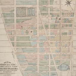
74. Map of the "Murray Hill Farm," "Ogden Place Farm," Lawrence & Astor, Wiswall & Price, Corporation, Wm. Wright, John Taylor and other property
Holmes, J. B
maps
- Name: Holmes, J. B
- Published: City Surveyor: New York. 1867]
- Format: maps
- Online: click here for full-text
- Catalog Record: check availability

75. Map shewing a division of part of the real estate late of Nicholas W. Stuyvesant decd. among his heirs situated in the 11th Ward of the City of New York
Doughty, Saml. S
maps
- Name: Doughty, Saml. S
- Published: Miller & Co. Lithog: New York. 1834 May
- Format: maps
- Online: click here for full-text
- Catalog Record: check availability
76. [Map showing area bounded by Tompkins Street and 3rd Avenue between 23rd and 9th Streets]
maps
- Published: s.n: New York?. 18--?]
- Format: maps
- Online: click here for full-text
- Catalog Record: check availability
77. [Maps of land use in Lower Manhattan from 1609-1900]
maps
- Published: s.n: New York?. 19--]
- Format: maps
- Online: click here for full-text
- Catalog Record: check availability
![[Maps of Manhattan]](https://archive.org/services/img/ldpd_11290413_000)
78. [Maps of Manhattan]
maps
- Published: s.n: New York?. ca. 1890]
- Format: maps
- Online: click here for full-text
- Catalog Record: check availability
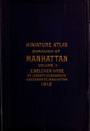
79. Miniature atlas of the borough of Manhattan : complete in two volumes
Hyde, E. Belcher
maps
- Name: Hyde, E. Belcher
- Published: E. Belcher Hyde: Brooklyn. 1912
- Format: maps
- Online: click here for full-text
- Catalog Record: check availability

80. Miniature atlas of the borough of Manhattan : in one volume
Hyde, E. Belcher
maps
- Name: Hyde, E. Belcher
- Published: Hyde: Brooklyn. 1912
- Format: maps
- Online: click here for full-text
- Catalog Record: check availability
81. New map of New York City : from the latest surveys showing all the ferries and steamship docks, elevated, cable, and cross town car lines
Brooks Bank Note Co
maps
- Name: Brooks Bank Note Co
- Published: Broadway Central Hotel, Tilly Haynes, proprietor: New York. [189-?]
- Format: maps
- Online: click here for full-text
- Catalog Record: check availability

82. A new map of the City of New York : comprising all the late improvements, compiled and corrected from authentic documents, designed to accompany the Description of New York
Marks, Samuel
maps
- Name: Marks, Samuel
- Published: S. Marks: New York. 1827
- Format: maps
- Online: click here for full-text
- Catalog Record: check availability
83. New map of the city of New York with part of Brooklyn & Williamsburg
Smith, J. Calvin
maps
- Name: Smith, J. Calvin
- Published: Published by H.S. Tanner map selr., 237 Broadway: New York. 1846
- Format: maps
- Online: click here for full-text
- Catalog Record: check availability
84. New York
maps
- Published: Letts, Son & Co: London. [1885?]
- Format: maps
- Online: click here for full-text
- Catalog Record: check availability
85. New York
maps
- Published: s.n: New York. between 1864 and 1869]
- Format: maps
- Online: click here for full-text
- Catalog Record: check availability
86. New York
maps
- Published: Letts, Son & Co: London. [1885?]
- Format: maps
- Online: click here for full-text
- Catalog Record: check availability
87. New York and Brooklyn
maps
- Published: s.n.]: S.l. c1867
- Format: maps
- Online: click here for full-text
- Catalog Record: check availability
88. New York and its surroundings : map of the metropolis from the Battery to One Hundred and Eighth Street, and parts of Brooklyn, Williamsburg, Greenpoint, Jersey City, and Hoboken
maps
- Published: Harper's Weekly: New York?. 1873
- Format: maps
- Catalog Record: check availability
89. New York City
Asher & Adams
maps
- Name: Asher & Adams
- Published: Asher & Adams: New York. 1871]
- Format: maps
- Online: click here for full-text
- Catalog Record: check availability
90. New York, city (lower part)
maps
- Published: s.n: S.l. 1889?]
- Format: maps
- Online: click here for full-text
- Catalog Record: check availability
91. New York city map
Phelps, Humphrey, active 19th century
maps
- Name: Phelps, Humphrey, active 19th century
- Published: H. Phelps: New York. c1857
- Format: maps
- Online: click here for full-text
- Catalog Record: check availability
92. New Yorke, 1695
Miller, John, 1666-1724
maps
- Name: Miller, John, 1666-1724
- Published: Lith. G. Hayward: New York. [1852]
- Format: maps
- Online: click here for full-text
- Catalog Record: check availability
93. New-York, April 1852 drawn on an enlarged scale from map of district burnt by great fire of 16th Dec. 1835, as published in the Journal of Commerce Dec. 18th, 1835
maps
- Published: s.n: New York?. 1852?]
- Format: maps
- Online: click here for full-text
- Catalog Record: check availability
94. New-York city & county map : with vicinity entire, Brooklyn, Williamsburgh, Jersey City &c. in the 79th year of the independence of the United States
Magnus, Charles
maps
- Name: Magnus, Charles
- Published: Charles Magnus: New York. [1855?]
- Format: maps
- Online: click here for full-text
- Catalog Record: check availability
95. New-York City, County and vicinity
Dripps, M
maps
- Name: Dripps, M
- Published: s.n: New York?. 1866]
- Format: maps
- Online: click here for full-text
- Catalog Record: check availability
![The Nicolls [sic] map, 1664...](https://triclops.library.columbia.edu/iiif/2/featured/cul:d7wm37pvtw/full/!256,256/0/default.jpg)
96. The Nicolls [sic] map, 1664-1668
Nicholls, Sutton
maps
- Name: Nicholls, Sutton
- Published: Lith. by G. Hayward for D.T. Valentine's Manual: N.Y., N.Y. 1863
- Format: maps
- Online: click here for full-text
- Catalog Record: check availability

97. One day's trucking to and from the New York Central's pier and inland stations south of Fifty-Ninth Street
maps
- Published: J.B. Lyon Co: Albany. 1920]
- Format: maps
- Online: click here for full-text
- Catalog Record: check availability
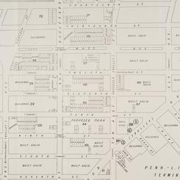
98. Outline and index map of volume three, atlas of New York City, borough of Manhattan 59th St. to 110th St
maps
- Published: G.W. Bromley & Co: New York?. 1916?]
- Format: maps
- Online: click here for full-text
- Catalog Record: check availability
99. Outline map of Manhattan island showing present and original shore lines and marshy tracts
maps
- Published: s.n: New York?. 189-?]
- Format: maps
- Online: click here for full-text
- Catalog Record: check availability
100. Part of Section 5, New York City
maps
- Published: s.n: New York?. 1891?]
- Format: maps
- Online: click here for full-text
- Catalog Record: check availability
101. Peremptory sale of valuable real estate : by Halliday & Jenkins on Tuesday, February 18th, 1845, at twelve o'clock at the Merchants' Exchange
maps
- Published: P. Miller: New York. 1845
- Format: maps
- Online: click here for full-text
- Catalog Record: check availability
102. Plan de New-York (Etats-Unis)
maps
- Published: Becquet: Paris. [188-?]
- Format: maps
- Online: click here for full-text
- Catalog Record: check availability
103. Plan of New York and Brooklyn
maps
- Published: s.n: S.l. 186-?]
- Format: maps
- Online: click here for full-text
- Catalog Record: check availability
104. Plan of New York &c
Mitchell, S. Augustus, Jr
maps
- Name: Mitchell, S. Augustus, Jr
- Published: S. Augustus Mitchell, Jr: Philadelphia. c1866
- Format: maps
- Online: click here for full-text
- Catalog Record: check availability
105. A Plan of New York Island, Part of Long Island, &c. shewing the Position of the American and British Armies, before, at, and after the Engagement of the Heights, August 27th, 1776
Lewis, Samuel, 1753 or 1754-1822
maps
- Name: Lewis, Samuel, 1753 or 1754-1822
- Published: Richard Phillips: London?. 1806
- Format: maps
- Online: click here for full-text
- Catalog Record: check availability
106. Plan of the city of New York
maps
- Published: Andrew B. Graham, Co: Washington, D.C. 1857
- Format: maps
- Online: click here for full-text
- Catalog Record: check availability

107. Plan of the city of New York
Poppleton, Thomas H
maps
- Name: Poppleton, Thomas H
- Published: Prior & Dunning: New York. 1817
- Format: maps
- Online: click here for full-text
- Catalog Record: check availability
108. A plan of the city of New York : reduced from an actual survey
Maerschalck, Francis W., -1776
maps
- Name: Maerschalck, Francis W., -1776
- Published: Lith. of H.R. Robinson for D.T. Valentine's Manual: New York, N.Y. [1850]
- Format: maps
- Online: click here for full-text
- Catalog Record: check availability