Search Results Header
Search Results
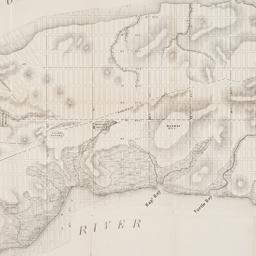
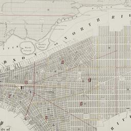
97. Map of the City of New York, from the Battery to 80th Street, showing the original topography of Manhattan Island
Viele, Egbert L. 1825-1902
maps
- Name: Viele, Egbert L. 1825-1902
- Published: s.n: New York. 1866?]
- Format: maps
- Online: click here for full-text
- Catalog Record: check availability
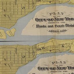
98. Map of the City of New York, showing its political divisions and subdivisions, August 1869
maps
- Published: s.n: New York?. 1869]
- Format: maps
- Catalog Record: check availability
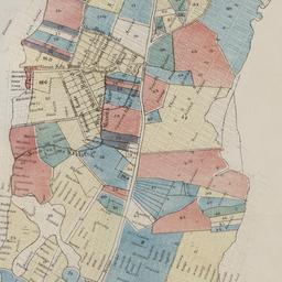
99. Map of the city of New York showing the original high water lines and the location of the different farms and estates
Hayward, George, approximately 1800-
maps
- Name: Hayward, George, approximately 1800-
- Published: Common Council: New York. 1852]
- Format: maps
- Online: click here for full-text
- Catalog Record: check availability
100. Map of the city of New York showing the proposed route of the "arcade" underground railway
maps
- Published: G.W. & C.B. Colton: New York. [1870?]
- Format: maps
- Online: click here for full-text
- Catalog Record: check availability
101. Map of the City of New-York
Hayward, George, approximately 1800-
maps
- Name: Hayward, George, approximately 1800-
- Published: Common Council, 1854]: New York. 1854
- Format: maps
- Online: click here for full-text
- Catalog Record: check availability
102. Map of the city of New-York, 1853
Hayward, George, approximately 1800-
maps
- Name: Hayward, George, approximately 1800-
- Published: Common Council: New York, N.Y. 1853]
- Format: maps
- Online: click here for full-text
- Catalog Record: check availability
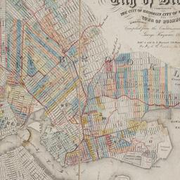
103. Map of the consolidated City of Brooklyn : comprising the City of Brooklyn, City of Williamsburgh and Town of Bushwick, Kings County, Long Island
Hayward, George, approximately 1800-
maps
- Name: Hayward, George, approximately 1800-
- Published: G. Hayward: New York. 1854
- Format: maps
- Online: click here for full-text
- Catalog Record: check availability
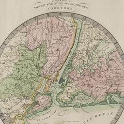
104. Map of the country twenty-five miles round the city of New-York
Burr, David H., 1803-1875
maps
- Name: Burr, David H., 1803-1875
- Published: David H. Burr: New York. 1831
- Format: maps
- Online: click here for full-text
- Catalog Record: check availability
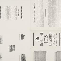
105. Map of the Dell, Chester Hill City of Mount Vernon N.Y
maps
- Published: George W. Bard Real Estate Company: Mount Vernon, N.Y. [1907]
- Format: maps
- Online: click here for full-text
- Catalog Record: check availability

106. Map of the five cities of New York, Brooklyn, Jersey City, Hoboken & Hudson City
Dripps, M
maps
- Name: Dripps, M
- Published: M. Dripps: New York?. 1860
- Format: maps
- Online: click here for full-text
- Catalog Record: check availability
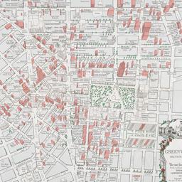
107. Map of the Greenwich Village section of New York City
Fahey, Lawrence
maps
- Name: Fahey, Lawrence
- Published: Lawrence Fahey: New York, N.Y. 1961
- Format: maps
- Online: click here for full-text
- Catalog Record: check availability
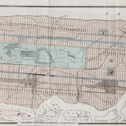
108. Map of the lands included in the Central Park
Viele, Egbert L. 1825-1902
maps
- Name: Viele, Egbert L. 1825-1902
- Published: s.n.]: New York. 1856
- Format: maps
- Online: click here for full-text
- Catalog Record: check availability
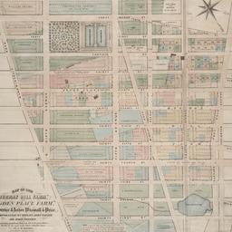
109. Map of the "Murray Hill Farm," "Ogden Place Farm," Lawrence & Astor, Wiswall & Price, Corporation, Wm. Wright, John Taylor and other property
Holmes, J. B
maps
- Name: Holmes, J. B
- Published: City Surveyor: New York. 1867]
- Format: maps
- Online: click here for full-text
- Catalog Record: check availability
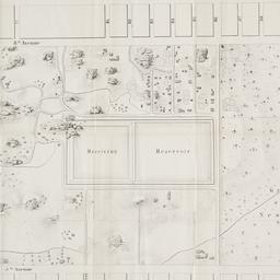
110. Map of the Passaic and Croton water-sheds, water courses, storage reservoirs and sources of supply for the cities, towns, & villages within a radius of 50 miles from the City of New York
Bartlett, John Russell, 1805-1886
maps
- Name: Bartlett, John Russell, 1805-1886
- Published: J.R. Bartlett: New York. c1888
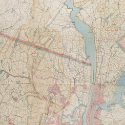
- Format: maps
- Online: click here for full-text
- Catalog Record: check availability
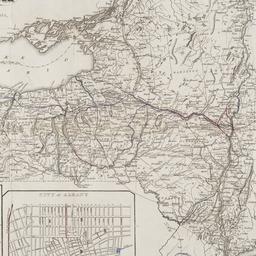
111. Map of the State of New York : with the latest improvements showing all the canals, railroads, &c
maps
- Published: J. Disturnell: New York. 1836
- Format: maps
- Online: click here for full-text
- Catalog Record: check availability

112. Map shewing a division of part of the real estate late of Nicholas W. Stuyvesant decd. among his heirs situated in the 11th Ward of the City of New York
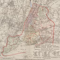
Doughty, Saml. S
maps
- Name: Doughty, Saml. S
- Published: Miller & Co. Lithog: New York. 1834 May
- Format: maps
- Online: click here for full-text
- Catalog Record: check availability
113. [Map showing area bounded by Tompkins Street and 3rd Avenue between 23rd and 9th Streets]
maps
- Published: s.n: New York?. 18--?]
- Format: maps
- Online: click here for full-text
- Catalog Record: check availability
114. Map showing the limits of greater New York, as defined by the Municipal Consolidation Inquiry Commisssion appointed under the authority of Chapter 311, Laws of 1890 including the following cities, towns, etc
maps
- Published: E.C. Bridgman: New York?. 1890?]
- Format: maps
- Online: click here for full-text
- Catalog Record: check availability
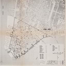
115. [Maps of land use in Lower Manhattan from 1609-1900]
maps
- Published: s.n: New York?. 19--]
- Format: maps
- Online: click here for full-text
- Catalog Record: check availability
![[Maps of Manhattan]](https://archive.org/services/img/ldpd_11290413_000)
116. [Maps of Manhattan]
maps
- Published: s.n: New York?. ca. 1890]
- Format: maps
- Online: click here for full-text
- Catalog Record: check availability

117. The metropolis and its surroundings showing Staten Island and the New Baltimore and Ohio railroad line to New York directly connecting with all the elevated railways in the City and most convenient to every route in and through New York and Brooklyn
maps
- Published: s.n: New York?. 1885?]
- Format: maps
- Online: click here for full-text
- Catalog Record: check availability
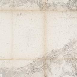
118. Middle part of Long Island Sound
United States Coast Survey
maps
- Name: United States Coast Survey
- Published: U.S.C. & G.S: Washington, D.C. 1855
- Format: maps
- Online: click here for full-text
- Catalog Record: check availability
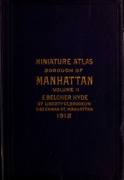
119. Miniature atlas of the borough of Manhattan : complete in two volumes
Hyde, E. Belcher
maps
- Name: Hyde, E. Belcher
- Published: E. Belcher Hyde: Brooklyn. 1912
- Format: maps
- Online: click here for full-text
- Catalog Record: check availability

120. Miniature atlas of the borough of Manhattan : in one volume
Hyde, E. Belcher
maps
- Name: Hyde, E. Belcher
- Published: Hyde: Brooklyn. 1912
- Format: maps
- Online: click here for full-text
- Catalog Record: check availability