Search Results Header
Search Results
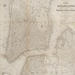
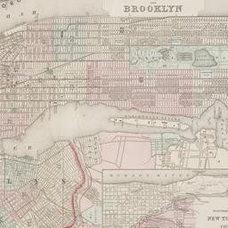
97. New map of the city of New York with part of Brooklyn & Williamsburg
Smith, J. Calvin
maps
- Name: Smith, J. Calvin
- Published: Published by H.S. Tanner map selr., 237 Broadway: New York. 1846
- Format: maps
- Online: click here for full-text
- Catalog Record: check availability
98. New York
maps
- Published: Letts, Son & Co: London. [1885?]
- Format: maps
- Online: click here for full-text
- Catalog Record: check availability
99. New York
maps
- Published: s.n: New York. between 1864 and 1869]
- Format: maps
- Online: click here for full-text
- Catalog Record: check availability
100. New York
maps
- Published: Letts, Son & Co: London. [1885?]
- Format: maps
- Online: click here for full-text
- Catalog Record: check availability
101. New York and Brooklyn
maps
- Published: s.n.]: S.l. c1867
- Format: maps
- Online: click here for full-text
- Catalog Record: check availability
102. New York and its surroundings : map of the metropolis from the Battery to One Hundred and Eighth Street, and parts of Brooklyn, Williamsburg, Greenpoint, Jersey City, and Hoboken
maps
- Published: Harper's Weekly: New York?. 1873
- Format: maps
- Catalog Record: check availability
103. New York City
Asher & Adams
maps
- Name: Asher & Adams
- Published: Asher & Adams: New York. 1871]
- Format: maps
- Online: click here for full-text
- Catalog Record: check availability
104. New York, city (lower part)
maps
- Published: s.n: S.l. 1889?]
- Format: maps
- Online: click here for full-text
- Catalog Record: check availability
105. New York city map
Phelps, Humphrey, active 19th century
maps
- Name: Phelps, Humphrey, active 19th century
- Published: H. Phelps: New York. c1857
- Format: maps
- Online: click here for full-text
- Catalog Record: check availability
106. New Yorke, 1695
Miller, John, 1666-1724
maps
- Name: Miller, John, 1666-1724
- Published: Lith. G. Hayward: New York. [1852]
- Format: maps
- Online: click here for full-text
- Catalog Record: check availability
107. New-York, April 1852 drawn on an enlarged scale from map of district burnt by great fire of 16th Dec. 1835, as published in the Journal of Commerce Dec. 18th, 1835
maps
- Published: s.n: New York?. 1852?]
- Format: maps
- Online: click here for full-text
- Catalog Record: check availability
108. New-York city & county map : with vicinity entire, Brooklyn, Williamsburgh, Jersey City &c. in the 79th year of the independence of the United States
Magnus, Charles
maps
- Name: Magnus, Charles
- Published: Charles Magnus: New York. [1855?]
- Format: maps
- Online: click here for full-text
- Catalog Record: check availability
109. New-York City, County and vicinity
Dripps, M
maps
- Name: Dripps, M
- Published: s.n: New York?. 1866]
- Format: maps
- Online: click here for full-text
- Catalog Record: check availability
![The Nicolls [sic] map, 1664...](https://triclops.library.columbia.edu/iiif/2/featured/cul:d7wm37pvtw/full/!256,256/0/default.jpg)
110. The Nicolls [sic] map, 1664-1668
Nicholls, Sutton
maps
- Name: Nicholls, Sutton
- Published: Lith. by G. Hayward for D.T. Valentine's Manual: N.Y., N.Y. 1863
- Format: maps
- Online: click here for full-text
- Catalog Record: check availability

111. One day's trucking to and from the New York Central's pier and inland stations south of Fifty-Ninth Street
maps
- Published: J.B. Lyon Co: Albany. 1920]
- Format: maps
- Online: click here for full-text
- Catalog Record: check availability
112. Outline and index map of volume three, atlas of New York City, borough of Manhattan 59th St. to 110th St
maps
- Published: G.W. Bromley & Co: New York?. 1916?]
- Format: maps
- Online: click here for full-text
- Catalog Record: check availability

113. Outline map of Brooklyn, N.Y., showing present and original shoreline and marshy tracts
maps
- Published: s.n: New York?. 189-?]
- Format: maps
- Online: click here for full-text
- Catalog Record: check availability
114. Outline map of Manhattan island showing present and original shore lines and marshy tracts
maps
- Published: s.n: New York?. 189-?]
- Format: maps
- Online: click here for full-text
- Catalog Record: check availability
115. A part of Roggeveen's map of New Netherland, Amsterdam, 1676
Roggeveen, Arent, -1679
maps
- Name: Roggeveen, Arent, -1679
- Published: Bowen & Co: Philad[elphi]a. [19--]
- Format: maps
- Online: click here for full-text
- Catalog Record: check availability
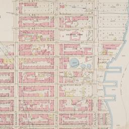
116. Part of Section 5, New York City
maps
- Published: s.n: New York?. 1891?]
- Format: maps
- Online: click here for full-text
- Catalog Record: check availability
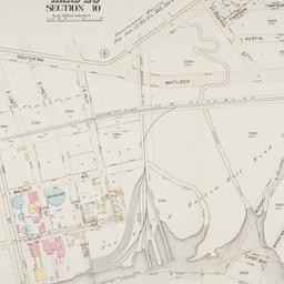
117. Part of ward 23, section 10
maps
- Published: G.W. Bromley and Co: Philadelphia. 1897]
- Format: maps
- Online: click here for full-text
- Catalog Record: check availability
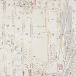
118. Part of ward 23, section 9
maps
- Published: G.W. Bromley and Co: Philadelphia. 1897]
- Format: maps
- Online: click here for full-text
- Catalog Record: check availability
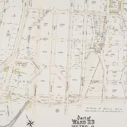
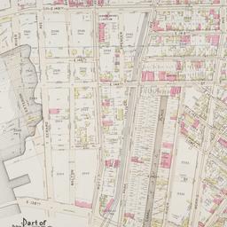
119. Part of ward 23, section 9
maps
- Published: G.W. Bromley and Co: Philadelphia. 1897]
- Format: maps
- Online: click here for full-text
- Catalog Record: check availability
120. Part of ward 23, section 9
maps
- Published: G.W. Bromley and Co: Philadelphia. 1897]
- Format: maps
- Online: click here for full-text
- Catalog Record: check availability